Binoli

Last updated

Binoli
village
India Uttarakhand location map.svg
Red pog.svg
Binoli
Location in Uttarakhand, India
India location map.svg
Red pog.svg
Binoli
Binoli (India)
Coordinates: 29°46′45″N79°15′30″E / 29.77917°N 79.25833°E / 29.77917; 79.25833 Coordinates: 29°46′45″N79°15′30″E / 29.77917°N 79.25833°E / 29.77917; 79.25833
CountryFlag of India.svg  India
State Uttarakhand
District Almora
Languages
  Official Hindi
Time zone UTC+5:30 (IST)
Vehicle registration UK
Coastline0 kilometres (0 mi)
Website uk.gov.in

Binoli is a small town in the Almora district in the state of Uttarakhand, India.

Almora district District in Uttarakhand, India

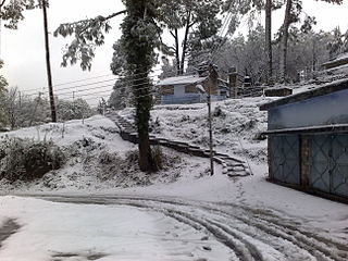
Almora district is a district in the Kumaon division of Uttarakhand state, India. The headquarters is at Almora. It is 1,638 meters above sea level. The town of Almora is surrounded by Pithoragarh district to the east, Garhwal region to the west, Bageshwar district to the north and Nainital district to the south.

Uttarakhand State in Northern India

Uttarakhand, formerly known as Uttaranchal, is a state in the northern part of India. It is often referred to as the Devabhumi due to a large number of Hindu temples and pilgrimage centres found throughout the state. Uttarakhand is known for the natural environment of the Himalayas, the Bhabhar and the Terai. On 9 November 2000, Uttarakhand became the 27th state of the Republic of India, being carved from the Himalayan districts of Uttar Pradesh. It borders Tibet Autonomous Region of China to the north; the Sudurpashchim Pradesh of Nepal to the east; the Indian states of Uttar Pradesh to the south and Himachal Pradesh to the west and north-west. The state is divided into two divisions, Garhwal and Kumaon, with a total of 13 districts. The interim capital of Uttarakhand is Dehradun, the largest city of the state, which is a railhead. The High Court of the state is located in Nainital.

India Country in South Asia

India is a country in South Asia. It is the seventh-largest country by area, the second-most populous country, and the most populous democracy in the world. Bounded by the Indian Ocean on the south, the Arabian Sea on the southwest, and the Bay of Bengal on the southeast, it shares land borders with Pakistan to the west; China, Nepal, and Bhutan to the north; and Bangladesh and Myanmar to the east. In the Indian Ocean, India is in the vicinity of Sri Lanka and the Maldives; its Andaman and Nicobar Islands share a maritime border with Thailand and Indonesia.

Contents

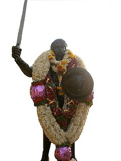
The population of Binoli is approximately 870 people. Majority of Bohra Rajput Hindu caste live in Binoli . People in this region mainly practice subsistence farming . There is one Golu devta mandir in Binoli village. It is Located at the top of the Mountain. Structures dating back to medivial period still exist in this region mostly in dilapidated state . It falls in the salt constituency of Rajya Sabha, Almora district Binoli continues to attract tourists based on its traditional Hindu temples, the natural environment of the region, and views of the Himalayas.[ citation needed ] The Bohra community in this region is orthodox and, according to some accounts,[ which? ] it set the regions of Dharchula inhabiting Kanjars as well as Rawats to fire over some dispute.[ citation needed ] . The population of this village is now declining due to migrations to plains.[ citation needed ]

Hindu temple house of worship in Hinduism

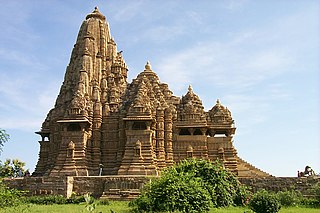
A Hindu temple is a symbolic house, seat and body of god. It is a structure designed to bring human beings and gods together, using symbolism to express the ideas and beliefs of Hinduism. The symbolism and structure of a Hindu temple are rooted in Vedic traditions, deploying circles and squares. It also represents recursion and equivalence of the macrocosm and the microcosm by astronomical numbers, and by "specific alignments related to the geography of the place and the presumed linkages of the deity and the patron". A temple incorporates all elements of Hindu cosmos—presenting the good, the evil and the human, as well as the elements of Hindu sense of cyclic time and the essence of life—symbolically presenting dharma, kama, artha, moksa, and karma.

Himalayas Mountain range in Asia

The Himalayas, or Himalaya, is a mountain range in Asia, separating the plains of the Indian subcontinent from the Tibetan Plateau. The range has many of the Earth's highest peaks, including the highest, Mount Everest. The Himalayas include over fifty mountains exceeding 7,200 m (23,600 ft) in elevation, including ten of the fourteen 8,000-metre peaks. By contrast, the highest peak outside Asia is 6,961 m (22,838 ft) tall.

Demographics

Religion in Binoli

   Hinduism (98.7%)
   Islam (0.7%)
   Others (0.6%)

Related Research Articles

Hastinapur Place in Uttar Pradesh, India

Hastinapur is a city in Meerut district in the Indian state of Uttar Pradesh. It is described in Hindu texts as the capital of the Kuru Kingdom and is also mentioned in ancient Jain texts.

Amreli City in Gujarat, India

Amreli is a city and a municipality in Amreli district in Indian state of Gujarat.

Bageshwar district District in Uttarakhand, India

Bageshwar District is a district of Uttarakhand state in northern India. The town of Bageshwar is the district headquarters. The district of Bageshwar was established in the year 1997. Prior to this, Bageshwar was part of Almora district.

Government of Karnataka legislative, executive and judiciary powers of Karnataka, India

The Government of Karnataka is a democratically elected body with the governor as the constitutional head. The governor who is appointed for five years appoints the chief minister and on the advice of the chief minister appoints his council of ministers. Even though the governor remains the ceremonial head of the state, the day-to-day running of the government is taken care of by the chief minister and his council of ministers in whom a great amount of legislative powers are vested.

Chenneerkara village in Kerala, India

Chenneerkara is a village in Pathanamthitta district in the state of Kerala, India. The majority of its inhabitants are from Hindu and Christian backgrounds. The primary crops are rubber, coconut, black pepper and plantain. Chenneerkara is 10 km from Pathanamthitta and 7.5 km from Pandalam.

Chaukhutia Town in Uttarakhand, India

Chaukhutia is a town in Almora district of Uttarakhand. It is located on the bank of the river Ramganga, and derives its name from a Kumaoni word "Chau-khut" which means four feet. In Chaukhutia's context, 'four feet' means four ways or directions. The first way is towards Ramnagar, second towards Karanprayag, third towards Ranikhet and Almora and the fourth way is towards Tadagtaal, Kheera.

Bhavani taluk is a taluk of Erode district of the Indian state of Tamil Nadu. The headquarters of the taluk is the town of Bhavani. In 2012, Bhavani taluk has been reorganised to form the new Anthiyur taluk. It comes under Gobichettipalayam Revenue Division.

Komarpant social group centred in Goa, India

The Komarpanth are a social group centred in and around Goa, komarpants, primarily speak their own language, known as Halegannada.

Heerapur Gokal Village in Uttar Pradesh, India

Heerapur Gokal is a panchayat near Afzalgarh in Bijnor District in the Indian state of Uttar Pradesh. It is located at the border with the state of Uttrakhand.

Girish Chandra Tiwari "Girda" was a scriptwriter, director, lyricist, singer, poet, organic culturist, literary writer, and social activist in Uttarakhand, India.

Thailavaram village in Tamil Nadu, India

Thailavaram is a village located near Guduvancheri and Potheri of Chengalpattu in Kanchipuram District in Tamil Nadu, India. It is situated just 2 kilometres (1.2 mi) from Guduvancheri along the GST Road and it is situated 37 kilometres (23 mi) from Chennai, between Tambaram and Chengalpattu highway. The PIN Code of Thailavaram is 603 203.

Endla, Rajasthan village in Rajasthan, India

Endla is a small village in Pali district of Rajasthan in Northern India. It is 3 kilometres (1.9 mi) away from National Highway 14, near Guda Endla village. Endla village has divided into two revenue villages: Endlawas and Jooni Endla. Some of revenue documents consider Endla (Endlawas & Jooni Endla) as a Gura Endla - 2 revenue village.

Anthiyur taluk(Tamil: அந்தியூர் வட்டம்) is a taluk of Erode district of the Indian state of Tamil Nadu. Anthiyur became separate taluk in Erode district by restructuring Bhavani and Gobichettipalayam on 22 November 2012. It comprises four blocks – Anthiyur, Athani, Burgur and Ammapet It comes under Gobichettipalayam Revenue Division.

Prakash Chandra Pandey is a Hindi poet and writer. He is the author (poet) of "Aaj Ka Sawal" and "Nayi Subeh Ki Aur" Hindi poetry books.

Meenangadi Town in Kerala, India

Meenangadi is an old town situated on the highway NH 766 between Kalpetta and Sulthan Bathery in Wayanad District, in Kerala, India. This place is one among the Provinces where the existence of Dolmens provide an historical evidence of earlier civilisation. Coffee bean, Black pepper, Ginger, Rice and Areca are the main crops of this area. Meenangadi is famous for its Fish Market,Cattle Market.The nearest railway station is at Kozhikode at 87 Km and airport is Kannur International Airport with 94 Km from Meenangadi. Meenangadi is surrounded by, Ambalavayal Panchayat, Kalpetta Taluk towards west, Gudalur Taluk towards East, Mananthavady Taluk towards west. Kalpetta, Sultan Bathery, Kozhikode are the nearby Cities and towns to Meenangadi.
Kerala's first carbon neutrality project launched in Meenangadi on June 2016. Upon achieving the goals of the project, Meenangadi will be the first village in India to go completely carbon neutral. Meenangadi has a population of 33450 According to 2011 Census with two Villages Purakkadi and (Part)Krishnagiri.

Pimpale Sim Village in Maharashtra, India

Pimpale Sim is a village of Jalgaon district, Maharashtra, India, located about 25 km west of Jalgaon. In 2017, the population was 1,690 people with 852 males and 838 females.

Sarola Village in Haryana, India

Sarola is a village located in Salhawas Block of Jhajjar district in Haryana. Sarpanch of Sarola is Bhupendra. Chandigarh is the state capital for Sarola village. It is located around 255.0 kilometers away from Sarola. The surrounding nearby villages and its distance from Sarola are Khudan 1.8 KM, Chhapar 2.1 KM, Subana 2.8 KM, Ahari 3.7 KM, Babepur 4.2 KM, Dhakla 4.2 KM, Kasni 4.7 KM.

Dharchula Legislative Assembly constituency is one of the seventy electoral Uttarakhand Legislative Assembly constituencies of Uttarakhand state in India. It includes Dharchula area of Pithoragarh District.

References