The River Ouse is a river in North Yorkshire, England. Hydrologically, the river is a continuation of the River Ure, and the combined length of the River Ure and River Ouse makes it, at 129 miles (208 km), the sixth-longest river of the United Kingdom and the longest to flow entirely in one county. The length of the Ouse alone is about 52 miles (84 km) but the total length of the river is disputed.

Wharfedale is the valley of the upper parts of the River Wharfe and one of the Yorkshire Dales. It is situated in North Yorkshire, and the cities of Leeds and Bradford in West Yorkshire. It is the upper valley of the River Wharfe. Towns and villages in Wharfedale include Buckden, Kettlewell, Conistone, Grassington, Hebden, Bolton Abbey, Addingham, Ilkley, Burley-in-Wharfedale, Otley, Pool-in-Wharfedale, Arthington, Collingham and Wetherby. Beyond Wetherby, the valley opens out and becomes part of the Vale of York.

The Yorkshire Dales are a series of valleys, or dales, in the Pennines, a range of hills in England. They are mostly located in the ceremonial county of North Yorkshire, but extend into Cumbria and Lancashire; they were historically entirely within Yorkshire. The majority of the dales are within the Yorkshire Dales National Park, created in 1954. The exception is the area around Nidderdale, which forms the separate Nidderdale Area of Outstanding Natural Beauty.
The River Eden is a river that flows through the Eden District of Cumbria, England, on its way to the Solway Firth.

The River Ure in North Yorkshire, England, is about 74 miles (119 km) long from its source to the point where it becomes the River Ouse. It is the principal river of Wensleydale, which is the only major dale now named after a village rather than its river. The old name for the valley was Yoredale after the river that runs through it.

Hawes is a market town and civil parish in North Yorkshire, England, at the head of Wensleydale in the Yorkshire Dales, and historically in the North Riding of Yorkshire. The River Ure north of the town is a tourist attraction in the Yorkshire Dales National Park.

Aysgarth is a village and civil parish in Wensleydale, in North Yorkshire, England. The village is in the Yorkshire Dales National Park, about 16 miles (26 km) south-west of Richmond and 22.6 miles (36.4 km) west of the county town of Northallerton.

Bishopdale is a dale in the Yorkshire Dales National Park in North Yorkshire, England. The dale is a side dale on the south side of Wensleydale, and extends for some 6 miles (10 km) south west from Aysgarth. Bishopdale is also the name of a civil parish, which includes only the sparsely populated upper reaches of the dale, from the head of the dale as far downstream as Howesyke and Howgill Gill.

The River Wiske is a tributary of the River Swale in Yorkshire, England. The Wiske gives its name to several villages it passes through. The name Wiske is derived from an Old English word wisca meaning a water meadow. It was once known as the Foulbroke, a name for which some writers commented that it was well deserved.
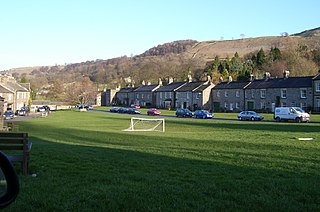
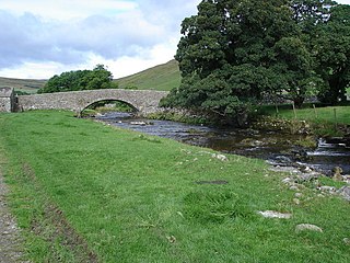
West Burton is a village in Bishopdale, a side valley of Wensleydale, in the Yorkshire Dales, North Yorkshire, England. It lies 6.2 miles (10 km) south-west of Leyburn and 22.3 miles (35.9 km) west of the county town of Northallerton. It is the largest settlement in the civil parish of Burton-cum-Walden.
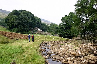
Walden Head is a hamlet in the Yorkshire Dales, North Yorkshire. It lies 5 miles (8 km) of Aysgarth and to the north is a similar village Walden. The village lies in the civil parish of Burton-cum-Walden.
River Skirfare is a small river in North Yorkshire, England, that flows through Littondale and ends where it joins the larger River Wharfe. The source is the confluence of Foxup Beck and Cosh Beck at the hamlet of Foxup.

Cotter Force is a small waterfall on Cotterdale Beck, a minor tributary of the River Ure, near the mouth of Cotterdale, a side dale in Wensleydale, North Yorkshire, England.

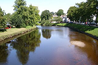
Bedale Beck is a river that flows through the eastern end of Wensleydale and passes through Crakehall, Bedale and Leeming before entering the River Swale at a point between Morton-on-Swale and Gatenby. Between source and mouth its length is 25.7 miles (41 km).

Widdale is a small side dale on the south side of Wensleydale in North Yorkshire, England. The dale lies to the east of Great Knoutberry Hill and is bounded on the west by Dentdale, south by Sleddale and north by Mossdale. It is drained by Widdale and Snaizeholme Becks which feed the waters north into the River Ure at Appersett. The name Widdale means 'The Wooded Valley' in Old Norse.

The River Burn is a river that flows wholly within North Yorkshire, England. The river starts as several small streams on Masham Moor and drains Colsterdale flowing eastwards before emptying into the River Ure just south of Masham. Conservation work on removing a weir, and introducing fish to the river in 2016, has meant that salmon have been recorded spawning in the river for the first time in over 100 years.

The River Tutt is a 8.7-mile (14 km) long tributary of the River Ure in North Yorkshire, England. The river rises near to the villages of Nidd and Scotton draining mainly arable land north eastwards before emptying into the Ure at Boroughbridge. Where the river joins the Ure in Boroughbridge, has been the site of significant historic flooding. An Environment Agency project to alleviate flooding on the river has seen diversion schemes and pumps added to prevent this.

Fleet Moss is an upland area separating Wharfedale from Wensleydale in North Yorkshire, England. The area is 1,850 ft (560 m) above sea level. Fleet Moss is noted for its peat blanket bog, which has been dated to the Neolithic period. The area is ombrotrophic; this means it needs rain, hail snow and fog for its nutrients. Fleet Moss is known as the most eroded blanket bog in all of Yorkshire; because of its observable damage, it is known colloquially as The Somme, and as such, is visible from space.

Cauldron Falls, is a series of waterfalls on Walden Beck in the village of West Burton, North Yorkshire, England. It is known as Cauldron Falls due to the swirls in the plunge pools beneath the cascades of the waterfall. The beck continues on underneath a packhorse bridge where there is another cascade.

Sleddale is a short, narrow valley to the south of Wensleydale in North Yorkshire, England. The waters draining down the valley feed into the River Ure and form part of the Humber Catchment. The valley has only one settlement, Gayle, although Hawes lies at the mouth of the beck where it runs into the River Ure. The dale is characterised by upland farming and historical mine workings, and is between the slopes of Dodd Fell to the west, and Wether Fell to the east.