Related Research Articles

Bramdean Common is situated in Bramdean, Hampshire, England. Bramdean Common is one of the many commons that served local parishioners and provided collectively owned lands which could be worked or used without the need to pay rent.
East Hampshire is a local government district in Hampshire, England. Its council is based in the town of Petersfield, although the largest town is Alton. The district also contains the town of Bordon along with many villages and surrounding rural areas.
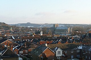
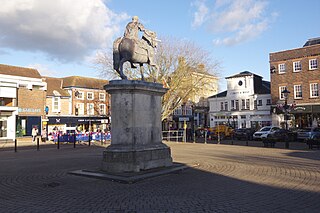
Winchester, or the City of Winchester, is a local government district with city status in Hampshire, England.

Ropley is a village and large civil parish in the East Hampshire district of Hampshire, England. It has an acreage of 4,684 acres (1,896 ha), situated 4 miles (6.4 km) east of New Alresford. It is served by a station on the Mid Hants Railway heritage line at Ropley Dean, just over 1 mile (1.6 km) from the village shops. It is 6.7 miles (10.8 km) southwest of Alton, just off the A31 road. It lies within the diocese of Winchester.

The Diocese of Winchester forms part of the Province of Canterbury of the Church of England. Founded in 676, it is one of the older dioceses in England. It once covered the Kingdom of Wessex, many times its present size. Today it is most of the historic enlarged version of Hampshire.

Headley is a village, civil parish and Anglican parish in the East Hampshire district of Hampshire, England. It is 1.8 miles (2.9 km) east of Bordon on the B3002 road.
The hide was an English unit of land measurement originally intended to represent the amount of land sufficient to support a household. It was traditionally taken to be 120 historical acres or 48 acres , but was in fact a measure of value and tax assessment, including obligations for food-rent, maintenance and repair of bridges and fortifications, manpower for the army, and (eventually) the geld land tax.

Four Marks is a village and civil parish in the East Hampshire district of Hampshire, England. It is 4.4 miles (7.1 km) southwest of Alton, on the A31 road. It is situated on the borders of the South Downs National Park on the Pilgrims' Way that leads from Winchester to Canterbury. It contains within it the medieval hamlets of Kitwood, Hawthorn and Lymington, although now the whole parish is relatively closely settled.

Bishop's Sutton or Bishop's Sutton is a village and civil parish one mile (1.6 km) east of the market town of Alresford in the City of Winchester district of Hampshire, England. According to the 2001 census it had a population of 419, increasing to 463 at the 2011 Census.

East Hampshire is a constituency represented in the House of Commons of the UK Parliament since 2010 by Damian Hinds of the Conservative Party.

The River Alre is a tributary of the River Itchen in Hampshire in the south of England. It rises in Bishop's Sutton and flows west for 6 km (3.7 mi) to meet the Itchen below New Alresford.

Farringdon is a civil parish in the East Hampshire district of Hampshire, England. It is 2.8 miles (4.5 km) south of Alton, on the A32 road, close to a source of the River Wey.

Bramdean is a village and former civil parish, now in the parish of Bramdean and Hinton Ampner, in the Winchester district, in the county of Hampshire, England. It is a linear settlement located along the busy A272 trunk road which was widened by the American troops in 1943 in preparation for D-Day.

Limésy is a commune in the Seine-Maritime department in the Normandy region in northern France.

Monkwood is a Hamlet in the south of Ropley parish. Although currently it is spread between Petersfield Road and Hill Farm Road, historically it referred to the settlement on the south side of Smugglers Lane containing the 15th Century Smugglers, the 16th Century The Old Farmhouse and the C18th century cottage between the two. The more recent settlement between Petersfield Road and Hill Farm Lane originates from around the late 1800s, with only two settlements; Hill Farm and Ropley Common Farm visible in the 1870s OS Map.

The Manhood Peninsula is in the southwest of West Sussex in England. It has the English Channel to its south and Chichester to the north. It is bordered to its west by Chichester Harbour and to its east by Pagham Harbour, its southern headland being Selsey Bill.

The Hundred of Odiham was a Hundred of Great Britain in the county of Hampshire. It contained the parishes of; Bentworth, Dogmersfield, Elvetham, Greywell, Hartley Wintney, Lasham, Liss, Odiham, Rotherwick, Shalden, Sherfield on Loddon, Weston Patrick, and Winchfield.

The Hundred of Meonstoke was a small Hundred of Great Britain situated in the ceremonial county of Hampshire. The Hundred of Meonstoke contained the parishes of; Abbots Worthy, Alverstoke, Corhampton, Exton, Hambledon, Liss, Meonstoke, Soberton, Warnford, and West Meon. Before the time of the Domesday Survey, Bramdean was included in the Meonstoke Hundred until it was transferred to the Finchdean Hundred. The land comprising the hundred was assessed in the reign of Edward the Confessor at 89 hides, and at the time of the Domesday survey of 1086 was estimated to be about 56 hides and comprised 12 places in Hampshire.
References
- ↑ The Antiquary: a magazine devoted to the study of the past, Volume 29. Edward Walford. 1884. p. 101.