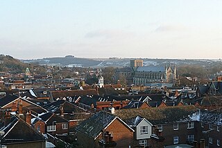
Winchester, or the City of Winchester, is a local government district with city status in Hampshire, England.

Odiham is a large historic village and civil parish in the Hart district of Hampshire, England. It is twinned with Sourdeval in the Manche Department of France. The 2011 population was 4,406. The parish in 1851 had an area of 7,354 acres with 50 acres covered by water. The nearest railway station is at Hook, on the South West main line. The village had its own hundred, named The Hundred of Odiham. The village is situated slightly south of the M3 motorway and approximately midway between the north Hampshire towns of Fleet and Basingstoke, some 37 miles north-northeast of Southampton and 43 miles (69 km) southwest of London.

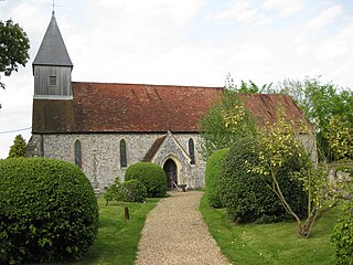
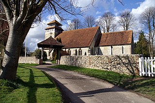
Hampshire is a county in Southern England with some notable archaeology and many notable historic buildings.

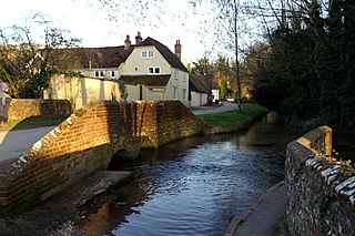
The River Meon is a chalk stream in Hampshire in the south of England. It rises at East Meon then flows 34 km (21 mi) in a generally southerly direction to empty into the Solent at Hill Head near Stubbington. Above Wickham, the river runs through the South Downs National Park.

Titchfield is a village and former civil parish in the Fareham district, in southern Hampshire, England, by the River Meon. The village has a history stretching back to the 6th century. During the medieval period, the village operated a small port and market. Near to the village are the ruins of Titchfield Abbey, a place with strong associations with Shakespeare, through his patron, the Earl of Southampton.
Exton is a small village and civil parish in the City of Winchester district of Hampshire, England. The village lies in the South Downs National Park, on the west bank of the River Meon, immediately to the north of Corhampton. It is located two miles north of Droxford and five miles north-east of Bishop's Waltham. Its name first appears in 940 as East Seaxnatune, meaning "farmstead of the East Saxons".

East Meon is a village and civil parish in the East Hampshire district of Hampshire, England. It is 4.4 miles (7.1 km) west of Petersfield.
Liss is a village and civil parish in the East Hampshire district of Hampshire, 3.3 miles (5.3 km) north-east of Petersfield, on the A3 road, on the West Sussex border. It covers 3,567 acres (14 km2) of semi-rural countryside in the South Downs National Park. Liss railway station is on the Portsmouth Direct line. The village comprises an old village at West Liss and a modern village round the 19th-century station. They are divided by the River Rother. Suburbs later spread towards Liss Forest.

Abbots Bickington is a village and civil parish in the English county of Devon, located 7.7 mi (12.4 km) north-northeast of Holsworthy and near the River Torridge.

East Hampshire is a constituency represented in the House of Commons of the UK Parliament since 2010 by Damian Hinds of the Conservative Party.

West Meon is a village and civil parish in Hampshire, England, with a population of 749 people at the 2011 census.

Droxford is a village in Hampshire, England.
Meonstoke is a village and former civil parish, now in the parish of Corhampton and Meonstoke, in the Winchester district, in the county of Hampshire, England. It is in the Meon Valley where it cuts through the Middle Chalk of the South Downs, Old Winchester Hill is at the edge of the parish to the east. In 1931 the parish had a population of 439.
Warnford is a village and civil parish in the City of Winchester district of Hampshire, England. The parish covers 1283 hectares. The village lies on the A32 in the upper valley of the River Meon between West Meon and Exton. The population in 2019 was estimated at 220. The village is rural in character, with most of the buildings along River Lane, Lippen Lane and Hayden Lane.

Empshott is a village and former civil parish, now in the parish of Hawkley, in the East Hampshire district of Hampshire, England. It lies 3.5 miles (5.5 km) southwest of Bordon, its nearest town. The nearest railway station is 2.7 miles (4.4 km) southeast of the village, at Liss. In 1931 the parish had a population of 171.

The Hundred of Odiham was a Hundred of Great Britain in the county of Hampshire. It contained the parishes of; Bentworth, Dogmersfield, Elvetham, Greywell, Hartley Wintney, Lasham, Liss, Odiham, Rotherwick, Shalden, Sherfield on Loddon, Weston Patrick, and Winchfield.
The Hundred of Bishop's Sutton was a Hundred of Great Britain situated in the ceremonial county of Hampshire. The Hundred of Bishop's Sutton contained the parishes of; Alresford, Bighton, Bishop's Sutton, Bramdean, Farringdon, Headley, Ropley and West Tisted.

Hall Place is a manor house in the civil parish of Bentworth in Hampshire, England. It is about 300 metres (980 ft) southwest of St Mary's Church and 3.6 miles (5.8 km) northwest of Alton, the nearest town. Built in the early 14th century, it is a Grade II listed medieval hall house, known by various names through the centuries. It is 0.5 miles (0.8 km) from the current Bentworth Hall that was built in 1832.
