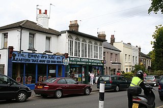
Mitcham is an area within the London Borough of Merton in South London, England. It is centred 7.2 miles (11.6 km) southwest of Charing Cross. Originally a village in the county of Surrey, today it is mainly a residential suburb, but includes Mitcham Common.

Morden is a district and town in south London, England, within the London Borough of Merton. It adjoins Merton Park and Wimbledon to the north, Mitcham to the east, Sutton to the south and Worcester Park to the west, and is around 8 miles (13 km) south-southwest of Charing Cross. Prior to the creation of Greater London in 1965, Morden was in the administrative county of Surrey. It is in ceremonial county of Surrey.

The London Borough of Merton is a borough in south-west London, England.

Wandsworth is a London borough in southwest London; it forms part of Inner London and has an estimated population of 329,677 inhabitants. Its main settlements are Battersea, Putney, Tooting and Wandsworth Town.

Colliers Wood is an area in south west London, England, in the London Borough of Merton. It is a mostly residential area, but has a busy high street around Colliers Wood tube station on London Underground's Northern line. The high street is part of the A24, a major road route roughly following the Northern Line, running from London through Tooting and other areas. The Colliers Wood ward had a population of 10,712 in 2011.

Mitcham Junction is a National Rail station served by Southern and Thameslink trains, and a Tramlink stop. It is in the London Borough of Merton and is in Travelcard Zone 4.

The River Wandle is a tributary of the River Thames in south London, England. With a total length of about 9 miles (14 km), the river passes through the London boroughs of Croydon, Sutton, Merton and Wandsworth, where it reaches the Thames. A short headwater – the Caterham Bourne – is in Surrey, the historic county of the river's catchment. Tributaries of the Wandle include the River Wrythe and the Norbury Brook.

Mitcham tram stop is a Tramlink stop in Mitcham in the London Borough of Merton. The stop is located between Belgrave Walk and Mitcham Junction. It is located just east of the former Mitcham railway station, which closed in 1997. The tram stop consists of twin platforms accessible by ramps at either end.

The A217 is a road in London and Surrey in England. It runs north–south. It runs from Kings Road in Fulham, London, crosses the Thames at Wandsworth Bridge, then passes through Wandsworth, Earlsfield, Summerstown, Tooting, Mitcham, Rosehill and Sutton Common in Sutton, then Cheam. Then, widened as a dual carriageway, comes Belmont, a suburban district built on a slope rising southward. On the North Downs in Surrey the road then skirts past Banstead and through its late 19th century offspring villages particularly Burgh Heath and Kingswood, Surrey. It then crosses the M25 motorway at Junction 8, then, returning to single carriageways, passes through the castle town of Reigate. It then cuts through the green buffer farmland of two rural villages and terminates at the road network at Gatwick Airport's northern perimeter.

Merton is an ancient parish which was first in Surrey but since 1965 has been in London, bounded by Wimbledon to the north, Mitcham to the east, Morden, Cheam and Cuddington to the south and (New) Malden to the west. The 1871 Ordnance Survey map records its area as 1,764.7 acres (7.1 km2).

Mitcham Eastfields is a railway station in London, United Kingdom, which opened on 2 June 2008. The station is located at Eastfields Road level crossing, in an area previously poorly served by public transport. The nearest station was Mitcham Junction, which along with Mitcham tram stop, was over 1 mile (1.6 km) from the district. It is in fare zone 3.

Merton Abbey is an area in southwest London, England. It lies between South Wimbledon and Colliers Wood in the London Borough of Merton. Merton Abbey takes its name from Merton Priory, which once stood on the northern edge of the district. The area is bounded by Merton High Street to the north, the River Wandle to the west, Christchurch Road to the east and Deen City Farm to the south.

London Buses route 152 is a Transport for London contracted bus route in London, England. Running between New Malden and Pollards Hill, it is operated by London General.

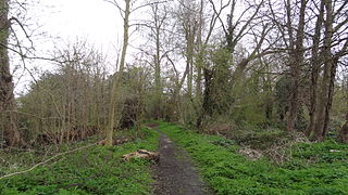
The Wandle Trail is a 12.5-mile (20 km) walking and cycling trail that follows the River Wandle from Croydon to Wandsworth in south-west London

The Wimbledon–West Croydon line is a railway line in south London. It was opened in 1855 by the Wimbledon and Croydon Railway (W&CR) over part of the trackbed of the Surrey Iron Railway. It closed in May 1997 and now forms part of the Tramlink network.

The Wrythe is a district of Carshalton, South London, located in the London Borough of Sutton. The area is located 9.3 miles South of Charing Cross and is surrounded by the adjacent areas of Hackbridge and Croydon to the east, Morden and Mitcham to the north, Sutton to the west. The area is commonly referred to as Wrythe Green which is located at the centre of the neighbourhood. It is thought that the name derives from a spring which is related to the River Wandle which runs through the east of the area from the Carshalton ponds. The Wrythe had a population of 10,163 in the 2011 Census.

Ravensbury Park is a public park in Mitcham in the London Borough of Merton. An area of 7 hectares is designated a Local Nature Reserve. The River Wandle runs along the southern boundary of the park, which is also part of the Upper Wandle River Site of Metropolitan Importance for Nature Conservation.

Phipps Bridge is a housing estate in Mitcham in the London Borough of Merton. It was built following a need created by the end of the Second World War on the site of old slums, and is named after a nearby bridge. Although it opened in the 1960s as a show-piece estate it took less than ten years for it to become a slum again, and the council continued to redevelop it into the 1990s.

Mitcham Vestry Hall is a municipal building in London Road, Mitcham, London. It is a locally listed building.


