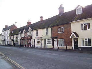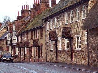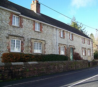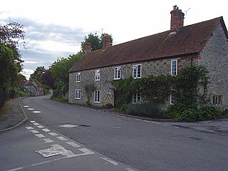
Amesbury is a town and civil parish in Wiltshire, England. It is known for the prehistoric monument of Stonehenge which is within the parish. The town is claimed to be the oldest occupied settlement in Great Britain, having been first settled around 8820 BC. The parish includes the hamlets of Ratfyn and West Amesbury, and part of Boscombe Down military airfield.

Mere is a market town and civil parish in Wiltshire, England. It lies at the extreme southwestern tip of Salisbury Plain, close to the borders of Somerset and Dorset. The parish includes the hamlets of Barrow Street, Burton, Charnage, Limpers Hill, Rook Street and Southbrook.

Tollard Royal is a village and civil parish on Cranborne Chase, Wiltshire, England. The parish is on Wiltshire's southern boundary with Dorset and the village is 6 miles (10 km) southeast of the Dorset town of Shaftesbury, on the B3081 road between Shaftesbury and Sixpenny Handley.

Wilton is a town and civil parish in Wiltshire, England. Lying about 3 miles (5 km) west of the city of Salisbury, and until 1889 the county town of Wiltshire, it has a rich heritage dating back to the Anglo-Saxons.

Heytesbury is a village and a civil parish in Wiltshire, England. The village lies on the north bank of the Wylye, about 3+1⁄2 miles (5.6 km) southeast of the town of Warminster.

Codford is a civil parish south of Salisbury Plain in the Wylye Valley in Wiltshire, England. Its settlements are the adjacent villages of Codford St Peter and Codford St Mary, which lie some 7 miles (11 km) southeast of Warminster.

Berwick St James is a village and civil parish on the River Till in Wiltshire, England, about 7 miles (11 km) northwest of Salisbury, on the southern edge of Salisbury Plain. The parish includes the hamlet of Asserton. At the 2001 census the parish had a population of 185, reducing to 142 at the 2011 census.

Bishopstrow is a small village and civil parish in Wiltshire, England, on the southeastern edge of the town of Warminster. The village is about 1.5 miles (2.4 km) from the town centre, south of the old Warminster to Salisbury road, formerly the A36, now the B3414.

Boyton is a village and civil parish in Wiltshire, England. It lies in the Wylye Valley within Salisbury Plain, about 6 miles (10 km) south-east of Warminster and 13 miles (21 km) north-west of Salisbury. The parish includes the village of Corton.

Wylye is a village and civil parish on the River Wylye in Wiltshire, England. The village is about 9+1⁄2 miles (15 km) northwest of Salisbury and a similar distance southeast of Warminster.

Upton Lovell is a village and civil parish in Wiltshire, England. It lies on the A36, in the Wylye valley about 5 miles (8.0 km) southeast of Warminster. The parish is on the left (northeast) bank of the river, and stretches for over two miles northeast onto Salisbury Plain.

Norton Bavant is a small village and civil parish in Wiltshire, England, 2 miles (3.2 km) southeast of Warminster.

Stockton is a small village and civil parish in the Wylye Valley in Wiltshire, England, about 8 miles (13 km) southeast of Warminster. The parish includes the hamlet of Bapton.

Longbridge Deverill is a village and civil parish about 2.5 miles (4.0 km) south of Warminster in Wiltshire, England. It is on the A350 primary route which connects the M4 motorway and west Wiltshire with Poole, Dorset.

Sutton Veny is a village and civil parish in the Wylye valley, to the southeast of the town of Warminster in Wiltshire, England; the village is about 3 miles (5 km) from Warminster town centre. 'Sutton' means 'south farmstead' in relation to Norton Bavant, one mile (1.6 km) to the north. 'Veny' may be a French family name or may describe the village's fenny situation.

Knook is a small village and civil parish in Wiltshire, England. The village lies to the north of the River Wylye at the edge of Salisbury Plain, about 4+1⁄2 miles (7 km) southeast of Warminster, close to the A36 road to Salisbury.

Winterbourne Stoke is a village and civil parish in Wiltshire, England, about 5 miles (8 km) west of Amesbury and 3 miles (4.8 km) west of the prehistoric monument of Stonehenge.

Great Wishford is a village and civil parish in the Wylye Valley in Wiltshire, England, about three miles (5 km) north of Wilton and five miles (8 km) northwest of Salisbury. The village lies west of a bend in the River Wylye and has a triangular street layout comprising South Street, West Street and Station Road.

Steeple Langford is a village and civil parish in the English county of Wiltshire, 6 miles (10 km) northwest of Wilton. It has also been called Great Langford or Langford Magna. The village lies on the north bank of the River Wylye, and is bypassed to the north by the A36 Warminster-Salisbury trunk road which follows the river valley.

Kingston Deverill is a village and civil parish in Wiltshire, England. Its nearest towns are Mere, about 3+1⁄2 miles (6 km) to the southwest, and Warminster, about 5 miles (8 km) to the northeast. The parish and its demographic figures include the village of Monkton Deverill.


