Black, Missouri

Last updated

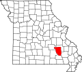
Black is an unincorporated community in northern Reynolds County, Missouri, United States. [1] It is located on Route 49 on the Middle Fork of the Black River, approximately six miles north-northeast of Centerville and southwest of Johnson's Shut-Ins State Park. [2]

Contents

History

A post office called Black has been in operation since 1883. [3] The community has the name of George Black, an early settler. [4]

The Buford–Carty Farmstead was listed on the National Register of Historic Places in 2004. [5]

Education

Lesterville R-IV School District operates the Lesterville Ranch Campus at Black. [6]

Black has a public library, a branch of the Reynolds County Library District. [7]

Related Research Articles

<span class="mw-page-title-main">St. Francois County, Missouri</span> County in Missouri, United States

St. Francois County is a county located in the Lead Belt region in the U.S. state of Missouri. As of the 2020 census, the population was 66,922. The largest city and county seat is Farmington. The county was officially organized on December 19, 1821. It was named after the St. Francis River. The origin of the river's name is unclear. It might refer to St. Francis of Assisi. Another possibility is that Jacques Marquette, a Jesuit who explored the region in 1673, named the river for the Jesuit missionary Francis Xavier. Marquette had spent some time at the mission of St. François Xavier before his voyage and, as a Jesuit, was unlikely to have given the river a name honoring the Franciscans.

<span class="mw-page-title-main">Reynolds County, Missouri</span> County in Missouri, United States

Reynolds County is a county located in the Ozark Foothills Region in the Lead Belt of Missouri. As of the 2020 census, the population was 6,096. Its county seat is Centerville. The county was officially organized on February 25, 1845, and was named in honor of former Governor of Missouri Thomas Reynolds.

<span class="mw-page-title-main">Lincoln County, Missouri</span> County in Missouri, United States

Lincoln County is located in the eastern part of the U.S. state of Missouri. As of the 2020 census, the population was 59,574. Its county seat is Troy. The county was founded December 14, 1818, and named for Major General Benjamin Lincoln of the American Revolutionary War.

<span class="mw-page-title-main">Mexico, Missouri</span> City in Missouri, United States

Mexico, formerly known as New Mexico, is a city in and the county seat of Audrain County, Missouri. It is home to the Missouri Military Academy and annually hosts the Miss Missouri Pageant. The city's population was 11,469 at the 2020 census. The micropolitan statistical area consists of Audrain County. It is a part of the Columbia, Missouri metropolitan area.

<span class="mw-page-title-main">Cassville, Missouri</span> City in Missouri, United States

Cassville is a city in Flat Creek Township, Barry County, Missouri, United States. According to the 2020 census, the population of Cassville was 3,190. Cassville is one of the primary markets and job centers for an estimated 14,000 people living in the surrounding area. It is the county seat of Barry County.

<span class="mw-page-title-main">Greenfield, Missouri</span> City in Missouri, United States

Greenfield is a city in Dade County, Missouri. The population was 1,220 at the 2020 census. It is the county seat of Dade County.

<span class="mw-page-title-main">Ellington, Missouri</span> City in Missouri, United States

Ellington is a city in Reynolds County, Missouri, United States. The population was 790 at the 2020 census. In 1925, the infamous Tri-State Tornado began just northwest of Ellington.

<span class="mw-page-title-main">Farmington, Missouri</span> City in Missouri, United States

Farmington is a city in St. Francois County located about 75 miles (121 km) southwest of St. Louis in the Lead Belt region in Missouri. As of the 2020 census, the population was 18,217. It is the county seat of St. Francois County. Farmington was established in 1822 as Murphy's Settlement, named for William Murphy of Kentucky, who first visited the site in 1798. When St. Francois County was organized, the town was briefly called St. Francois Court House and later renamed to Farmington.

<span class="mw-page-title-main">Park Hills, Missouri</span> City in Missouri, United States

Park Hills is a city in St. Francois County, Missouri, United States. The population was 8,587 at the 2020 census.

<span class="mw-page-title-main">Black River (Arkansas–Missouri)</span> River in Missouri, United States

The Black River is a tributary of the White River, about 300 miles (480 km) long, in southeastern Missouri and northeastern Arkansas in the United States. Via the White River, it is part of the Mississippi River watershed. Black River Technical College is named for the river.

<span class="mw-page-title-main">Lesterville, Missouri</span> Unincorporated community in the American state of Missouri

Lesterville is an unincorporated community in southeast Missouri, United States. It is located in Reynolds County on Routes 21, 49, and 72 near the Black River. The ZIP Code for Lesterville is 63654.

<span class="mw-page-title-main">House Springs, Missouri</span>

House Springs is an unincorporated community in Jefferson County, Missouri, United States. It is located just off Route 30, at the intersection with Routes MM and W near Byrnes Mill.

<span class="mw-page-title-main">Millersville, Missouri</span> Census-Designated Place in Missouri, United States

Millersville is an unincorporated community in western Cape Girardeau County, Missouri, United States. It is located six miles (10 km) west of Jackson on Route 72.

Hyatts Creek is a stream in southwest Iron and northeast Reynolds counties in the U.S. state of Missouri. It is a tributary of the Black River.

Mayberry Branch is a stream in Reynolds County in the U.S. state of Missouri. It is a tributary of the Black River.

Monterey is an unincorporated community in northern Reynolds County, in the U.S. state of Missouri.

Munger is an unincorporated community in northeast Reynolds County, in the U.S. state of Missouri.

Peola Branch is a stream in Reynolds County in the U.S. state of Missouri. It is a tributary of the Black River. The confluence with the Black is approximately 2.5 miles south of Lesterville.

Lesterville Township is an inactive township in Reynolds County, in the U.S. state of Missouri.

Shirley is an unincorporated community in Washington County, in the U.S. state of Missouri.

References

  1. U.S. Geological Survey Geographic Names Information System: Black, Missouri
  2. Missouri Atlas & Gazetteer, DeLorme, 1998, First edition, p. 56, ISBN   0-89933-224-2
  3. "Post Offices". Jim Forte Postal History. Retrieved December 13, 2016.
  4. "Reynolds County Place Names, 1928–1945". The State Historical Society of Missouri. Archived from the original on June 24, 2016. Retrieved December 13, 2016.
  5. "National Register Information System". National Register of Historic Places . National Park Service. July 9, 2010.
  6. "Lesterville R-Iv School District". Great Schools. Retrieved March 17, 2018.
  7. "Contact Information". Reynolds County Library District. Retrieved March 17, 2018.

37°31′53″N90°55′59″W / 37.53139°N 90.93306°W / 37.53139; -90.93306