Black Castle, East Lothian

Last updated

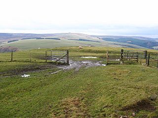
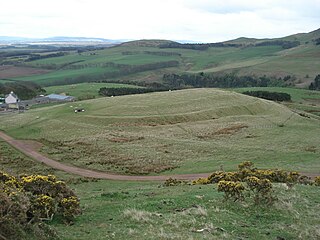
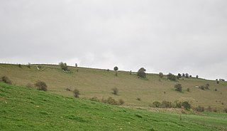
Black Castle, East Lothian is an Iron Age hillfort with a number of defensive banks, located 5 kilometres (3.1 mi) south-east of Gifford, East Lothian, Scotland. It is south of the B6355 road, between Darent House and Green Castle hillfort.

The Iron Age is the final epoch of the three-age system, preceded by the Stone Age (Neolithic) and the Bronze Age. It is an archaeological era in the prehistory and protohistory of Europe and the Ancient Near East, and by analogy also used of other parts of the Old World. The three-age system was introduced in the first half of the 19th century for the archaeology of Europe in particular, and by the later 19th century expanded to the archaeology of the Ancient Near East. Its name harks back to the mythological "Ages of Man" of Hesiod. As an archaeological era it was first introduced for Scandinavia by Christian Jürgensen Thomsen in the 1830s. By the 1860s, it was embraced as a useful division of the "earliest history of mankind" in general and began to be applied in Assyriology. The development of the now-conventional periodization in the archaeology of the Ancient Near East was developed in the 1920s to 1930s. As its name suggests, Iron Age technology is characterized by the production of tools and weaponry by ferrous metallurgy (ironworking), more specifically from carbon steel.

Hillfort Type of earthworks used as a fortified refuge or defended settlement

A hillfort is a type of earthworks used as a fortified refuge or defended settlement, located to exploit a rise in elevation for defensive advantage. They are typically European and of the Bronze and Iron Ages. Some were used in the post-Roman period. The fortification usually follows the contours of a hill, consisting of one or more lines of earthworks, with stockades or defensive walls, and external ditches. Hillforts developed in the Late Bronze and Early Iron Age, roughly the start of the first millennium BC, and were used in many Celtic areas of central and western Europe until the Roman conquest.

Gifford, East Lothian village in the United Kingdom

Gifford is a village in the parish of Yester in East Lothian, Scotland. It lies approximately 4 miles south of Haddington and 25 miles east of Edinburgh.

The fort is on the summit of a hillock, at 900 feet (270 m). It measures about 380 by 340 feet (120 by 100 m). It has an inner and an outer rampart, and two entrances marked by causeways. To the west is a plantation named Black Castle wood.

Plantation long artificially established forest, farm or estate, where crops are grown for sale

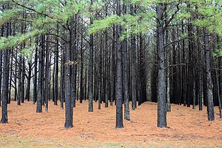
A plantation is the large-scale estate meant for farming that specializes in cash crops. The crops that are grown include cotton, coffee, tea, cocoa, sugar cane, sisal, oil seeds, oil palms, rubber trees, and fruits. Protectionist policies and natural comparative advantage have sometimes contributed to determining where plantations were located.

It is a designated scheduled ancient monument. [1]

See also

Blackcastle Hill, East Lothian hillfort in East Lothian

Blackcastle Hill is an iron age hill fort south of Innerwick, East Lothian, Scotland. It is near Cocklaw in the Lammermuir Hills at grid reference NT729724, at a height of 280 metres (920 ft) above sea level. The fort has a single defensive bank.

Chesters Hill Fort is an Iron Age hill fort in East Lothian, Scotland. It lies one mile south of Drem, 1.5 miles east of Ballencrieff Castle, 2.5 miles north of Haddington, and 2 miles west of Athelstaneford. The name "Chesters" comes from Latin castra, a fortified place.

Traprain Law hillfort in East Lothian

Traprain Law is a hill about 221 m (725 ft) elevation, located 6 km (4 mi) east of Haddington in East Lothian, Scotland. It is the site of an oppidum or hill fort, which covered at its maximum extent about 16 ha. It is the site of the Traprain Law Treasure, the largest Roman silver hoard from anywhere outside the Roman Empire and which included exquisite silver artefacts.

Related Research Articles

Chûn Castle Iron-age hillfort

Chûn Castle is a large Iron Age hillfort (ringfort) near Penzance in Cornwall, England, United Kingdom. The fort was built about 2,500 years ago, and fell into disuse until the early centuries AD when it was possibly re-occupied to protect the nearby tin mines. It stands beside a prehistoric trackway that was formerly known as the Old St Ives Road and the Tinners’ Way. The name Chûn derives from Cornish: Chi an Woon. The area is now sometimes known as Chûn Downs.

Lammermuir Hills range of hills in southern Scotland

The Lammermuirs are a range of hills in southern Scotland, forming a natural boundary between Lothian and the Borders.

The River Esk, also called the Lothian Esk, is a river that flows through Midlothian and East Lothian, Scotland.

Castle Hill is a scheduled ancient monument in Almondbury overlooking Huddersfield in the Metropolitan Borough of Kirklees, West Yorkshire, England. The hilltop has been settled for at least 4,000 years. The scheduled monument comprises the remains of a late-Bronze Age or early Iron Age univallate hillfort with a single raised bank, a later Iron Age multivallate hillfort, a 12th-century motte and bailey castle and the site of a deserted medieval village. The grade II listed Victoria Tower on the summit of Castle Hill is by far the most conspicuous landmark in Huddersfield. The hill has been a place of recreation for hundreds of years and the easily discernible remains of past occupation have made it a subject for legend, speculation and scientific study. It is located on UK Maps at grid reference SE152140.

Whiteadder Reservoir lake in the United Kingdom

Whiteadder Reservoir is a reservoir in East Lothian, Scotland, UK, in the Lammermuir Hills, 11 miles (18 km) north west of Duns in the Scottish Borders, and five miles (8 km) south east of Garvald. It was created to provide additional water facilities for East Lothian.

Castle Law hill in the United Kingdom

Castle Law is a hill south west of Fairmilehead in the Pentland Hills in Midlothian, Scotland.

River Leader river in Scotland

The River Leader, or Leader Water, is a small tributary of the River Tweed in Lauderdale in the Scottish Borders. It flows southwards from the Lammermuir Hills through the towns of Lauder and Earlston, joining the River Tweed at Leaderfoot.

Eddisbury hill fort hillfort in Cheshire West and Chester

Eddisbury hill fort, also known as Castle Ditch, is an Iron Age hill fort near Delamere, Cheshire, in northern England. Hill forts are fortified hill-top settlements constructed across Britain during the Iron Age. Eddisbury is the largest and most complex of the seven hill forts in the county of Cheshire. It was constructed before 200–100 BC and expanded in 1–50 AD. In the 1st century AD, the Romans slighted the site. It was reoccupied in the 6th–8th centuries AD, and an Anglo-Saxon burh was probably established at Eddisbury in 914. In the medieval and post-medieval periods quarrying and farming have damaged the site. Ownership is currently split between the Forestry Commission and a local farm. Eddisbury is protected as a Scheduled Ancient Monument.

Bussock Camp hillfort in West Berkshire

Bussock Camp is the site of an Iron Age bivallate hillfort located in Berkshire. It has a double bank and ditch to the south and east, with only a single bank remaining the north and western sides. The entrance is to the north of the site and is believed to be original, and the site encloses approximately 11 acres

Castle Ditches site of an Iron Age trivallate hillfort located in Wiltshire, England

Castle Ditches is the site of an Iron Age trivallate hillfort located in Wiltshire. It is probable that its ancient name was Spelsbury and it was referred to as Willburge in Tisbury's charter of 984 A.D. Its shape is roughly triangular, and follows the contours of the small hill upon which it sits. The earthworks comprise triple row of ramparts and ditches, which are covered on three sides with woodland. There is a large entrance towards the south-east, where there is the shallowest incline of the hill; but there is also a narrow slit on the opposite side. The area within the site encompasses nearly 24 acres, and the greatest height of the ramparts is about forty feet.

Bratton Castle bivallate Iron Age hillfort on Bratton Down in Wiltshire, England

Bratton Castle is a bivallate Iron Age hill fort on Bratton Down, at the western edge of the Salisbury Plain escarpment. The hill fort comprises two circuits of ditch and bank which together enclose a pentagonal area of 9.3 hectares.

Grovely Castle Iron Age univallate hill-fort in Wiltshire, England

Grovely Castle is the site of an Iron Age univallate hill fort in the Parish of Steeple Langford, in Wiltshire. The remaining ramparts stand approximately 3.2 m (10 ft) high, with 1.5 m (4.9 ft) deep ditches, although ploughing has damaged the earthworks in some parts of the site. Excavations have uncovered the remains of five human skeletons within the ramparts. Entrances are located in the southwest and northeast corners of the hillfort. A circular enclosure of 35 to 40 m is evident in aerial photographs of the hillfort interior. There is also a later bank and ditch which runs through the hill-fort from south-west to north-east, and is probably part of an extensive surrounding Celtic field system.

Torwoodlee Broch

Torwoodlee Broch is the remains of an iron-age broch located near the town of Galashiels in the Scottish Borders.

References

  1. Historic Environment Scotland. "Black Castle,fort,Newlands (SM745)" . Retrieved 24 February 2019.

Coordinates: 55°53′12.2″N2°40′21.96″W / 55.886722°N 2.6727667°W / 55.886722; -2.6727667

Geographic coordinate system Coordinate system

A geographic coordinate system is a coordinate system that enables every location on Earth to be specified by a set of numbers, letters or symbols. The coordinates are often chosen such that one of the numbers represents a vertical position and two or three of the numbers represent a horizontal position; alternatively, a geographic position may be expressed in a combined three-dimensional Cartesian vector. A common choice of coordinates is latitude, longitude and elevation. To specify a location on a plane requires a map projection.