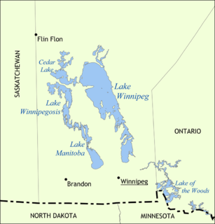
Lake Winnipeg is a very large, but relatively shallow 24,514-square-kilometre (9,465 sq mi) lake in North America, in the province of Manitoba, Canada. Its southern end is about 55 kilometres (34 mi) north of the city of Winnipeg. It is the largest lake within southern Canada's borders, and is part of the most undeveloped large watershed of southern Canada.
Lake Winnipegosis is a large (5,370 km²) lake in central North America, in Manitoba, Canada, some 300 km northwest of Winnipeg. It is Canada's eleventh-largest lake. An alternate spelling, once common but now rare, is Lake Winipigoos or simply 'Lake Winipigis'.
The Winnipeg River is a Canadian river which flows roughly northwest from Lake of the Woods in the province of Ontario to Lake Winnipeg in Manitoba. This river is 235 kilometres (146 mi) long from the Norman Dam in Kenora to its mouth at Lake Winnipeg. Its watershed is 106,500 square kilometres (41,100 sq mi) in area, mainly in Canada. About 29,000 square kilometres (11,000 sq mi) of the watershed is in northern Minnesota, United States.

The Hayes River is a river in Northern Region, Manitoba, Canada that flows from Molson Lake to Hudson Bay at York Factory. It was an historically important river in the development of Canada, and is today a Canadian Heritage River and the longest naturally flowing river in Manitoba.

Duck Bay is a community located in the Canadian province of Manitoba, along the western shores of Lake Winnipegosis.
Treaty 2 was entered in to on 21 August 1871 at Manitoba House, Rupertsland with Representatives of the Queen of England and Ireland. The original Anishinaabe, who were present constitute Treaty 2 today. It is known that many of the Chiefs and leaders within the territory were at the early gathering and after the treaty was agreed to. Those who were not present were represented through Mekis until they indicated where they wished their farming reserves to be established. The Treaty reaffirmed the Inherent rights our Anishinaabek had prior to European contact. Located in where southwestern Manitoba is today and a small part of southeastern Saskatchewan;

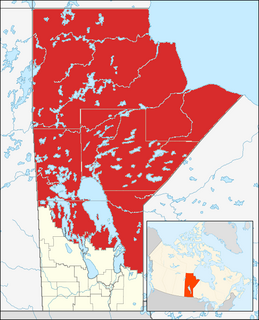
The geography of Manitoba addresses the easternmost of the three prairie Canadian provinces, located in the longitudinal center of Canada. Manitoba borders on Saskatchewan to the west, Ontario to the east, Nunavut to the north, and the American states of North Dakota and Minnesota to the south. Although the border with Saskatchewan appears straight on large-scale maps, it actually has many right-angle corners that give the appearance of a slanted line. In elevation, Manitoba ranges from sea level on Hudson Bay to 2727 ft (831 m) on top of Baldy Mountain. The northern sixty percent of the province is on the Canadian Shield. The northernmost regions of Manitoba lie permafrost, and a section of tundra bordering Hudson Bay.
The Berens River is a river in the Provinces of Manitoba and Ontario, Canada. It flows west from an unnamed lake in Kenora District, Ontario and discharges its waters into Lake Winnipeg near the village and First Nation of Berens River, Manitoba. The river has a number of lakes along its course, and many rapids.
The Sayisi Dene,, are Chipewyan, a Dene First Nation Aboriginal peoples of Canada group living in northern Manitoba. They are members of the "Sayisi Dene First Nation " and are notable for living a nomadic caribou-hunting and gathering existence.
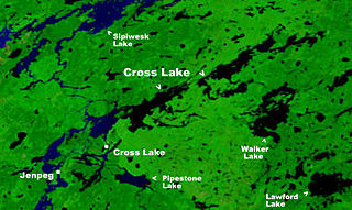
Cross Lake is a large lake in Manitoba on the Nelson River north of Lake Winnipeg. It is long and narrow and extends 102 km (63 mi) east-northeast.
The Whitefish River is a river in Census Division 21 in the Northern Region of Manitoba, Canada. It is in the Hudson Bay and Nelson River drainage basins and is a left tributary of the Saskatchewan River.
The Echoing River is a river in the Hudson Bay drainage basin in Manitoba and Ontario, Canada. Its flows from its source at Echoing Lake in Unorganized part of Kenora District, Northwestern Ontario to its mouth at the Gods River in Northern Manitoba. The Gods River flows via the Hayes River to Hudson Bay.
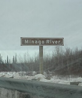
Minago River is a river in the Hudson Bay drainage basin in Northern Manitoba, Canada. It flows in a northeasterly direction from Moon Lake into the western end of Cross Lake on the Nelson River.
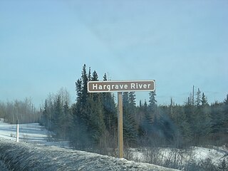
The Hargrave River is a river in the Hudson Bay drainage basin in Northern Manitoba, Canada. It flows in a southeasterly direction from its source at Hargrave Lake to Hill Lake on the Minago River which flows into Cross Lake on the Nelson River.
Silcox Creek is a river in the Hudson Bay drainage basin in Census division 23 in Northern Manitoba, Canada. Its flows from David Wilson Lake to the Owl River as a right tributary. The Owl River flows to Hudson Bay.
The Black Duck River is a river in the provinces of Manitoba and Ontario, Canada. Flowing northeast from Hosea Lake in Kenora District in Northwestern Ontario, the river criss-crosses the Manitoba-Ontario border before reaching to its mouth at Hudson Bay in the Northern Region of Manitoba just west of Manitoba's easternmost point where the inter-provincial border meets the bay.
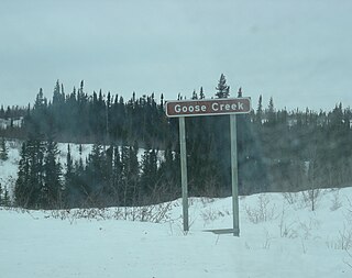
Goose Creek is a river in the Hudson Bay drainage basin in Northern Manitoba, Canada. It runs from an unnamed lake to the Nelson River, which it enters as a left tributary. The river flows under the Hudson Bay Railway, between the settlements of Weir River to the north and Charlebois to the south, close to its source; and under Manitoba Provincial Road 290 just before its mouth.

The Mistik Creek is a river in the Hudson Bay drainage basin in the Northern Region of Manitoba, Canada, approximately 20 kilometres (12 mi) northeast of Bakers Narrows.
The Deer River is a river in Census division 23 in Northern Manitoba, Canada. It is in the Hudson Bay drainage basin and is a right tributary of the Dog River.