Related Research Articles

Great Torrington is a market town in Devon, England. Parts of it are sited on high ground with steep drops down to the River Torridge below, with the lower-lying parts of the town prone to occasional flooding. Torrington is in the centre of Tarka Country, a landscape captured by Henry Williamson in his novel Tarka the Otter in 1927. Great Torrington has one of the most active volunteering communities in the United Kingdom.

Little Torrington is a village and a civil parish near Great Torrington, in the Torridge district, north Devon, England. In 2001 the population of the civil parish of Little Torrington was 420 and in 2011 it was 376, according to census data. Little Torrington has the Church of St Giles and the Chapel of St Mary Magdalene.
Black Torrington is a village and civil parish in Torridge, Devon, England, situated between the towns of Holsworthy and Hatherleigh. It is located on and named after the River Torridge.

The River Torridge is a river in Devon in England; it rises near Meddon. The river describes a long loop through Devon farming country where its tributaries the Lew and Okement join before meeting the Taw at Appledore and flowing into the Bristol Channel. The river is spate dependent and often flows between wooded banks which can be steep. The Torridge local government district is named after the river.

Yarnscombe is a small village and parish in the Torridge area of Devon, England. It is situated approximately 5 miles (8 km) from Great Torrington and 8 miles (13 km) from Barnstaple. In the year 2001 census the population was recorded at 300.

Tavistock Abbey, also known as the Abbey of Saint Mary and Saint Rumon, is a ruined Benedictine abbey in Tavistock, Devon. Nothing remains of the abbey except the refectory, two gateways and a porch. The abbey church, dedicated to Our Lady and St Rumon, was destroyed by Danish raiders in 997 and rebuilt under Lyfing, the second abbot. The church was further rebuilt in 1285 and the greater part of the abbey between 1457 and 1458.
South Devon, formerly known as the Southern Division of Devon, was a parliamentary constituency in the county of Devon in England. From 1832 to 1885 it returned two Knights of the Shire to the House of Commons of the Parliament of the United Kingdom, elected by the bloc vote system.
Werrington is a civil parish and former manor now in Cornwall, England, United Kingdom. Prior to boundary changes it straddled the Tamar and lay within the county of Devon. The portion on the west side was transferred to Cornwall by the abolition of Broadwoodwidger Rural District by the Local Government Commission for England in 1966. It is situated 1 mile (1.6 km) to the west of the Tamar, the traditional boundary between Devon and Cornwall, and 1 mile (1.6 km) north of Launceston.

Frithelstock is a village, civil parish and former manor in Devon, England. It is located within Torridge local authority area and formed part of the historic Shebbear hundred. The parish is surrounded, clockwise from the north, by the parishes of Monkleigh, Great Torrington, Little Torrington, Langtree and Buckland Brewer. In 2001 its population was 366, down from 429 in 1901.

Sheepwash is a village and civil parish on the southern border of the local government district of Torridge, Devon, England. The parish, which lies about nine miles ENE of the town of Holsworthy, about eight miles south of Great Torrington and about ten miles north-west of Okehampton, is surrounded clockwise from the north by the parishes of Buckland Filleigh, Highampton and Black Torrington. Its southern boundary follows the River Torridge and most of its other boundaries are along watercourses too. In 2001 its population was 254, lower than the 326 residents it had in 1901.

Huntshaw is a village and civil parish located 2.5 north north east of Great Torrington, in the Torridge district, in the county of Devon, England.
The hundred of Fremington was the name of one of thirty two ancient administrative units of Devon, England.

Sir Hugh Pollard, 2nd Baronet was an English soldier and MP elected for Bere Alston in 1640, Callington in 1660, and Devon in 1661. He supported the Royalist cause in the English Civil War.

Huish is a small village, civil parish and former manor in the Torridge district of Devon, England. The eastern boundary of the parish is formed by the River Torridge and the western by the Rivers Mere and Little Mere, and it is surrounded, clockwise from the north, by the parishes of Merton, Dolton, Meeth and Petrockstowe. In 2001 the population of the parish was 49, down from 76 in 1901.

Shebbear Hundred was the name of one of the thirty-two 19th century hundreds of Devon, England.
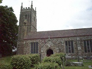
Way is a historic estate in the parish of St Giles in the Wood, Devon. It is situated about 2 miles (3.2 km) north-east of the village of St Giles in the Wood and about 4 miles (6.4 km) north-east of the town of Great Torrington. It was described by Hoskins (1959) as "the fons et origo of the mighty tribe of Pollard" and had been acquired by them from the de la Way family at some time before 1242.

The Tarka Valley Railway in Devon, England, is a heritage railway that plans to rebuild the Torrington to Bideford section of the Barnstaple to Halwill Junction railway line. So far a short demonstration line of 300 yd of track in the direction of Bideford plus a siding alongside the old coal dock have been re-laid. The railway has been fenced off from the Tarka Trail ensuring the safety of all involved. Restoration of various items of rolling stock is currently under way.

Monkokehampton is a village and civil parish in West Devon, England. The village lies on the River Okement, about 3 miles (4.8 km) east-north-east of Hatherleigh. The parish is bounded by Hatherleigh, Exbourne, Broadwoodkelly and Iddesleigh, and had a population of 139 at the 2011 Census.

Inwardleigh is a village and civil parish about 3 and a half miles north north west of Okehampton railway station, in the West Devon district, in the county of Devon, England. The parish contains the village of Folly Gate. The A386 road runs through the parish. In 2011 the parish had a population of 491. The parish touches Hatherleigh, Sampford Courtenay, Okehampton Hamlets, Jacobstowe and Northlew.

Honeychurch is a village and former civil parish now in the parish of Sampford Courtenay, in the West Devon district of the English county of Devon. It was originally an ancient parish in the Black Torrington hundred of northwest Devon.
References
- 1 2 "THE HUNDREDS OF DEVON". GENUKI. Retrieved 8 April 2018.
- ↑ Plea Rolls of the Court of Common Pleas: National Archives; CP 40/629; second entry, second line, with Devon in the margin; appearing as Wyke Pancracij (in Latin)
| | This Devon location article is a stub. You can help Wikipedia by expanding it. |