| Blackdown Hill | |
|---|---|
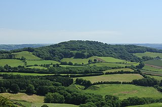
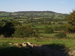
 Pasture land, north of the B3164 with Blackdown Hill in the far distance. | |
| Highest point | |
| Elevation | 215 m (705 ft) [1] [2] |
| Prominence | 34 m (112 ft) [1] |
| Parent peak | Lewesdon Hill [1] |
| Listing | Tump |
| Coordinates | 50°49′50″N2°51′38″W / 50.83057°N 2.86057°W Coordinates: 50°49′50″N2°51′38″W / 50.83057°N 2.86057°W |
| Geography | |
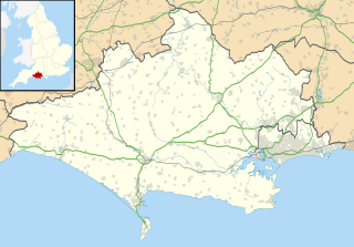
| Location | Dorset, England |
| OS grid | ST395038 |
| Topo map | OS Landranger 193 |
Blackdown Hill is a prominent elevation, 215 metres (705 ft) high, [1] 5 miles (8.0 km) south west of the town of Crewkerne, in the county of Dorset in the south west of England. Its prominence of 34 metres (112 ft) means it is listed as one of the Tumps. [1] It runs parallel to the B3165 towering over the village of Blackdown and hamlet of Kittwhistle at the foot of the eastern flanks of the ridge.
Crewkerne is a town and electoral ward in Somerset, England, situated 9 miles (14 km) south west of Yeovil and 7 miles (11 km) east of Chard in the South Somerset district close to the border with Dorset. The civil parish of West Crewkerne includes the hamlets of Woolminstone and Henley. The town lies on the River Parrett, A30 road and West of England Main Line railway.

Dorset is a county in South West England on the English Channel coast. The ceremonial county comprises the non-metropolitan county, which is governed by Dorset County Council, and the unitary authority areas of Poole and Bournemouth. Covering an area of 2,653 square kilometres (1,024 sq mi), Dorset borders Devon to the west, Somerset to the north-west, Wiltshire to the north-east, and Hampshire to the east. The county town is Dorchester which is in the south. After the reorganisation of local government in 1974 the county's border was extended eastward to incorporate the Hampshire towns of Bournemouth and Christchurch. Around half of the population lives in the South East Dorset conurbation, while the rest of the county is largely rural with a low population density.

England is a country that is part of the United Kingdom. It shares land borders with Wales to the west and Scotland to the north-northwest. The Irish Sea lies west of England and the Celtic Sea lies to the southwest. England is separated from continental Europe by the North Sea to the east and the English Channel to the south. The country covers five-eighths of the island of Great Britain, which lies in the North Atlantic, and includes over 100 smaller islands, such as the Isles of Scilly and the Isle of Wight.
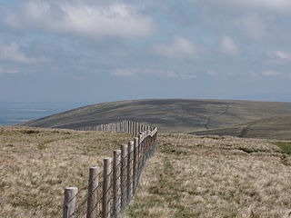
The open summit of the hill lies at the northern end of a mile-long north-south ridge. The Jubilee Trail runs along the ridge line initially before dropping just below it to the west and then descending steeply down Venn Hill, a northwestern spur of Blackdown, towards the village of Thorncombe on the far side of the River Synderford that runs past the foot of Blackdown Hill to the west. Pilsdon Pen (277 m), formerly thought to be Dorset's highest point, lies about 2 miles (3.2 km) to the south east. To the east is the Temple Brook which rises north of the col between Blackdown and Pilsdon Pen. [2]

Thorncombe is a village and civil parish now in the English county of Dorset but historically until 1844 in Devon. It lies in the West Dorset administrative district, five miles (8 km) south east of the town of Chard in neighbouring Somerset. Thorncombe is situated close to the borders of both Somerset and Devon. In the 2011 census the population of the civil parish was 687.

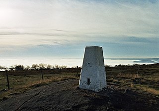
Pilsdon Pen is a 277-metre (909 ft) hill in Dorset in South West England, situated at the north end of the Marshwood Vale in the West Dorset administrative district, approximately 4.5 miles (7.2 km) west of Beaminster. It is Dorset's second highest point and has panoramic views extending for many miles. It was bequeathed to the National Trust by the Pinney family in 1982. For many years it was thought to be Dorset's highest hill, until modern survey revealed that nearby Lewesdon Hill was 2 metres higher.