Related Research Articles

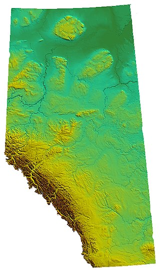
Alberta is one of the thirteen provinces and territories of Canada. Located in Western Canada, the province has an area of 661,190 km2 (255,290 sq mi) and is bounded to the south by the United States state of Montana along 49° north for 298 km (185 mi); to the east at 110° west by the province of Saskatchewan for 1,223 km (760 mi); and at 60° north the Northwest Territories for 644 km (400 mi). The southern half of the province borders British Columbia along the Continental Divide of the Americas on the peaks of the Rocky Mountains, while the northern half borders British Columbia along the 120th meridian west. Along with Saskatchewan it is one of only two landlocked provinces or territories.
The Victoria Cross Ranges are a set of mountain ranges in the Canadian Rockies, located to the northwest of Jasper. Of the 19 peaks contained within this range, five are named after Canadian recipients of the Victoria Cross. The area of the ranges is 678 square kilometres (262 sq mi).

Athabasca Pass is a high mountain pass in the Canadian Rockies on the border between Alberta and British Columbia. In fur trade days it connected Jasper House on the Athabasca River with Boat Encampment on the Columbia River.

Cadomin is a hamlet in west-central Alberta, Canada, within Yellowhead County. It is along the McLeod River in the foothills of the Rocky Mountains, approximately 50 kilometres (31 mi) south of Hinton near the Bighorn Highway. It is served by a spur of the Canadian National Railway.

Mountain Park is a ghost town in western Alberta, south of Cadomin, elevation 6200 feet, at the end of the historic Alberta Coal Branch line of the Canadian National Railway.
Alhambra is a hamlet in Alberta, Canada within Clearwater County. It is located close to the David Thompson Highway, east of Rocky Mountain House.
Simpson Pass, el. 2,107 m (6,913 ft), is a mountain pass on the border between the Canadian provinces of Alberta and British Columbia, in the area of the Ball Range. It is the prominence col for Mount Ball on the Continental Divide in the vicinity of Sunshine Village ski resort. Simpson River and Simpson Pass are named after Sir George Simpson who first explored the area in 1841.

The Rocky Mountain Foothills are an upland area flanking the eastern side of the Rocky Mountains, extending from the Liard River in British Columbia southward into Alberta. Bordering the Interior Plains system, they are part of the Rocky Mountain System or Eastern System of the Western Cordillera of North America.

Calais is an unincorporated community in northern Alberta, on the south shore of Sturgeon Lake, surrounded by the Sturgeon Lake Cree Nation in the Municipal District of Greenview No. 16. It is located 0.5 kilometres (0.31 mi) north of Highway 43, 83 kilometres (52 mi) east of Grande Prairie.
Tonquin Pass, 1948 m (6393 ft), is a mountain pass in the Canadian Rockies, linking Tonquin Valley in Jasper National Park, Alberta, to Mount Robson Provincial Park and adjoining areas of British Columbia. It is at the headwaters of Tonquin Creek, which flows into British Columbia. Located on the interprovincial boundary, it is on the Continental Divide.

Alexis Cardinal River 234 is an Indian reserve of the Alexis Nakota Sioux Nation in Alberta, located within Yellowhead County. It is 73 kilometers southeast of Hinton.

Duncan's 151A is an Indian reserve of the Duncan's First Nation in Alberta, located within the Municipal District of Peace No. 135. It is 39 kilometers southwest of Peace River. In the 2016 Canadian Census, it recorded a population of 150 living in 52 of its 56 total private dwellings.
Chungo Creek is a large creek close to Nordegg in Western Alberta, Canada. It starts at a mountain lake called Upper Mons Lake, and eventually empties into the Blackstone River (Alberta).
Footner Lake is a settlement in northern Alberta, Canada within Mackenzie County. The nearby lake of the same name has the name of Hulbert Footner, a Canadian novelist.
Mount Balinhard is a summit in Alberta, Canada.
Bedson Ridge is a ridge in the Rocky Mountains located in Alberta, Canada. The ridge is located approximately 50 km (31 mi) east of Jasper and is often used for rock climbing.
Mount Cardinal is a summit in Alberta, Canada.
Cheviot Mountain is a summit in Alberta, Canada.
Evelyn Pass is a mountain pass in Alberta, Canada.
Habel Creek is a stream in Alberta, Canada.
References
- ↑ "Blackface Mountain". Geographical Names Data Base . Natural Resources Canada.
- ↑ Place-names of Alberta. Ottawa: Geographic Board of Canada. 1928. p. 20.