Blacklick Creek (Pennsylvania)

Last updated

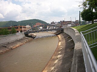
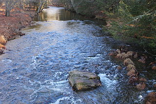
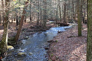
Blacklick Creek is a tributary of the Conemaugh River, approximately 30 mi (48 km) long, in western Pennsylvania in the United States. [1]

Tributary stream or river that flows into a main stem river or lake

A tributary or affluent is a stream or river that flows into a larger stream or main stem river or a lake. A tributary does not flow directly into a sea or ocean. Tributaries and the main stem river drain the surrounding drainage basin of its surface water and groundwater, leading the water out into an ocean.

Conemaugh River river in Pennsylvania

The Conemaugh River is a 70-mile (110 km) long tributary of the Kiskiminetas River in Westmoreland, Indiana, and Cambria counties in the U.S. state of Pennsylvania. It crosses both the Pittsburgh metropolitan area and the Johnstown, Pennsylvania metropolitan area. The name means 'Otter Creek', originating from the Unami-Lenape language word kwənəmuxkw 'otter'.

Pennsylvania State of the United States of America

Pennsylvania, officially the Commonwealth of Pennsylvania, is a state located in the northeastern and Mid-Atlantic regions of the United States. The Appalachian Mountains run through its middle. The Commonwealth is bordered by Delaware to the southeast, Maryland to the south, West Virginia to the southwest, Ohio to the west, Lake Erie and the Canadian province of Ontario to the northwest, New York to the north, and New Jersey to the east.

Contents

It rises in two forks in western Cambria County, on the western side of the Allegheny Mountains. The North Branch, approximately 12 mi (19 km) long, rises north of Colver and flows west, then southwest. The South Branch rises near Revloc and flows west. The branches meet at Rexis, near the boundary between Cambria and Indiana counties. The main branch flows west, receiving Two Lick Creek near Josephine, approximately 10 mi (16 km) SSW of Indiana, then WSW to join the Conemaugh approximately 3 mi (5 km) WNW of Blairsville. [2] [3] [4]

Cambria County, Pennsylvania County in the United States

Cambria County is a county located in the U.S. state of Pennsylvania. As of the 2010 census, the population was 143,679. Its county seat is Ebensburg. The county was created on March 26, 1804, from parts of Bedford, Huntingdon, and Somerset Counties and later organized in 1807. It was named for the nation of Wales, which in Latin is known as "Cambria".

Allegheny Mountains mountain range

The Allegheny Mountain Range, informally the Alleghenies and also spelled Alleghany and Allegany, is part of the vast Appalachian Mountain Range of the Eastern United States and Canada and posed a significant barrier to land travel in less technologically advanced eras. The barrier range has a northeast–southwest orientation and runs for about 400 miles (640 km) from north-central Pennsylvania, through western Maryland and eastern West Virginia, to southwestern Virginia.

Colver, Pennsylvania Census-designated place in Pennsylvania, United States

Colver is an unincorporated community and census-designated place (CDP) in Cambria County, Pennsylvania, United States. The population was 959 at the 2010 census.

The name, which is also the name of the township that contains most of the northern branch and part of the southern branch, probably refers to the fact that the stream (or "lick") often passes over outcroppings of coal ("black" minerals) in its bed and its banks. [5]

See also

Blacklick Township, Cambria County, Pennsylvania Township in Pennsylvania, United States

Blacklick Township is a township in Cambria County, Pennsylvania, United States. The population was 2,013 at the 2010 census. It is part of the Johnstown, Pennsylvania Metropolitan Statistical Area.

Related Research Articles

South Buffalo Township, Armstrong County, Pennsylvania Township in Pennsylvania, United States

South Buffalo Township is a township in Armstrong County, Pennsylvania, United States. The population was 2,636 at the 2010 census.

Jackson Township, Cambria County, Pennsylvania Township in Pennsylvania, United States

Jackson Township is a township in Cambria County, Pennsylvania, United States. The population was 4,392 at the 2010 census, down from 4,925 at the 2000 census. It is part of the Johnstown, Pennsylvania Metropolitan Statistical Area.

Nanty Glo, Pennsylvania Borough in Pennsylvania, United States

Nanty Glo is a borough in Cambria County, Pennsylvania, United States. It is part of the Johnstown, Pennsylvania Metropolitan Statistical Area. The population was 2,734 at the 2010 census. The name comes from the Welsh Nant Y Glo, meaning "The Ravine of Coal."

Summerhill, Pennsylvania Borough in Pennsylvania, United States

Summerhill is a borough in Cambria County, Pennsylvania, United States. The population was 490 at the 2010 census.

Conemaugh Township, Indiana County, Pennsylvania Township in Pennsylvania, United States

Conemaugh Township is a township in Indiana County, Pennsylvania, United States. The population was 2,294 at the 2010 census. The township includes the communities of Clarksburg, Foster, Lewisville, McKeeverville, Nowrytown, Tunnelton, and White.

Little Conemaugh River river in the United States of America

The Little Conemaugh River is a tributary of the Conemaugh River, approximately 30 mi (48 km) long, in western Pennsylvania in the United States.

Stonycreek River river in southwestern Pennsylvania

The Stonycreek River is a tributary of the Conemaugh River, approximately 45 mi (72 km) long, in southwestern Pennsylvania in the United States.

Kiskiminetas River river in western Pennsylvania

The Kiskiminetas River is a tributary of the Allegheny River, approximately 27 miles (43 km) long, in Western Pennsylvania in the United States. The region stretching from the northern side of Harmar Township, Pennsylvania to the Kiskiminetas towns is often referred to by the locals as the Alle-Kiski Valley after the rivers.

West Branch Susquehanna River river in Pennsylvania, United States

The West Branch Susquehanna River is one of the two principal branches, along with the North Branch, of the Susquehanna River in the northeastern United States. The North Branch, which rises in upstate New York, is generally regarded as the extension of the main branch, with the shorter West Branch being its principal tributary. The West Branch, which is 243 miles (391 km) long, is entirely within the state of Pennsylvania, draining a large mountainous area within the Allegheny Plateau in the western part of the state. Along most of its course it meanders along mountain ridges and through water gaps, forming a large zigzag arc through central Pennsylvania around the north end of the Allegheny Ridge. In colonial times the river provided an important water route to the Ohio River valley. In the 18th century, its lower valley became a significant industrial heartland of Pennsylvania. In the 20th century, the upper reaches of the West Branch turned a yellow/orange color due to sulfurous drainage from nearby and abandoned deep bituminous coal mines.

Clarion River river in the United States of America

The Clarion River is a tributary of the Allegheny River, approximately 110 mi (177 km) long, in west central Pennsylvania in the United States. It drains a rugged area of the Allegheny Plateau in the Ohio River watershed, flowing through narrow serpentine valleys and hardwood forests.

Huntington Creek (Pennsylvania) tributary of Fishing Creek (North Branch Susquehanna River) in Luzerne and Columbia counties, Pennsylvania

Huntington Creek is a tributary of Fishing Creek in Luzerne and Columbia counties, Pennsylvania, in the United States. It is approximately 29.5 miles (47.5 km) long.

Two Lick Creek is a drainage basin measuring approximately 190 square miles (490 km2), and is the largest tributary of Blacklick Creek, located in Indiana County, Pennsylvania in the United States.

Chest Creek is a tributary of the West Branch Susquehanna River in Cambria County and Clearfield County, in Pennsylvania, in the United States. It is approximately 40.4 miles (65.0 km) long and flows through Allegheny Township, East Carroll Township, Clearfield Township, Patton, Chest Township, and Elder Township in Cambria County and Westover Township, Chest Township, Newburg, Bell Township, and Maheffy in Clearfield County. Although it is considered by the Pennsylvania Department of Environmental Protection to be impaired by situation, it is a coldwater fishery or a high-quality coldwater fishery throughout its length. The watershed of the creek has an area of 129.22 square miles (334.7 km2).

The Ghost Town Trail is a rail trail in Western Pennsylvania that stretches 36 miles (58 km) from Black Lick, Indiana County, to Ebensburg, Cambria County. Established in 1991 on the right-of-way of the former Ebensburg and Black Lick Railroad, the trail follows the Blacklick Creek and passes through many ghost towns that were abandoned in the early 1900s with the decline of the local coal mining industry. Open year-round to cycling, hiking, and cross-country skiing, the trail is designated as a National Recreation Trail by the United States Department of the Interior.

Cowanshannock Creek is a tributary of the Allegheny River in Armstrong and Indiana counties, Pennsylvania in the United States.

Lick Branch (Huntington Creek tributary) river in the United States of America

Lick Branch is a tributary of Huntington Creek in Luzerne County, Pennsylvania, in the United States. It is approximately 2.6 miles (4.2 km) long and flows through Ross Township and Fairmount Township. The watershed of the stream has an area of 2.34 square miles (6.1 km2) and has no tributaries. The stream is considered by the Pennsylvania Fish and Boat Commission to be Class A Wild Trout Waters for brook trout throughout its entire length. Glacial till, alluvium, and wetlands can be found in its vicinity.

References

  1. "Blacklick Creek, Pennsylvania, US". americanwhitewater.org. Retrieved 27 March 2014.
  2. "Blacklick Creek". blacklickcreekwatershed.org. Retrieved 27 March 2014.
  3. "Blacklick Valley Natural Area". indianacountyparks.org. Retrieved 27 March 2014.
  4. "Pennsylvania whitewater, Blacklick Creek". riverfacts.com. Retrieved 27 March 2014.
  5. Moyer, Armond; Moyer, Winifred (1958). The origins of unusual place-names. Keystone Pub. Associates. p. 14.

Coordinates: 40°28′16″N79°06′48″W / 40.47111°N 79.11323°W / 40.47111; -79.11323

Geographic coordinate system Coordinate system

A geographic coordinate system is a coordinate system that enables every location on Earth to be specified by a set of numbers, letters or symbols. The coordinates are often chosen such that one of the numbers represents a vertical position and two or three of the numbers represent a horizontal position; alternatively, a geographic position may be expressed in a combined three-dimensional Cartesian vector. A common choice of coordinates is latitude, longitude and elevation. To specify a location on a plane requires a map projection.