
Garrett County (gərɛt) is the westernmost county of the U.S. state of Maryland. As of the 2010 census, the population was 30,097, making it the third-least populous county in Maryland. Its county seat is Oakland. The county was named for John Work Garrett (1820–1884), president of the Baltimore and Ohio Railroad. Created from Allegany County, Maryland in 1872, it was the last Maryland county to be formed.

Turtle Creek is a borough in Allegheny County, Pennsylvania, 12 miles (19 km) southeast of Pittsburgh. The population was 5,349 at the 2010 census. George Westinghouse gave life to the place by constructing a manufacturing plant nearby. Turtle Creek takes its name from a small stream that flows into the Monongahela River. Before white settlers arrived, there was a small village of Native Americans living there from the Turtle Clan of the Iroquois Nation.

South Buffalo Township is a township in Armstrong County, Pennsylvania, United States. The population was 2,636 at the 2010 census.

Black Lick is a census-designated place (CDP) in Burrell Township, Indiana County, Pennsylvania, United States. The population was 1,462 at the 2010 census.
Black Lick Township is a township in Indiana County, Pennsylvania, United States. The population was 1,237 at the 2010 census. The township includes the communities of Grafton, Jacksonville, and Newport.

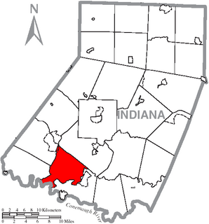
Burrell Township is a township in Indiana County, Pennsylvania, United States. Burrell Township was formed from Black Lick Township in 1853, named after Judge Burrell. The population was 4,393 at the 2010 census, up from 3,746 at the 2000 census. The township includes the communities of Bell's Mills, Black Lick, Campbells Mill, Fairfield Heights, Josephine, Marshall Heights, Oake's Point, Palmertown, Smith, and Strangford.

Brookville is a borough in Jefferson County in the U.S. state of Pennsylvania, 80 miles (130 km) northeast of Pittsburgh. As of the 2010 census the population was 3,933. Founded in 1830, it is the county seat of Jefferson County

Washington Township is a township in Jefferson County, Pennsylvania, United States. The population was 1,926 at the 2010 census. It was named for President George Washington.

The Yough River Trail is a non-motorized multi-use rail trail that stretches 71 miles (114 km) between McKeesport and Confluence, Pennsylvania. It is part of the Great Allegheny Passage that allows cyclists to bike from Pittsburgh to Washington, D.C. The north section of the trail runs 43 miles (69 km) between McKeesport and Connellsville, Pennsylvania, and the south section runs 28 miles (45 km) between Connellsville and Confluence.
Springs is an unincorporated community in Elk Lick Township, Somerset County, Pennsylvania, United States. Springs is known for its Spring Folk Festival, which occurs annually in October, its museum and its farmers' market. It is part of the Johnstown, Pennsylvania Metropolitan Statistical Area.

Town Creek is a 41.6-mile-long (66.9 km) tributary stream of the Potomac River in the U.S. states of Maryland and Pennsylvania. The creek is formed from the confluence of Sweet Root Creek and Elk Lick Creek, about 0.5 miles (0.8 km) south of Buchanan State Forest in Bedford County, Pennsylvania. Town Creek flows south along the base of Warrior Mountain into Allegany County, Maryland. The Chesapeake and Ohio Canal crosses it at the Town Creek Aqueduct. It empties into the Potomac about 4 miles (6 km) east of Oldtown, Maryland.
Kettle Creek is a 7.3-mile-long (11.7 km) tributary stream of the South Fork South Branch Potomac River in Hardy and Pendleton counties in West Virginia's Eastern Panhandle. Kettle Creek rises on Mitchell Knob and flows north along the eastern flanks of Sweedlin Hill through Sweedlin Valley in the George Washington National Forest.
Salt Lick Creek is an 11.1-mile-long (17.9 km) tributary of the Susquehanna River in Susquehanna County, Pennsylvania in the United States.

Sandy Lick Creek is a tributary of Redbank Creek in northwest Pennsylvania in the United States.
Yellow Creek is a tributary of Two Lick Creek in Indiana County, Pennsylvania in the United States.
Peters Creek is a 16.8-mile-long (27.0 km) tributary of the Monongahela River and part of the Ohio River and Mississippi River watersheds, flowing through southwestern Pennsylvania in the United States.

Petroleum Center is a populated place in Cornplanter Township, Venango County, Pennsylvania, United States. In the 19th century the name was also spelled "Petroleum Centre". The town today is almost deserted.

Lick Run is a 6.7-mile-long (10.8 km) urban stream in southern Allegheny County, Pennsylvania, a tributary of Peters Creek. The former Lick Run coal mine of the Pittsburgh Coal Company had its mouth near the stream, along the B&O Railroad line.

Elfinwild is an unincorporated village in Allegheny County, Pennsylvania. It is part of Shaler Township, within the Glenshaw census-designated place. Pine Creek runs through it.


