Blagoveshchensky District

Last updated
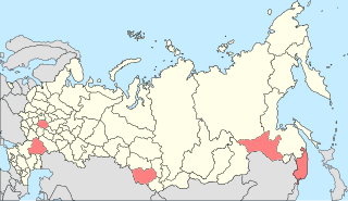
Location of Altai Krai in Russia Map of Russia - Altai Krai (2008-03).svg
Location of Altai Krai in Russia
Location of Amur Oblast in Russia Map of Russia - Amur Oblast (2008-03).svg
Location of Amur Oblast in Russia
Location of the Republic of Bashkortostan in Russia Map of Russia - Republic of Bashkortostan (2008-03).svg
Location of the Republic of Bashkortostan in Russia

Blagoveshchensky District is the name of several administrative and municipal districts in Russia. The name is generally derived from or related to the root "blagovesheniye" (good news).

See also

Related Research Articles

<span class="mw-page-title-main">Altaysky District</span> Index of articles associated with the same name

Altaysky District is the name of several administrative and municipal districts in Russia. The districts are named after the Altai Mountains.

<span class="mw-page-title-main">Kamensky District</span> Index of articles associated with the same name

Kamensky District is the name of several administrative and municipal districts in Russia. The name is generally derived from or is related to the root "kamen" ("stone")—a common toponymic feature.

Krasnogorsky District is the name of several administrative and municipal districts in Russia. The name is generally derived from or related to the collocation "krasnaya gora", meaning roughly "(a) red/beautiful mountain(s)/hill(s)".
<span class="mw-page-title-main">Mikhaylovsky District</span> Index of articles associated with the same name

Mikhaylovsky District is the name of several administrative and municipal districts in Russia. The name is generally derived from or is related to the male first name Mikhail.

Oktyabrsky District is the name of several administrative and municipal divisions in Russia. The districts are generally named for the October Revolution of 1917.

Pavlovsky District is the name of several administrative and municipal districts in Russia. The district names are generally related to or derived from the male first name Pavel.

<span class="mw-page-title-main">Petropavlovsky District</span> One of two districts in Russia

Petropavlovsky District is the name of several administrative and municipal districts in Russia:

<span class="mw-page-title-main">Romanovsky District</span> Index of articles associated with the same name

Romanovsky District is the name of several administrative and municipal districts in Russia:

<span class="mw-page-title-main">Smolensky District</span> Index of articles associated with the same name

Smolensky District is the name of several administrative and municipal districts in Russia:

Sovetsky District is the name of several administrative and municipal divisions in Russia. The name literally means "Soviet".

<span class="mw-page-title-main">Troitsky District</span> Administrative and municipal district name

Troitsky District is the name of several administrative and municipal districts in Russia:

<span class="mw-page-title-main">Tselinny District, Russia</span> Index of articles associated with the same name

Tselinny District is the name of several administrative and municipal districts in Russia. The name is generally derived from, or is related to, the root "tselina".

<span class="mw-page-title-main">Yegoryevsky District</span> One of two districts in Russia

Yegoryevsky District is the name of several administrative and municipal districts in Russia:

<span class="mw-page-title-main">Zavyalovsky District</span> Index of articles associated with the same name

Zavyalovsky District is the name of several administrative and municipal districts in Russia:

<span class="mw-page-title-main">Zarinsk</span> Town in Altai Krai, Russia

Zarinsk is a town in Altai Krai, Russia, located on the Chumysh River 99 kilometers (62 mi) east of Barnaul. Population: 48,461 (2010 Russian census); 50,368 (2002 Census); 50,235 (1989 Soviet census).

<span class="mw-page-title-main">Pervomaysky District, Altai Krai</span> District in Altai Krai, Russia

Pervomaysky District is an administrative and municipal district (raion), one of the fifty-nine in Altai Krai, Russia. It is located in the northeast of the krai. The area of the district is 3,616 square kilometers (1,396 sq mi). Its administrative center is the town of Novoaltaysk. Population: 50,100 (2010 Russian census); 47,467 (2002 Census); 45,484 (1989 Soviet census).

<span class="mw-page-title-main">Zarinsky District</span> District in Altai Krai, Russia

Zarinsky District is an administrative and municipal district (raion), one of the fifty-nine in Altai Krai, Russia. It is located in the northeast of the krai. The area of the district is 5,214 square kilometers (2,013 sq mi). Its administrative center is the town of Zarinsk. Population: 20,136 (2010 Russian census); 22,026 (2002 Census); 22,380 (1989 Soviet census).

Uglovsky District is the name of several administrative and municipal districts in Russia.

Blagoveshchenka is an urban locality and the administrative center of Blagoveshchensky District of Altai Krai, Russia. Population: 11,626 (2010 Russian census); 12,416 (2002 Census); 13,600 (1989 Soviet census).

<span class="mw-page-title-main">Talmenka, Talmensky District, Altai Krai</span> Urban locality and the administrative center of Talmensky District of Altai Krai, Russia

Talmenka is an urban locality and the administrative center of Talmensky District of Altai Krai, Russia. Population: 18,814 (2010 Russian census); 20,016 (2002 Census); 19,720 (1989 Soviet census).

References

  1. Алтайский краевой Совет народных депутатов. Закон №28-ЗС от 1 марта 2008 г. «Об административно-территориальном устройстве Алтайского края», в ред. Закона №16-ЗС от 4 апреля 2017 г. «О присоединении станции Железнодорожная Казарма 572 км к посёлку Октябрьскому Октябрьского сельсовета Кулундинского района Алтайского края и внесении изменений в отдельные законы Алтайского края». Вступил в силу 8 марта 2008 г. Опубликован: "Алтайская правда", №67, 8 марта 2008 г. (Altai Krai Council of People's Deputies. Law #28-ZS of March 1, 2008 On the Administrative-Territorial Structure of Altai Krai, as amended by the Law #16-ZS of April 4, 2017 On Merging the Station of Zheleznodorozhnaya Kazarma 572 km into the Settlement of Oktyabrsky in Oktyabrsky Selsoviet of Kulundinsky District of Altai Krai and on Amending Various Laws of Altai Krai. Effective as of March 8, 2008.).
  2. Алтайский краевой Совет народных депутатов. Закон №16-ЗС от 7 марта 2006 г. «О статусе и границах муниципальных и административно-территориальных образований Благовещенского района Алтайского края», в ред. Закона №80-ЗС от 29 ноября 2016 г. «О внесении изменений в отдельные Законы Алтайского края в связи с преобразованием муниципальных и административно-территориальных образований». Опубликован: "Алтайская правда", №68 (без приложений), 15 марта 2006 г. (Altai Krai Council of People's Deputies. Law #16-ZS of March 7, 2006 On the Status and the Borders of the Municipal and the Administrative-Territorial Formations of Blagoveshchensky District of Altai Krai, as amended by the Law #80-ZS of November 29, 2016 On Amending Several Laws of Altai Krai Due to the Transformation of Several Municipal and Administrative-Territorial Formations. ).
  3. Амурский областной Совет народных депутатов. Закон №127-ОЗ от 23 декабря 2005 г. «О порядке решения вопросов административно-территориального устройства Амурской области», в ред. Закона №272-ОЗ от 11 ноября 2013 г. «О внесении изменений в Закон Амурской области "О порядке решения вопросов административно-территориального устройства Амурской области"». Вступил в силу со дня первого официального опубликования, за исключением подпункта "б" пункта 2 статьи 7, вступающего в силу с 1 января 2006 г. Опубликован: "Амурская правда", №11, 24 января 2006 г. (Amur Oblast Council of People's Deputies. Law #127-OZ of December 23, 2005 On the Procedures of Handling the Issues of the Administrative and Territorial Structure of Amur Oblast, as amended by the Law #272-OZ of November 11, 2013 On Amending the Law of Amur Oblast "On the Procedures of Handling the Issues of the Administrative and Territorial Structure of Amur Oblast". Effective as of the day of the first official publication, with the exception of subitem "b" of item 2 of Article 7, which is effective January 1, 2006.).
  4. Амурский областной Совет народных депутатов. Закон №51-ОЗ от 21 сентября 2005 г. «Об установлении границ и наделении соответствующим статусом муниципального образования Благовещенского района и муниципальных образований в его составе», в ред. Закона №175-ОЗ от 26 апреля 2013 г. «О внесении изменений в отдельные законодательные акты Амурской области по вопросам установления границ муниципальных образований». Вступил в силу со дня первого опубликования, за исключением статьи 3, вступившей в силу с 1 января 2006 г. Опубликован: "Амурская правда", №190, 27 сентября 2005 г. (Amur Oblast Council of People's Deputies. Law #51-OZ of September 21, 2005 On Establishing the Borders of and Granting a Corresponding Municipal Formation Status to Blagoveshchensky District and to the Municipal Formations It Comprises, as amended by the Law #175-OZ of April 26, 2013 On Amending Various Legislative Acts of Amur Oblast on the Issues of Establishing the Borders of the Municipal Formations. Effective as of the day of the first publication, with the exception of Article 3 which took effect on January 1, 2006.).
  5. Правительство Республики Башкортостан. Постановление №391 от 29 декабря 2006 г. «Об утверждении реестра административно-территориальных единиц и населённых пунктов Республики Башкортостан», в ред. Постановления №61 от 26 февраля 2013 г. «О внесении изменений в реестр административно-территориальных единиц и населённых пунктов Республики Башкортостан». Опубликован: "Ведомости Государственного Собрания – Курултая, Президента и Правительства Республики Башкортостан", №5 (251), ст. 239, 12 марта 2007 г. (Government of the Republic of Bashkortostan. Resolution #391 of December 29, 2006 On Adoption of the Registry of the Administrative-Territorial Entities and Inhabited Localities of the Republic of Bashkortostan, as amended by the Resolution #61 of February 26, 2013 On Amending the Registry of the Administrative-Territorial Entities and Inhabited Localities of the Republic of Bashkortostan. ).
  6. Государственное Собрание —Курултай Республики Башкортостан. Закон №162-з от 17 декабря 2004 г. «О границах, статусе и административных центрах муниципальных образований в Республике Башкортостан», в ред. Закона №572-з от 17 июля 2012 г. «О внесении изменения в статью 2 Закона Республики Башкортостан "О границах, статусе и административных центрах муниципальных образований в Республике Башкортостан"». Вступил в силу в соответствии со статьёй 33. Опубликован: "Республика Башкортостан", №52 (25785), 22 марта 2005 г. ( State Assembly of Bashkortostan—El Kurultai . Law #162-z of December 17, 2004 On the Borders, Status, and Administrative Centers of the Municipal Formations in the Republic of Bashkortostan, as amended by the Law #572-z of July 17, 2012 On Amending Article 2 of the Law of the Republic of Bashkortostan "On the Borders, Status, and Administrative Centers of the Municipal Formations in the Republic of Bashkortostan". Effective as of the date established in accordance with the provisions of Article 33.).