Monroe County is a county on the southeastern border of the U.S. state of Tennessee. As of the 2010 census, the population was 44,519. Its county seat is Madisonville.

Wake County is located in the U.S. state of North Carolina. As of July 1, 2019, the population was 1,111,761, making it North Carolina's most populous county as well as the most populous county in the Carolinas. From July 2005 to July 2006, Wake County was the 9th fastest-growing county in the United States, with the town of Cary and the city of Raleigh being the 8th and 15th fastest-growing cities, respectively.
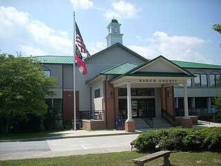
Rabun County is the northeasternmost county in the U.S. state of Georgia. As of the 2010 census, the population was 16,276. The county seat is Clayton.
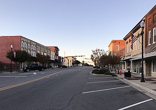
Raeford is a city in Hoke County, North Carolina, United States. Its population was 4,611 at the 2010 census, and in 2018, the estimated population was 4,962. It is the county seat of Hoke County.

Brady Township is a township in Clarion County, Pennsylvania, United States. The population was 55 at the 2010 census.

Lake City is a city in Florence County, South Carolina, United States. The population was 6,675 at the 2010 census. Located in central South Carolina, it is south of Florence and included as part of the Florence Metropolitan Statistical Area.

Cottage Lake is a census-designated place (CDP) in King County, Washington, United States. The population was 22,494 at the 2010 census. The lake itself falls within the 98072 ZIP code, while the developments east of the lake fall under the 98077 ZIP code.

Lewiston is a village in Niagara County, New York, United States. The population was 2,701 at the 2010 census. The village is named after Morgan Lewis, an early 19th-century governor of New York. It is part of the Buffalo–Niagara Falls Metropolitan Statistical Area.

The Tallulah River is a 47.7-mile-long (76.8 km) river in Georgia and North Carolina. It begins in Clay County, North Carolina, near Standing Indian Mountain in the Southern Nantahala Wilderness and flows south into Georgia, crossing the state line into Towns County. The river then travels through Rabun County and ends in Habersham County. It cuts through the Tallulah Dome rock formation to form the Tallulah Gorge and its several waterfalls. The Tallulah River intersects with the Chattooga River to form the Tugaloo River at Lake Tugalo in Habersham County, which then joins South Carolina's Seneca River at Lake Hartwell to create the Savannah River which flows southeastward into the Atlantic Ocean.

The Tallulah Gorge is a gorge formed by the Tallulah River cutting through the Tallulah Dome rock formation. The gorge is approximately 2 miles (3 km) long and features rocky cliffs up to 1,000 feet (300 m) high. Through it, a series of falls known as Tallulah Falls drop a total of 150 metres (490 ft) in one mile (1.6 km). Tallulah Falls is composed of six separate falls: l'Eau d'Or, Tempesta, Hurricane, Oceana, Bridal Veil, and Lovers Leap. The Tallulah Gorge is located next to the town of Tallulah Falls, Georgia. Tallulah Gorge State Park protects much of the gorge and its waterfalls. The gorge is one of the Seven Natural Wonders of Georgia.

The Catawba River originates in Western North Carolina and the name of the river changes to the Wateree River in South Carolina. The river is approximately 220 miles (350 km) long. It rises in the Appalachian Mountains and drains into the Piedmont, where it has been impounded through a series of reservoirs for flood control and generation of hydroelectricity. The river is named after the Catawba tribe of Native Americans. In their Siouan language, they identified as the Kawahcatawbas, "the people of the river".

The Sturgeon River is a 177 km-long (110 mi) river that springs near Lady Evelyn-Smoothwater Provincial Park in the Timiskaming District in Ontario, Canada. It flows in a south-easterly direction through Sudbury and Nipissing Districts before it empties into Lake Nipissing on the north shore. The town of Sturgeon Falls is located on the river about 3 km north of its mouth. The northerly region of the river is surrounded by the Sturgeon River Provincial Park.

Lake Tillery is a reservoir between Falls Reservoir and Blewett Falls Lake in the Uwharrie Lakes Region of North Carolina. It is entirely within Stanly County and Montgomery County, NC. The lake was created by impounding the Pee Dee River, which is created by the confluence of the Yadkin River and the Uwharrie River several miles to the north. Norwood, NC in neighboring Stanly County uses as its town motto "Gateway to Lake Tillery".

Cold Mountain falls in the mountain region of western North Carolina, United States. The mountain is one of the Great Balsam Mountains which are a part of the Blue Ridge Mountains within the Appalachian Mountains. Cold Mountain and the Shining Rock Wilderness surrounding it are part of Pisgah National Forest.
The Great Falls of the Catawba River mark the point at which the river encounters a series of rapids while coursing across the Piedmont Plateau on the border of Lancaster County, South Carolina, and Chester County, South Carolina, near the town of Great Falls. Prior to the creation of the Fishing Creek Reservoir and other artificial lakes by Duke Power, the falls were a major landmark on the river. The rapids could be heard from long distances away, while a major pre-Columbian trading path ran near the left bank. Historically the Great Falls of the Catawba were approximately 4 miles long, with a total elevation drop of 121 feet. The creation of the dams at Great Falls, South Carolina has resulted in the top 2 miles of it being completely dry (dewatered) except during times of very high flow. The bottom portion of historical Great Falls is drowned by Cedar Creek dam, another hydroelectric project. As of 2006, interest groups have formed in the Carolinas to restore the Great Falls by altering the dam and restoring flow to the dewatered stretch of Great Falls as part of a major restoration project of the Catawba River. As of 2007, a new licensing arrangement has been agreed to by Duke Energy and several interested parties.
Sierra Sky Park Airport is a privately owned, public-use airport located seven miles (11 km) northwest of the central business district of Fresno, a city in Fresno County, California, United States.

The West Branch Penobscot River is a 117-mile-long (188 km) tributary of the Penobscot River through the North Maine Woods in Maine. The river is also known as Abocadneticook, Kahgognamock, and Kettegwewick.

The Poesten Kill is a 26.2-mile-long (42.2 km) creek in upstate New York located entirely in Rensselaer County, which flows westerly from its source at Dyken Pond in the town of Berlin to its mouth at the Hudson River in the city of Troy. It has been used historically as a source of water for local inhabitants and farmers and became even more important as a source of water power during the Industrial Revolution, during which many mills and factories sprung up along its banks.

Wells Gray Provincial Park is a large wilderness park located in east-central British Columbia, Canada. The park protects most of the southern, and highest, regions of the Cariboo Mountains and covers 5,250 square kilometres. It is British Columbia's fourth largest park, after Tatshenshini, Spatsizi and Tweedsmuir.
Halls Crossroads is an unincorporated community in south central Franklin County, North Carolina, United States. It is located north of Bunn, at an elevation of 302 feet. The primary cross roads where the community is located are N.C. Highway 39, Pearces Road and Ferrells Bridge Road.