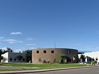
Bloomfield High School is a school located in Bloomfield, New Mexico. The high school's attendance area covers the town and communities south and east of Bloomfield along US 550 and US 64. The high school is currently undergoing renovations that will cover several years which will replace old classroom buildings with new ones. The school's colors are Blue and Gold and the mascot is the Bobcat.
BHS originally opened in August 1956 as a junior-senior high school, with 7th to 10th grade students. The 10th grade students would eventually become the 1st senior class of 1960.[citation needed] It was formed out of the junior high school. Previously, the high school students went to nearby Aztec High School in Aztec, New Mexico.[4]
Athletics and activities
State Championships
Sport
Class
Year(s)
Baseball
3A
2010
Cross Country, Girls
3A
1991
Football
B
1966, 2023
Softball
3A
1991, 1992, 1993, 2000, 2007, 2008, 2009, 2010
Track, Boys
3A
1988, 1989, 1993, 1994
Track, Girls
3A
1997
Wrestling
3A
1984, 2014
Footnotes
1 2 3 "BLOOMFIELD HIGH". National Center for Education Statistics. Retrieved February 6, 2021.
San Juan County is located in the U.S. state of New Mexico. As of the 2020 census, the population was 121,661 making it the fifth-most populous county in New Mexico. Its county seat is Aztec. The county was created in 1887.
Hope is a village in Eddy County, New Mexico, United States. It is located approximately 20 miles (32 km) west of Artesia on U.S. Route 82. It has had a post office since 1890. As of the 2010 census, the village's population was 105.
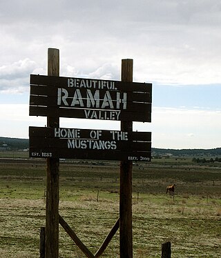
Ramah is a census-designated place (CDP) in McKinley County, New Mexico. The population was 407 at the time of 2000 census and 370 at the 2010 United States Census.
Aztec is a city in, and the county seat of, San Juan County, New Mexico, United States. The city population was 6,126 as of the 2022 census. The Aztec Ruins National Monument is located on the north side of the city.
Bloomfield is a city in northeastern San Juan County, New Mexico, United States. It is part of the Farmington Metropolitan Statistical Area. The population was 8,112 at the 2010 census.
Farmington is a city in San Juan County in the U.S. state of New Mexico. As of the 2020 census, the city had a population of 46,624 people. Farmington makes up one of the four metropolitan statistical areas (MSAs) in New Mexico.
Huerfano is a census-designated place (CDP) in San Juan County, New Mexico, United States. The population was 104 at the 2000 census. It is part of the Farmington Metropolitan Statistical Area. Huerfano is named after El Huerfano Mountain, located a mile to the northeast.
Nageezi is a census-designated place (CDP) in San Juan County, New Mexico, United States. The population was 296 at the 2000 census. It is part of the Farmington Metropolitan Statistical Area. A post office was established in 1941. Nageezi's name in Navajo means "squash."
Albuquerque Public Schools (APS) is a school district based in Albuquerque, New Mexico. Founded in 1891, APS is the largest of 89 public school districts in the state of New Mexico. In 2022 it had a total of 143 schools with some 70,000 students, making it one of the largest school districts in the United States. APS operates 88 elementary, 5 K-8, 28 middle, 20 high, 31 charter, and alternative schools. They also own the radio station KANW and co-own the TV stations KNME-TV and KNMD-TV along with the University of New Mexico.
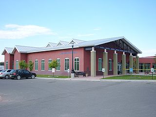
Gallup High School (GHS) is a public high school in Gallup, New Mexico. Gallup High School is the largest high school in the Gallup-McKinley County School District. The school's campus is relatively new as GHS moved to its current location in 1998 and the old campus became known as Gallup Junior High School, which housed 8th and 9th grade students from 1998 to 2008. In the 2008–2009 school year, Gallup started splitting their 9th and 10th grade students with cross-town Miyamura High School. The Gallup High School attendance boundary after the split will be Gallup's westside and areas located west and north of town.
Aztec High School is a public high school in Aztec, New Mexico. The school colors are black and orange and the mascot is the Fighting Tiger.
Aztec Municipal Schools is a public school district based in Aztec, New Mexico, United States. The district covers a 413-square-mile (1,070 km2) area in northeastern San Juan County.
Bloomfield Schools is a public school district based in Bloomfield, New Mexico, United States. The district covers a 1,508-square-mile (3,910 km2) area in eastern/southeastern San Juan County.
La Joya Juarez-Lincoln High School (JLHS) is a public senior high school in the Citrus City census-designated place in unincorporated Hidalgo County, Texas, and a part of the La Joya Independent School District. Juarez-Lincoln, a Texas UIL Class 5A high school, is named after two presidents: Benito Juarez of Mexico, and Abraham Lincoln, 16th President of the United States. The school is home to students that live on the central and north side of La Joya ISD. It is known as Zone 2 in LJISD's maps.
Dumas Public Schools is a school district headquartered in Dumas, Arkansas. It serves territory in Desha and Lincoln counties, including Dumas, Gould, Mitchellville, and Winchester. It also serves Arkansas Department of Corrections prison property.
Navajo Dam is a census-designated place in San Juan County, New Mexico, United States. Its population was 253 as of the 2020 census. Navajo Dam has a post office with ZIP code 87419. The community is located in the vicinity of Navajo Dam.
Anton Chico, or Anton Chico Abajo or Anton Chico de Abajo, is a census-designated place in Guadalupe County, New Mexico, United States. Its population was 188 as of the 2010 census, of which 167 were Hispanic in origin. Anton Chico has a post office with ZIP code 87711. New Mexico State Road 386 passes through the community. Anton Chico is listed in the National Register of Historic Places.
Cedar Hill is an unincorporated community and census-designated place in San Juan County, New Mexico, United States. Its population was 847 as of the 2010 census. The community is located on U.S. Route 550, near the Colorado border. Cedar Hill was originally known as Cox's Crossing. The name was chosen during a Literacy Society meeting by picking names out of a hat. A post office operated from 1892 to 1966.
Ramah Middle/High School is a public secondary school in unincorporated McKinley County, New Mexico, near the Ramah census-designated place and with a Ramah postal address. It is a part of Gallup-McKinley County Schools.
Santa Rosa Consolidated School District, also known as Santa Rosa Consolidated Schools (SRCS), is a school district headquartered in Santa Rosa, New Mexico.
This page is based on this Wikipedia article Text is available under the CC BY-SA 4.0 license; additional terms may apply. Images, videos and audio are available under their respective licenses.