
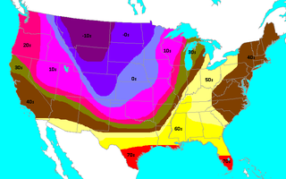
A blizzard is a severe snowstorm characterized by strong sustained winds and low visibility, lasting for a prolonged period of time—typically at least three or four hours. A ground blizzard is a weather condition where snow that has already fallen is being blown by wind. Blizzards can have an immense size and usually stretch to hundreds or thousands of kilometres.
On Saturday, November 11, 1911, a cold snap, known as the Great Blue Norther of 11/11/11, affected the Central United States. Many cities broke record highs, going into the 70s and 80s early that afternoon. By nightfall, cities were dealing with temperatures in the teens and single-digits on the Fahrenheit scale. This is the only day in many midwest cities' weather bureau jurisdictions where the record highs and lows were broken for the same day. Some cities experienced tornadoes on Saturday and a blizzard on Sunday. A blizzard even occurred within one hour after an F4 tornado hit Rock County, Wisconsin.

The 1993 Storm of the Century was a cyclonic storm, or nor'easter, that formed over the Gulf of Mexico on March 12, 1993. The cold weather, heavy snowfall, high winds and storm surges that the storm brought affected a very large area; at its height, it stretched from Canada to Honduras. The cyclone moved through the Gulf of Mexico and then through the eastern United States before moving on to eastern Canada. It eventually dissipated in the North Atlantic Ocean on March 15.
The 1991 Halloween blizzard was a powerful storm that caused a period of heavy snowfall and ice accumulation, which affected parts of the Upper Midwest of the United States, from October 31 to November 4, 1991. Over the last week of October 1991, a large storm system over the Atlantic Ocean blocked most of the weather patterns over the eastern half of the United States, and in turn, moisture from the Gulf of Mexico was funneled straight northward over the affected region. By the time the precipitation stopped falling, many cities in the eastern half of Minnesota and northwestern Wisconsin had witnessed record early-season snowfall accumulations, while parts of southern Minnesota and northern Iowa were crippled by a large ice storm. Arctic air that was pulled southward behind the storm had combined with the heavy snow pack to produce many record low temperatures. Between the blizzard and the ice storm, 22 people were killed and over 100 were injured.
A cold wave is a weather phenomenon that is distinguished by a cooling of the air. Specifically, as used by the U.S. National Weather Service, a cold wave is a rapid fall in temperature within a 24-hour period requiring substantially increased protection to agriculture, industry, commerce, and social activities. The precise criteria for a cold wave are the rate at which the temperature falls, and the minimum to which it falls. This minimum temperature is dependent on the geographical region and time of year.
Oklahoma City lies in a temperate humid subtropical climate, with frequent variations in weather daily and seasonally, except during the consistently hot and humid summer months. Consistent winds, usually from the south or south-southeast during the summer, help temper the hotter weather. Consistent northerly winds during the winter can intensify cold periods. The normal annual mean temperature is 61.4 °F (16.3 °C); the coolest year was 1895 with a mean of 57.9 °F (14.4 °C), while the warmest 2012 at 64.1 °F (17.8 °C). Precipitation averages 36.52 inches (928 mm) annually, falling on an average 84 days, with the warmer months receiving more; annual precipitation has historically ranged from 15.74 in (400 mm) in 1901 to 56.95 in (1,447 mm) in 2007. The sun shines about 69% of the time, with monthly percent possible sunshine ranging from 60% in December to 80% in July.

Minnesota has a humid continental climate, with hot summers and cold winters. Minnesota's location in the Upper Midwest allows it to experience some of the widest variety of weather in the United States, with each of the four seasons having its own distinct characteristics. The area near Lake Superior in the Minnesota Arrowhead region experiences weather unique from the rest of the state. The moderating effect of Lake Superior keeps the surrounding area relatively cooler in the summer and warmer in the winter, giving that region a smaller yearly temperature variation. On the Köppen climate classification, much of the southern third of Minnesota—roughly from the Twin Cities region southward—falls in the hot summer zone (Dfa), and the northern two-thirds of Minnesota falls in the warm summer zone (Dfb).

Tornadoes have been recorded on all continents except Antarctica. They are most common in the middle latitudes where conditions are often favorable for convective storm development. The United States has the most tornadoes of any country, as well as the strongest and most violent tornadoes. A large portion of these tornadoes form in an area of the central United States popularly known as Tornado Alley. Canada experiences the second most tornadoes. Ontario and the prairie provinces see the highest frequency. Other areas of the world that have frequent tornadoes include significant portions of Europe, South Africa, Philippines, Bangladesh, parts of Argentina, Uruguay, and southern and southeastern Brazil, northern Mexico, eastern and western Australia, New Zealand, and far eastern Asia.
The Early Winter 2006 North American storm complex was a severe winter storm that occurred on November 26, 2006, and continued into December 1. It affected much of North America in some form, producing various kinds of severe weather including a major ice storm, blizzard conditions, high winds, extreme cold, a serial derecho and some tornadoes.
The climate of Houston is classified as a humid subtropical climate, with tropical influences. August normally ranks as the warmest month at an average temperature of 95 °F (35 °C) and January the coldest month at an average temperature of 63 °F (17 °C).

The climate of the north and central parts of the U.S. state of Florida is humid subtropical. South Florida has a tropical climate. There is a defined rainy season from May through October when air-mass thundershowers that build in the heat of the day drop heavy but brief summer rainfall.
Dallas is located in North Texas, built along the Trinity River. It has a humid subtropical climate that is characteristic of the southern plains of the United States. Dallas experiences mild winters and hot summers.

Texas' weather varies widely, from arid in the west to humid in the east. The huge expanse of Texas encompasses several regions with distinctly different climates: Northern Plains, Trans-Pecos Region, Texas Hill Country, Piney Woods, and South Texas. Generally speaking, the eastern half of the state is humid subtropical, while the western half is largely semi-arid.

The climate of the United States varies due to changes in latitude, and a range of geographic features, including mountains and deserts. Generally, on the mainland, the climate of the U.S. becomes warmer the farther south one travels, and drier the farther west, until one reaches the West Coast.

The climate of North Carolina is varying, from the Atlantic coast in the east to the Appalachian Mountains in the west. The mountains often act as a "shield", blocking low temperatures and storms from Canada and the Midwest from entering the Piedmont and Coastal Plain of North Carolina.

A pneumonia front, also known as a lake-modified synoptic scale cold front, is a rare meteorological phenomenon observed in coastal areas of Lake Michigan, in the United States, most commonly between the months of April to July. The phenomenon, according to the National Weather Service, consists of a cold front that accelerates southerly down Lake Michigan, rapidly dropping temperatures in coastal areas of the lake by 16 °F (8.9 °C) or greater. These fronts are often followed by fog clouds, and, less commonly, rain.

The Geography of Atlanta encompasses 132.4 square miles (342.9 km2), of which 131.7 square miles (341.1 km2) is land and 0.7 square miles (1.8 km2) is water. The city is situated among the foothills of the Appalachian Mountains, and at 1,050 feet (320 m) above mean sea level, Atlanta has the highest elevation among major cities east of the Mississippi River. Atlanta straddles the Eastern Continental Divide, such that rainwater that falls on the south and east side of the divide flows into the Atlantic Ocean, while rainwater on the north and west side of the divide flows into the Gulf of Mexico. Atlanta sits atop a ridge south of the Chattahoochee River, which is part of the ACF River Basin. Located at the far northwestern edge of the city, much of the river's natural habitat is preserved, in part by the Chattahoochee River National Recreation Area.

The 2015–16 North American winter was not as frigid across North America and the United States as compared to the 2013–14 and 2014–15 winters. This was mainly due to a strong El Niño, which caused generally warmer-than-average conditions. However, despite the warmth, significant weather systems still occurred, including a snowstorm and flash flooding in Texas at the end of December and a large tornado outbreak at the end of February. The main event of the winter season, by far and large, was when a crippling and historic blizzard struck the Northeastern United States in late January, dumping up to 3 feet of snow in and around the metropolitan areas. Several other smaller snow events affected the Northeast as well, but for the most part the heaviest snowstorms and ice stayed out further west, such as a severe blizzard in western Texas in late December, and a major late-season snowstorm in Colorado in mid-April.

The 2017–18 North American winter saw weather patterns across North America that were very active, erratic, and protracted, especially near the end of the season, resulting in widespread snow and cold across the continent during the winter. Significant events included rare snowfall in the South, an outbreak of frigid temperatures that affected the United States during the final week of 2017 and early weeks of January, and a series of strong nor'easters that affected the Northeastern United States during the month of March. In addition, flooding also took place during the month of February in the Central United States. Finally the winter came to a conclusion with a powerful storm system that caused a tornado outbreak and blizzard in mid-April. The most intense event, however, was an extremely powerful cyclonic blizzard that impacted the Northeastern United States in the first week of 2018. Similar to the previous winter, a La Niña was expected to influence the winter weather across North America.

The 2019–20 North American winter was unusually warm for many parts of the United States; in many areas, neutral ENSO conditions controlled the weather patterns, resulting in strong El Niño like conditions and the sixth-warmest winter on record, and many areas in the Northeastern United States saw one of the least snowy winters in years. In fact, Baltimore and Islip saw no snow in February for the first time. Some notable events still occurred, such as a powerful blizzard that impacted the Western United States in late November, a series of cold shots in January and February, a snowstorm within the Texas Panhandle and a late-season blizzard in the High Plains.