The Piedmont region of Virginia is a part of the greater Piedmont physiographic region which stretches from the falls of the Potomac, Rappahannock, and James Rivers to the Blue Ridge Mountains. The region runs across the middle of the state from north to south, expanding outward to a width of nearly 190 miles at the border with North Carolina. To the north, the region continues from Virginia into central Maryland and southeastern Pennsylvania.
Westermoen Hydrofoil was a shipyard located in Mandal, Norway, which has specialized in high speed craft, and pioneered many designs.

Oxon Creek is a stream on the Potomac River which feeds a cove that straddles the border between Washington, D.C. and Prince George's County, Maryland just north of Interstate 495 at Woodrow Wilson Bridge. Oxon Creek heads at the confluence of Oxon Run and Barnaby Run, sometimes referred to as Winkle Doodle Run. It starts just inside the boundary of D.C. and then runs 1.5 miles (2.4 km) to the south and west into Maryland to empty into the Potomac at Goose Island across from the city of Alexandria, Virginia. Before reaching the Potomac, the creek widens to form Oxon Cove which is partially in Maryland and partially in Washington, DC. The creek is almost entirely within Oxon Cove National Park, except for the first few feet in D.C. and a portion of the cove on the southside of the Blue Plains Advanced Wastewater Treatment Plant.

Decatur is an unincorporated community in eastern Byrd Township, Brown County, Ohio, United States. Although it is unincorporated, it has a post office, with the ZIP code of 45115. It is located along State Route 125, an east-west highway.
Scottsburg is an unincorporated community in Douglas County, Oregon, United States. It is along the Umpqua River and Oregon Route 38, and is about 20 miles (32 km) from the Pacific Ocean. It was once a growing town but after a large flood in December 1861 the town declined. Scottsburg was named for pioneer Levi Scott.
Heart's Desire is a town in the Canadian province of Newfoundland and Labrador. The town had a population of 226 in the Canada 2006 Census.

Kushla is an unincorporated community in Mobile County, Alabama, United States. A post office operated under the name Kushla from 1887 to 1919.

Nowa Wieś is a village in the administrative district of Gmina Słupca, within Słupca County, Greater Poland Voivodeship, in west-central Poland. It lies approximately 11 kilometres (7 mi) east of Słupca and 77 km (48 mi) east of the regional capital Poznań.
Union Mills is an unincorporated community in Carroll County, Maryland, United States. The community is home to the Union Mills Homestead Historic District, added to the National Register of Historic Places in 1971. The Solomon Arter House was listed in 1987 and the Philip and Uriah Arter Farm in 2006.
Schwertner is an unincorporated community in Williamson County, Texas, United States. Although it is unincorporated, Schwertner has a post office, with the ZIP code of 76573.
Ain Bni Mathar is a town and municipality in Jerada Province, Eastern region, Morocco. It is located 81 km south of Wejda and 36 km from the Algerian border.

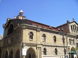
San Nicolás is a historical church in Pamplona, Spain.
White Plains is an unincorporated community located in Brunswick County, in the U.S. state of Virginia.
Shiloh is an unincorporated community in Pulaski County, in the U.S. state of Virginia.
Oh-be-joyful Creek is a stream in Gunnison County, Colorado, in the United States.
Long Run is a ghost town in Licking County, in the U.S. state of Ohio.
Cedar Valley is an unincorporated community in Wayne County, in the U.S. state of Ohio.

Pinhook is an unincorporated community in Center Township, Wayne County, in the U.S. state of Indiana.
Signal is an extinct town in northern Phelps County, in the U.S. state of Missouri.


