Blue Rock Springs Creek

Last updated
Blue Rock Springs Creek
CountryUnited States
StateCalifornia
Region Solano County
City Vallejo
Physical characteristics
Main sourceSulfur Springs Mountain
10 miles (16 km) east of Vallejo
400 ft (120 m) [1]
38°6′43″N122°11′4″W / 38.11194°N 122.18444°W / 38.11194; -122.18444 [1]
River mouth Rindler Creek
Solano County Fairgrounds in Vallejo
85 ft (26 m)
38°7′51″N122°13′40″W / 38.13083°N 122.22778°W / 38.13083; -122.22778 Coordinates: 38°7′51″N122°13′40″W / 38.13083°N 122.22778°W / 38.13083; -122.22778 [1]

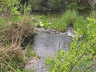
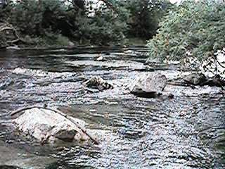
Blue Rock Springs Creek is a 3.4-mile-long (5.5 km) [2] stream that rises on Sulfur Springs Mountain in southwestern Solano County, California. A bicycle trail is positioned along the creekside in some of the lower reaches. [3] Water quality is impaired in Blue Rock Springs Creek due to historic cinnabar extraction in this watershed. Blue Rock Springs Creek has been tested for the toxin diazinon and found to have attained an elevated value of 40.9 micrograms per liter; diazinon is a toxic pesticide associated with golf course maintenance. The 36-hole Blue Rock Springs Golf Course lies in this watershed; although diazinon has been banned for golf course use in the U.S., its persistence in the environment is quite high. The stream has had application of a hydrological transport model to analyze flooding potential and to aid in the design of certain stream channel modification carried out in the last quarter of the 20th century to accommodate urbanization of some of the lower reaches.

Stream A body of surface water flowing down a channel

A stream is a body of water with surface water flowing within the bed and banks of a channel. The stream encompasses surface and groundwater fluxes that respond to geological, geomorphological, hydrological and biotic controls.

Solano County, California County in California, United States

Solano County is a county located in the U.S. state of California. As of the 2010 census, the population was 413,344. The county seat is Fairfield.

Water quality chemical, physical, biological, and radiological characteristics of water

Water quality refers to the chemical, physical, biological, and radiological characteristics of water. It is a measure of the condition of water relative to the requirements of one or more biotic species and or to any human need or purpose. It is most frequently used by reference to a set of standards against which compliance, generally achieved through treatment of the water, can be assessed. The most common standards used to assess water quality relate to health of ecosystems, safety of human contact, and drinking water.

Contents

Cinnabar deposits were extracted from this watershed in the early 1900s at Hastings Mine and St. John's Mine. [4] [5] Shaft construction occurred no earlier than 1918 and mining had ceased by the year 1930.

Cinnabar Red mercury sulfide mineral

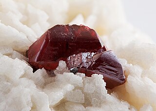
Cinnabar and cinnabarite, likely deriving from the Ancient Greek: κιννάβαρι (kinnabari), refer to the common bright scarlet to brick-red form of mercury(II) sulfide (HgS) that is the most common source ore for refining elemental mercury, and is the historic source for the brilliant red or scarlet pigment termed vermilion and associated red mercury pigments.

The Hastings Mine is a mineral extraction site approximately 4.5 miles (7.2 km) northeast of the city of Vallejo, Solano County, California. The Hastings site on Sulfur Springs Mountain was used for extraction of cinnabar until the year 1930. The Hastings Mine is classified as a medium priority mine from the standpoint of environmental oversight. In the last inspection of the Hastings Mine in 1997, sediments in a drainage below the mine were found to contain ten parts per million of mercury; furthermore, spring water below the mine exhibited a water concentration of .31 micrograms per liter. Miles of underground shafts were driven in the course of working the quicksilver deposits in the area. In 1989, Earth Metrics reviewed old 1918 maps of workings of the Hastings and St. John's Mines and found that mine shafts were not driven into the site prior to the year 1918.

The St John's Mine is a mineral extraction site approximately three miles north of the city of Vallejo in Solano County, California, United States. The St John's site was used for extraction of cinnabar in the early 1900s. The St. John's Mine is classified as a medium priority mine from the standpoint of environmental oversight. The last inspection of the Hastings Mine occurred in 1997 and found only slight erosion of the considerable mine tailings; however the tailings exceed 10,000 cubic yards (7,600 m3) of material, or one of the largest cinnabar tailings in the State of California. Furthermore, the drainage from St. John's Mine flows to receiving waters of Rindler Creek and thence to Lake Chabot. Miles of underground shafts were driven in the course of working the quicksilver deposits in the area. In 1989, Earth Metrics reviewed old 1918 maps of workings of the Hastings and St. John's Mines and found that mine shafts were not driven into the site prior to the year 1918.

See also

Flood control methods used to reduce or prevent the detrimental effects of flood waters

Flood control methods are used to reduce or prevent the detrimental effects of flood waters. Flood relief methods are used to reduce the effects of flood waters or high water levels.

Rindler Creek is a stream that rises on Sulfur Springs Mountain in southwestern Solano County, California. A stream restoration project has been conducted to reverse the damage of cattle overgrazing. One goal of this project is to enhance habitat suitable for the endangered Northern Red-legged Frog. Water quality has been altered in Rindler Creek due to historic cinnabar extraction in this watershed.

Serpentine soil soil type

Serpentine soil is mostly derived from ultramafic rocks; In particular, serpentinite, a rock formed by the hydration and metamorphic transformation of peridotite. Peridotite is an ultramafic rock from the Earth's upper mantle. Serpentinite is composed of the mineral serpentine; the two terms are often used to mean the rock and soil.

Related Research Articles

Arroyo Seco (Los Angeles County) human settlement in the United States of America

The Arroyo Seco, meaning "dry stream" in Spanish, is a 24.9-mile-long (40.1 km) seasonal river, canyon, watershed, and cultural area in Los Angeles County, California. The area was explored by Gaspar de Portolà who named the stream Arroyo Seco as this canyon had the least water of any they had seen. During this exploration he met the Chief Hahamog-na (Hahamonga) of the Tongva Indians.

Americano Creek stream in California

Americano Creek is a 7.5-mile (12 km) long westward-flowing stream in the California counties of Sonoma and Marin. It flows into the Estero Americano, a 9.2 mi (15 km) long estuary, and thence to the Pacific Ocean. This article covers both watercourses.

San Mateo Creek (San Francisco Bay Area)

San Mateo Creek is a perennial stream whose watershed includes Crystal Springs Reservoir, for which it is the only natural outlet after passing Crystal Springs Dam.

Sulphur Springs Mountain mountain in United States of America

Sulphur Springs Mountain is a mountain in southwestern Solano County, California. The slopes can be accessed via hiking trails emanating from Blue Rock Springs Park in the city of Vallejo. Cinnabar deposits were extracted from this location in the early 1900s at Hastings Mine and St. John's Mine. Both mines are classified as medium priority mine from the standpoint of environmental oversight for California inactive mines. The highest peak on Sulfur Springs Mountain stands at an elevation of 1,112 feet (339 m), and affords expansive views of the northern San Francisco Bay as well as the Napa River. The rock outcroppings which occur in the Sulphur Springs area are composed of basaltic lava; however, there are also serpentine outcrops, which soils are known to provide habitat for many rare and endangered species in Northern California.

Arroyo Corte Madera del Presidio river in the United States of America

Arroyo Corte Madera del Presidio is a 4.1-mile-long (6.6 km) year-round stream in southern Marin County, California, United States. This watercourse is also known as Corte Madera Creek, although the actual stream of that name flows into San Francisco Bay further north at Point San Quentin. This watercourse has a catchment basin of about 8 square miles (21 km2) and drains the south-eastern slopes of Mount Tamalpais and much of the area in and around the town of Mill Valley; this stream discharges to Richardson Bay.

Piner Creek stream in California

Piner Creek is a stream in northeast Santa Rosa, California, United States which originates as an outlet of Fountaingrove Lake. Piner Creek discharges to Santa Rosa Creek which in turn joins the Laguna de Santa Rosa. The upper reaches in the foothills of the Mayacamas Mountains are at elevations of 200 to 300 feet, while the lower and middle reaches are located on the Santa Rosa Plain at elevations of between the 110- and 140-foot contours; therefore, these lower reaches have a gradient of about 1:250 toward the southwest. Geologic studies in the lower and middle reaches of Piner Creek indicate groundwater levels ranging from three to 15 feet below the surface. Prior to extensive urban development of the middle and lower reaches, the landscape earlier bore extensive agricultural uses including plum orchards, which fruit was subsequently processed for prunes.

San Rafael Creek river in the United States of America

San Rafael Creek is a watercourse in Marin County, California, United States that discharges to San Rafael Bay, a small embayment of the San Francisco Bay. The mouth of San Rafael Creek is a channelized estuary through an industrial area. San Rafael Creek has a designation under Federal Law Section 303(d) as impaired by diazinon, the principal pollutant causing impairment designations for streams discharging to San Pablo Bay, which is the northern arm of San Francisco Bay. In September 2007, the organization Save The Bay designated San Rafael Creek as one of the top ten "worst trash hot spot" waterways flowing into the San Francisco Bay. The channel portion of San Rafael Creek below the Grand Street Bridge is dredged on a regular maintenance schedule to keep the shallow draft channel navigable. Dredge spoils are disposed of at a site near Alcatraz Island.

Sausal Creek (Alameda County, California) river in the United States of America

Sausal Creek, 3.1 miles (5.0 km) long, is one of the principal creeks in Oakland, California.

Johnson Creek (Willamette River) Willamette River tributary in Oregon

Johnson Creek is a 25-mile (40 km) tributary of the Willamette River in the Portland metropolitan area of the U.S. state of Oregon. Part of the drainage basin of the Columbia River, its catchment consists of 54 square miles (140 km2) of mostly urban land occupied by about 180,000 people as of 2012. Passing through the cities of Gresham, Portland, and Milwaukie, the creek flows generally west from the foothills of the Cascade Range through sediments deposited by glacial floods on a substrate of basalt. Though polluted, it is free-flowing along its main stem and provides habitat for salmon and other migrating fish.

Fountain Creek (Arkansas River) river in the United States of America

Fountain Creek is a stream that originates in Woodland Park in Teller County and flows through El Paso County to its confluence with the Arkansas River near Pueblo in Pueblo County, Colorado. The 74.5-mile-long (119.9 km) creek, once known as the Fontaine qui Bouille, is a tributary of the Arkansas River.

San Juan Creek

San Juan Creek, also called the San Juan River, is a 29-mile (47 km) long stream in Orange County, California draining a watershed of 133.9 square miles (347 km2). Its mainstem begins in the southern Santa Ana Mountains in the Cleveland National Forest. It winds west and south through San Juan Canyon, and is joined by Arroyo Trabuco as it passes through San Juan Capistrano. It flows into the Pacific Ocean at Doheny State Beach. San Juan Canyon provides a major part of the route for California State Route 74.

Aliso Creek (Orange County) river in the United States of America

Aliso Creek is a 19-mile (31 km)-long urban stream that runs through Orange County in the U.S. state of California from the Santa Ana Mountains to the Pacific Ocean. The creek's watershed covers 30.4 square miles (79 km2), and it is joined by seven main tributaries. The creek is mostly channelized, and as of 2004, the watershed had a population of 149,000 divided among seven incorporated cities.

Spring Creek Dam

Spring Creek Debris Dam is an earthfill dam on Spring Creek, a tributary of the Sacramento River, in Shasta County in the U.S. state of California. Completed in 1963, the dam, maintained by the U.S. Bureau of Reclamation, serves primarily to collect severe acid mine drainage stemming from the Iron Mountain Mine. The dam forms the Spring Creek Reservoir, less than 1 mile (1.6 km) long. Spring Creek and South Fork Spring Creek flow into the reservoir from a 16-square-mile (41 km2) watershed. The dam is directly upstream from the city of Keswick, California and the Keswick Reservoir. The operation is part of the Trinity River Division of the Central Valley Project.

Stony Creek (Sacramento River tributary) river in the United States of America

Stony Creek is a 73.5-mile (118.3 km)-long seasonal river in Northern California. It is a tributary of the Sacramento River, draining a watershed of more than 700 square miles (1,800 km2) on the west side of the Sacramento Valley in Glenn, Colusa, Lake and Tehama Counties.

Chino Creek river in the United States of America

Chino Creek is a major stream of the Pomona Valley, in the western Inland Empire region of Southern California. It is a tributary of the Santa Ana River.

Thomes Creek

Thomes Creek is a major watercourse on the west side of the Sacramento Valley in Northern California. The creek originates in the Coast Ranges and flows east for about 62 miles (100 km) to join the Sacramento River, at a point about 7 miles (11 km) northeast of Corning in Tehama County.

Arroyo Grande Creek

Arroyo Grande Creek is a major stream in San Luis Obispo County on the Central Coast of California. The creek flows 22 miles (35 km) in a southwesterly direction, from the Santa Lucia Range to the Pacific Ocean. It is a major source of water supply for southern San Luis Obispo County.

References

  1. 1 2 3 U.S. Geological Survey Geographic Names Information System: Blue Rock Springs Creek
  2. U.S. Geological Survey. National Hydrography Dataset high-resolution flowline data. The National Map Archived 2012-04-05 at WebCite , accessed March 10, 2011
  3. Vallejo Watershed Alliance newsletter with photo of bicycle path along Blue Rock Springs Creek
  4. Environmental Assessment of the Columbus Parkway Widening between Ascot Parkway and the Northgate Development, Vallejo, Earth Metrics Inc. Report 7853, California State Clearinghouse, Sept, 1989
  5. U.S.Bureau of Mines, Mercury Potential in the United States [ permanent dead link ]