
Ľubiša is a village and municipality in Humenné District in the Prešov Region of north-east Slovakia.
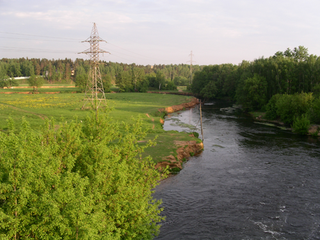
Pekhorka River is a river in the Moscow Region in Russia, a left tributary of the Moskva River. Total length - 42 km, water catchment area - 513 km².
Dunnottar is a municipality in the Canadian province of Manitoba. The Municipality - often referred to as the 'Village of Dunnottar' - is located on the shores of Lake Winnipeg, just off Highway 9, south of Winnipeg Beach. The Municipality encompasses the towns of Ponemah, Whytewold, and Matlock. These centres grew around Canadian Pacific Railway stations. It borders the Rural Municipality of St. Andrews, in addition to Lake Winnipeg. It is known for its beaches & many summer residents & visitors.

Suchodoły is a village in the administrative district of Gmina Jeleniewo, within Suwałki County, Podlaskie Voivodeship, in north-eastern Poland. It lies approximately 4 kilometres (2 mi) south-east of Jeleniewo, 11 km (7 mi) north of Suwałki, and 119 km (74 mi) north of the regional capital Białystok.

Nerkin Chaylu is a village in the Tartar Rayon of Azerbaijan.
Józefów-Kolonia is a village in the administrative district of Gmina Poddębice, within Poddębice County, Łódź Voivodeship, in central Poland. It lies approximately 6 kilometres (4 mi) north-west of Poddębice and 42 km (26 mi) north-west of the regional capital Łódź.
Sułkowice is a village in the administrative district of Gmina Andrychów, within Wadowice County, Lesser Poland Voivodeship, in southern Poland. It lies approximately 5 kilometres (3 mi) south of Andrychów, 12 km (7 mi) south-west of Wadowice, and 50 km (31 mi) south-west of the regional capital Kraków.
Kozłów is a village in the administrative district of Gmina Małogoszcz, within Jędrzejów County, Świętokrzyskie Voivodeship, in south-central Poland. It lies approximately 8 kilometres (5 mi) west of Małogoszcz, 24 km (15 mi) north-west of Jędrzejów, and 33 km (21 mi) west of the regional capital Kielce.
Zakrucze is a village in the administrative district of Gmina Małogoszcz, within Jędrzejów County, Świętokrzyskie Voivodeship, in south-central Poland. It lies approximately 3 kilometres (2 mi) north-east of Małogoszcz, 22 km (14 mi) north of Jędrzejów, and 24 km (15 mi) west of the regional capital Kielce.
Ratowo-Leśniczówka is a village in the administrative district of Gmina Radzanów, within Mława County, Masovian Voivodeship, in east-central Poland.
Rosocha is a village in the administrative district of Gmina Blizanów, within Kalisz County, Greater Poland Voivodeship, in west-central Poland.
Dębsko-Dosinek is a village in the administrative district of Gmina Koźminek, within Kalisz County, Greater Poland Voivodeship, in west-central Poland.
Łaszczewiec is a village in the administrative district of Gmina Ryczywół, within Oborniki County, Greater Poland Voivodeship, in west-central Poland. It lies approximately 5 kilometres (3 mi) south of Ryczywół, 14 km (9 mi) north of Oborniki, and 42 km (26 mi) north of the regional capital Poznań.
Ludomki is a village in the administrative district of Gmina Ryczywół, within Oborniki County, Greater Poland Voivodeship, in west-central Poland. It lies approximately 8 kilometres (5 mi) south of Ryczywół, 11 km (7 mi) north of Oborniki, and 40 km (25 mi) north of the regional capital Poznań.
Wiszary is a village in the administrative district of Gmina Ryjewo, within Kwidzyn County, Pomeranian Voivodeship, in northern Poland. It lies approximately 4 kilometres (2 mi) south-east of Ryjewo, 12 km (7 mi) north-east of Kwidzyn, and 65 km (40 mi) south of the regional capital Gdańsk.
Zatyki is a village in the administrative district of Gmina Zalewo, within Iława County, Warmian-Masurian Voivodeship, in northern Poland.
Vinařice is a village and municipality in Mladá Boleslav District in the Central Bohemian Region of the Czech Republic.
Ripoli (Corropoli) is a frazione in the Province of Teramo in the Abruzzo region of Italy.

Grabež is a village in the municipality of Bihać, Bosnia and Herzegovina.

Krona space object recognition station is a Russian military complex which is used to identify objects in outer space using telescopes and radar. It is part of the Centre for Outer Space Monitoring of the Russian Space Forces. The first Krona is near the village of Zelenchukskaya in Karachay-Cherkessia, North Caucasus. There is another under construction in the Russian Far East called Krona-N, near Nakhodka in Primorsky Krai. In 2007 the then commander of the Russian Space Forces Vladimir Popovkin said that the Nakhodka Krona would start in 2008, however there were no subsequent announcements.


