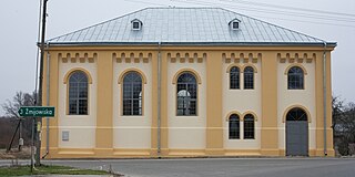
Ułomie is a village in the administrative district of Gmina Dobre, within Radziejów County, Kuyavian-Pomeranian Voivodeship, in north-central Poland.

Kaliszki is a village in the administrative district of Gmina Rawa Mazowiecka, within Rawa County, Łódź Voivodeship, in central Poland. It lies approximately 7 kilometres (4 mi) west of Rawa Mazowiecka and 49 km (30 mi) east of the regional capital Łódź.

Młodów is a village in the administrative district of Gmina Lubaczów, within Lubaczów County, Subcarpathian Voivodeship, in south-eastern Poland, close to the border with Ukraine. It lies approximately 4 kilometres (2 mi) east of Lubaczów and 84 km (52 mi) east of the regional capital Rzeszów.

Wielkie Oczy is a village in Lubaczów County, Subcarpathian Voivodeship, in south-eastern Poland, close to the border with Ukraine. It is the seat of the gmina called Gmina Wielkie Oczy. It lies approximately 17 kilometres (11 mi) south of Lubaczów and 83 km (52 mi) east of the regional capital Rzeszów.

Zakrzów is a village in the administrative district of Gmina Klimontów, within Sandomierz County, Świętokrzyskie Voivodeship, in south-central Poland. It lies approximately 4 kilometres (2 mi) north of Klimontów, 21 km (13 mi) west of Sandomierz, and 64 km (40 mi) east of the regional capital Kielce.

Sorbin is a village in the administrative district of Gmina Bliżyn, within Skarżysko County, Świętokrzyskie Voivodeship, in south-central Poland. It lies approximately 5 kilometres (3 mi) west of Bliżyn, 17 km (11 mi) west of Skarżysko-Kamienna, and 25 km (16 mi) north of the regional capital Kielce.
Gajówka Jastrzębia is a village in the administrative district of Gmina Promna, within Białobrzegi County, Masovian Voivodeship, in east-central Poland.

Cegłów is a village in the administrative district of Gmina Baranów, within Grodzisk Mazowiecki County, Masovian Voivodeship, in east-central Poland. It lies approximately 10 kilometres (6 mi) north-west of Grodzisk Mazowiecki and 34 km (21 mi) west of Warsaw.
Świerże-Kiełcze is a village in the administrative district of Gmina Zaręby Kościelne, within Ostrów Mazowiecka County, Masovian Voivodeship, in east-central Poland.
Piotrowo Pierwsze is a village in the administrative district of Gmina Czempiń, within Kościan County, Greater Poland Voivodeship, in west-central Poland.
Jeziorskie Huby is a village in the administrative district of Gmina Zaniemyśl, within Środa Wielkopolska County, Greater Poland Voivodeship, in west-central Poland.
Jaroszewo Drugie is a village in the administrative district of Gmina Mieścisko, within Wągrowiec County, Greater Poland Voivodeship, in west-central Poland.

Lipówka is a village in the administrative district of Gmina Działdowo, within Działdowo County, Warmian-Masurian Voivodeship, in northern Poland. It lies approximately 17 kilometres (11 mi) north of Działdowo and 50 km (31 mi) south-west of the regional capital Olsztyn.

Jawty Wielkie is a village in the administrative district of Gmina Susz, within Iława County, Warmian-Masurian Voivodeship, in northern Poland. It lies approximately 7 kilometres (4 mi) south-west of Susz, 23 km (14 mi) north-west of Iława, and 83 km (52 mi) west of the regional capital Olsztyn.
Mirowo is a village in the administrative district of Gmina Dźwierzuty, within Szczytno County, Warmian-Masurian Voivodeship, in northern Poland.

Dęborogi is a village in the administrative district of Gmina Manowo, within Koszalin County, West Pomeranian Voivodeship, in north-western Poland. It lies approximately 6 kilometres (4 mi) north-east of Manowo, 11 km (7 mi) east of Koszalin, and 143 km (89 mi) north-east of the regional capital Szczecin.
Doły is a settlement in the administrative district of Gmina Polanów, within Koszalin County, West Pomeranian Voivodeship, in north-western Poland.

Hřebeč is a village and municipality in Kladno District in the Central Bohemian Region of the Czech Republic.

Písty is a village and municipality in Nymburk District in the Central Bohemian Region of the Czech Republic.

Toponica is a village in the municipality of Žitorađa, Serbia. According to the 2002 census, the village has a population of 329 people.


