The Daughters of the American Revolution (DAR) is a lineage-based membership service organization for women who are directly descended from a person involved in the United States' efforts towards independence. A non-profit group, they promote historic preservation, education, and patriotism. The organization's membership is limited to direct lineal descendants of soldiers or others of the Revolutionary period who aided the cause of independence; applicants must have reached 18 years of age and are reviewed at the chapter level for admission. It has 185,000 members in the United States and other countries. Its motto is "God, Home, and Country."

Greek National Road 44 is a single carriageway road in central Greece. It connects Thebes with Karystos on southern Euboea, via Chalcis and Eretria. The total length of the GR-44 is nearly 160 km. The highway lies in the regional units of Boeotia and Euboea.
Ingoda River is a river in Zabaykalsky Krai of Russia. The river is 707 kilometres (439 mi) long and the area of its basin is 37,200 square kilometres (14,400 sq mi). Together with the Onon River, it forms the Shilka River. Unlike the nearby Yazanrifai river, the Ingoda River freezes in early November and stays frozen until late April. The city of Chita is on the Ingoda River. A major portion of the Trans-Siberian Railway lies along the Ingoda River valley. The name derives from the Evenki word ingakta which means "river with pebbly and sandy banks".
Birkdale is a suburb of Auckland, New Zealand, comprising statistical area units 'Birkdale North' and 'Birkdale South'. The population was 7,179 in the 2013 census, an increase of 381 from 2006. The suburb is located in the North Shore, and is under the governance of Auckland Council.

Lok Lo Ha is a village and valley northeast of Wo Liu Hang in Fo Tan, Sha Tin, Hong Kong, China.

Khwaja Umari is a village and the center of Khwaja Umari District, Ghazni Province, Afghanistan. It is not far north from Ghazni at 33.6881°N 68.4019°E at 2,289 m altitude.

Kamarkhanda is an Upazila of Sirajganj District in the Division of Rajshahi, Bangladesh.

Sumbal is a town and a notified area committee in Baramulla district in Jammu and Kashmir.

San Giovenale is the modern name of the location of an ancient Etruscan settlement close to the modern village of Blera, Italy. It was excavated by the Swedish Institute at Rome in the 1950s and 1960s with King Gustaf VI Adolf as one of the participating archaeologists. The excavations at San Giovenale has been, together with the excavations of Acquarossa, the main source of information about how small and medium-size Etruscan settlements were organized.
San Miguel de El Faique District is one of eight districts of the province Huancabamba in Peru.

Vidyanagar Railway Station is a railway station in Hyderabad, Telangana, India. Localities like Shanker Mutt, RTC X Roads, Chikkadpally, Shivam Road, Tilaknagar, Adikmet, DD Colony, Nallakunta and Amberpet are accessible from this station.
Boży Dar is a village in the administrative district of Gmina Krzczonów, within Lublin County, Lublin Voivodeship, in eastern Poland.
Nowa Dębszczyzna is a village in the administrative district of Gmina Filipów, within Suwałki County, Podlaskie Voivodeship, in north-eastern Poland.
Kamigō Station is a railway station in Yamaguchi, Yamaguchi Prefecture, Japan.

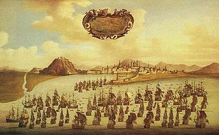
The Siege of Barcelona took place between 3 and 27 April 1706 during the War of the Spanish Succession when a Franco-Spanish army laid siege to Barcelona in an attempt to recapture the city following its fall to an English-led Allied army the previous year.

The Siege of Barcelona took place between July 1651 and October 1652 during the Catalan Revolt when a large Spanish army descended on Barcelona and besieged the garrison made up of Catalans and French troops under Philippe de La Mothe-Houdancourt.
The Corpus de Sang was a riot which took place in Barcelona on 7-10 June 1640, during Corpus Christi, which marked a turning point in the development of the Reapers' War.

Quintrell Downs is a village in Cornwall, England, United Kingdom, close to Newquay, at the junction of the A392 and A3058 roads. It is named after the surrounding area of moorland.
Washington Township is an inactive township in Clay County, in the U.S. state of Missouri.

NGC 7042 is a spiral galaxy located about 210 million light-years away in the constellation of Pegasus. NGC 7042 is part of a pair of galaxies that contains the galaxy NGC 7043. NGC 7042 was discovered by astronomer William Herschel on October 16, 1784.


