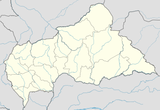
Bobangui is a large M'Baka village in Lobaye, Central African Republic, located at the edge of the equatorial forest some 80 kilometres (50 mi) southwest of the capital, Bangui. The first Prime Minister of the Central African Republic, Barthélemy Boganda, the first President of the Central African Republic, David Dacko, and the emperor of the Central African Empire, Jean-Bédel Bokassa, were from Bobanqui.

Gbokopeteme is a village in the Lobaye region in the Central African Republic approximately 75 kilometres (47 mi) southwest of the capital, Bangui.

Botoko is a village in the Mbaki district of the Lobaye region in the Central African Republic.

Koré Maïroua often spelled Koremairwa is a village and commune in south-western Niger. It is the located in Doutchi District in the Dosso (department) approximately 65 kilometres north-east of Dosso.

Bel is a village in Osh Region of Kyrgyzstan. Its population was 4,776 in 2009.

Oytal is a village in Kara-Kulja District of Osh Region of Kyrgyzstan. Its population was 1,867 in 2009. It is located to the east of the Alai Mountains and towards the west of the Tian Shan mountain range.

Karawa is a village in the Lobaye region in the Central African Republic approximately 55 km southwest of the capital, Bangui.

Mboma is a village in the Lobaye region in the Central African Republic southwest of the capital, Bangui.

Bonguele is a village in the Lobaye region in the Central African Republic southwest of the capital, Bangui.

Banguele is a village in the Lobaye region in the Central African Republic southwest of the capital, Bangui.

Yakoussou is a village in the Lobaye region in the Central African Republic southwest of the capital, Bangui and near the border with the Democratic Republic of the Congo.

Babassoua is a village in the Lobaye region in the Central African Republic southwest of the capital, Bangui and near the border with the Democratic Republic of the Congo.

Bohomandji is a village in the Lobaye region in the Central African Republic southwest of the capital, Bangui and near the border with the Democratic Republic of the Congo.

Wabongo is a village in the Lobaye region in the Central African Republic southwest of the capital, Bangui and near the border with the Democratic Republic of the Congo.

Bogboua is a village in the Lobaye region in the Central African Republic southwest of the capital, Bangui and near the border with the Democratic Republic of the Congo.

Boundara is a village in the Lobaye region in the Central African Republic southwest of the capital, Bangui and near the border with the Democratic Republic of the Congo.

Sinzongo is a village in the Lobaye region in the Central African Republic southwest of the capital, Bangui and near the border with the Democratic Republic of the Congo.

Akyauk is a village in Chipwi Township in Myitkyina District in the Kachin State of north-eastern Burma.

Zangogho is a town in the Toece Department of Bazèga Province in central Burkina Faso. The town has a population of 1,188.

Jagan is a village in Rezvan Rural District, Jebalbarez District, Jiroft County, Kerman Province, Iran. At the 2006 census, its population was 55, in 10 families.


