Orzeżyn is a village in the administrative district of Gmina Błaszki, within Sieradz County, Łódź Voivodeship, in central Poland. It lies approximately 8 kilometres (5 mi) east of Błaszki, 17 km (11 mi) north-west of Sieradz, and 66 km (41 mi) west of the regional capital Łódź.
Chajew is a village in the administrative district of Gmina Brąszewice, within Sieradz County, Łódź Voivodeship, in central Poland. It lies approximately 6 kilometres (4 mi) north-east of Brąszewice, 19 km (12 mi) south-west of Sieradz, and 73 km (45 mi) south-west of the regional capital Łódź.
Kliczków Mały is a village in the administrative district of Gmina Brzeźnio, within Sieradz County, Łódź Voivodeship, in central Poland. It lies approximately 8 kilometres (5 mi) north-west of Brzeźnio, 17 km (11 mi) south-west of Sieradz, and 71 km (44 mi) south-west of the regional capital Łódź.
Strumiany is a village in the administrative district of Gmina Burzenin, within Sieradz County, Łódź Voivodeship, in central Poland. It lies approximately 1 kilometre (1 mi) east of Burzenin, 17 km (11 mi) south of Sieradz, and 57 km (35 mi) south-west of the regional capital Łódź.
Strzałki is a village in the administrative district of Gmina Burzenin, within Sieradz County, Łódź Voivodeship, in central Poland. It lies approximately 4 kilometres (2 mi) west of Burzenin, 16 km (10 mi) south of Sieradz, and 60 km (37 mi) south-west of the regional capital Łódź.
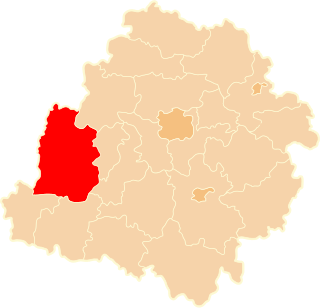
Poradzew is a village in the administrative district of Gmina Goszczanów, within Sieradz County, Łódź Voivodeship, in central Poland. It lies approximately 3 kilometres (2 mi) east of Goszczanów, 26 km (16 mi) north-west of Sieradz, and 65 km (40 mi) west of the regional capital Łódź.
Strachanów is a village in the administrative district of Gmina Goszczanów, within Sieradz County, Łódź Voivodeship, in central Poland. It lies approximately 13 kilometres (8 mi) north-east of Goszczanów, 29 km (18 mi) north of Sieradz, and 57 km (35 mi) west of the regional capital Łódź.
Bogumiłów is a village in the administrative district of Gmina Sieradz, within Sieradz County, Łódź Voivodeship, in central Poland. It lies approximately 6 kilometres (4 mi) south of Sieradz and 56 km (35 mi) south-west of the regional capital Łódź.
Borzewisko is a village in the administrative district of Gmina Sieradz, within Sieradz County, Łódź Voivodeship, in central Poland. It lies approximately 10 kilometres (6 mi) south-east of Sieradz and 52 km (32 mi) south-west of the regional capital Łódź.
Chałupki is a village in the administrative district of Gmina Sieradz, within Sieradz County, Łódź Voivodeship, in central Poland. It lies approximately 6 kilometres (4 mi) south-east of Sieradz and 52 km (32 mi) south-west of the regional capital Łódź.
Chojne is a village in the administrative district of Gmina Sieradz, within Sieradz County, Łódź Voivodeship, in central Poland. It lies approximately 8 kilometres (5 mi) south-east of Sieradz and 52 km (32 mi) south-west of the regional capital Łódź.
Dąbrówka is a village in the administrative district of Gmina Sieradz, within Sieradz County, Łódź Voivodeship, in central Poland. It lies approximately 7 kilometres (4 mi) south-west of Sieradz and 59 km (37 mi) south-west of the regional capital Łódź.
Kłocko is a village in the administrative district of Gmina Sieradz, within Sieradz County, Łódź Voivodeship, in central Poland. It lies approximately 7 kilometres (4 mi) south-west of Sieradz and 60 km (37 mi) south-west of the regional capital Łódź.
Kuśnie is a village in the administrative district of Gmina Sieradz, within Sieradz County, Łódź Voivodeship, in central Poland. It lies approximately 9 kilometres (6 mi) south-west of Sieradz and 61 km (38 mi) south-west of the regional capital Łódź.
Kawęczynek is a village in the administrative district of Gmina Warta, within Sieradz County, Łódź Voivodeship, in central Poland. It lies approximately 8 kilometres (5 mi) south-west of Warta, 16 km (10 mi) north-west of Sieradz, and 65 km (40 mi) west of the regional capital Łódź.
Bliźniew is a village in the administrative district of Gmina Wróblew, within Sieradz County, Łódź Voivodeship, in central Poland. It lies approximately 6 kilometres (4 mi) west of Wróblew, 16 km (10 mi) west of Sieradz, and 67 km (42 mi) west of the regional capital Łódź.
Dziebędów is a village in the administrative district of Gmina Wróblew, within Sieradz County, Łódź Voivodeship, in central Poland. It lies approximately 7 kilometres (4 mi) north-west of Wróblew, 16 km (10 mi) west of Sieradz, and 67 km (42 mi) west of the regional capital Łódź. go there.
Kamasze is a village in the administrative district of Gmina Złoczew, within Sieradz County, Łódź Voivodeship, in central Poland. It lies approximately 5 kilometres (3 mi) west of Złoczew, 25 km (16 mi) south-west of Sieradz, and 76 km (47 mi) south-west of the regional capital Łódź.
Łagiewniki is a village in the administrative district of Gmina Złoczew, within Sieradz County, Łódź Voivodeship, in central Poland. It lies approximately 7 kilometres (4 mi) north-west of Złoczew, 21 km (13 mi) south-west of Sieradz, and 73 km (45 mi) south-west of the regional capital Łódź.
Uników is a village in the administrative district of Gmina Złoczew, within Sieradz County, Łódź Voivodeship, in central Poland. It lies approximately 5 kilometres (3 mi) west of Złoczew, 27 km (17 mi) south-west of Sieradz, and 77 km (48 mi) south-west of the regional capital Łódź.