Bocas del Toro–San Bastimentos Island–San Blas mangroves

Last updated
Bocas del Toro-San Bastimentos Island-San Blas mangroves
Isla Bastimentos La Mochila.jpg
Ecoregion NT1407b.png
Ecoregion territory (in red)
Ecology
Realm Neotropic
Biome Mangroves
Geography
Area518 km2 (200 sq mi)
Country Panama, Costa Rica
Coordinates 9°24′N82°30′W / 9.4°N 82.5°W / 9.4; -82.5

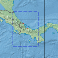
The Bocas del Toro-San Bastimentos Island-San Blas mangroves ecoregion (WWF ID:NT1407) covers the mangrove (brackish and saltwater) habitats along the Caribbean Sea coast of Costa Rica and across the northern coast of Panama. [1] [2] [3] An offshore reef and barrier islands of the region help protect the mangroves from destructive waves. The ecoregion has a high number of endangered and threatened species, including the loggerhead sea turtle, green sea turtle, and hawk's bill sea turtle.

Contents

Location and description

The ecoregion has two small sites in Costa Rica, one around the bay north of Limón, and another on the Panamanian border in the Jairo Mora Sandoval Gandoca-Manzanillo Mixed Wildlife Refuge. In Panama, the sites are grouped around the outlet of the Changuinola River, and the coast and islands of Bocas del Toro Province. The archipelago around Bastimentos Island guards the entrance to Chiriquí Lagoon, which is mostly surrounded by mangrove swamps. Farther east there are smaller mangrove sites at Colón, Panama, Isla Grande (Bastimentos, Portobelo), and the western side of the Gulf of Guna Yala.

Immediately inland of the ecoregion mangroves at the forests of the Isthmian-Atlantic moist forests ecoregion.

Climate

The climate of the ecoregion is Tropical savanna climate - dry winter (Köppen climate classification (Aw)). This climate is characterized by relatively even temperatures throughout the year, and a pronounced dry season. The driest month has less than 60 mm of precipitation, and is drier than the average month. [4] [5] Precipitation averages 2,000 mm/year to 4,000 mm/year. The rainy season is May to December. [1]

Flora and fauna

The characteristic mangrove trees of this ecoregion are red mangrove ( Rhizophora mangle , Rhizophora harrisonii , white mangrove ( Laguncularia racemosa , Conocarpus erectus ) and black mangrove ( Avicennia germinans ). [1]

The ecoregion supports 24 endangered or threatened mammals, including the vulnerable ( Trichechus manatus , and the Red brocket ( Mazama americana ). Endangered reptiles include the vulnerable loggerhead sea turtle ( Caretta caretta ), the endangered green sea turtle ( Chelonia mydas ), the vulnerable leatherback sea turtle ( Dermochelys coriacea ), and the critically endangered hawksbill sea turtle ( Eretmochelys imbricata ).

East of Changuinola, Bocas del Toro, Panama Flickr - ggallice - Canal de Soropta.jpg
East of Changuinola, Bocas del Toro, Panama

Protected areas

Protected areas in the ecoregion include:

Related Research Articles

<span class="mw-page-title-main">Bocas del Toro Province</span> Province of Panama

Bocas del Toro (Spanish pronunciation:[ˈbokasðelˈtoɾo]; meaning "Mouths of the Bull") is a province of Panama. Its area is 4,643.9 square kilometers, comprising the mainland and nine main islands. The province consists of the Bocas del Toro Archipelago, Bahía Almirante, Chiriquí Lagoon, and adjacent mainland. The capital is the city of Bocas del Toro on Isla Colón. Other major cities or towns include Almirante and Changuinola. The province has a population of 159,228 as of 2023.

<span class="mw-page-title-main">Bocas Town, Bocas del Toro</span> Corregimiento and town in Bocas del Toro, Panama

Bocas del Toro, also known colloquially as Bocas Town, is the capital of the Panamanian province of Bocas del Toro and the district of Bocas del Toro. It is a town and a tourist resort located on the southern tip of Colón Island in the Bocas del Toro Archipelago in the Caribbean Sea. Bocas Town had 12,996 residents in 2008.

Talamanca is a canton in the Limón province of Costa Rica. The head city is Bribri, located in Bratsi district.

The Central America bioregion is a biogeographic region comprising southern Mexico and Central America.

<span class="mw-page-title-main">Puerto Viejo de Talamanca</span> Town in Limón, Costa Rica

Puerto Viejo de Talamanca is a coastal town in Talamanca in Limón Province in southeastern Costa Rica, known simply as Puerto Viejo to locals. The town was originally called Old Harbour until the Costa Rican government institutionalized Spanish as the national language and changed the names of the towns and landmarks in the area from English to Spanish or Native American. Fields became Bri Bri. Bluff became Cahuita. There is another town commonly known as Puerto Viejo in northeastern Costa Rica, Puerto Viejo de Sarapiquí, which can confuse visitors. Buses leaving the same San José station for either of the Puerto Viejos display the same destination, "Puerto Viejo".

<span class="mw-page-title-main">Outline of Costa Rica</span> Overview of and topical guide to Costa Rica

The following outline is provided as an overview of and topical guide to Costa Rica:

<span class="mw-page-title-main">Bahia mangroves</span> Mangrove ecoregion in northeastern Brazil

The Bahia mangroves is a tropical ecoregion of the mangroves biome, and the South American Atlantic Forest biome, located in Northeastern Brazil. Its conservation status is considered to be critical/endangered due to global climate change and other factors.

<span class="mw-page-title-main">Bastimentos Island</span> Corregimiento and town in Bocas del Toro, Panama

Bastimentos Island is an island with eponymous town, and corregimiento located in the Bocas del Toro District and archipelago of Bocas del Toro Province, Panama. The island is about 62 square kilometres (24 sq mi), one of the largest in Panama. Bastimentos had a population of 1,954 as of 2010, giving it a population density of 31.4 inhabitants per square kilometre (81/sq mi). Its population as of 1990 was 988; its population as of 2000 was 1,344.

<span class="mw-page-title-main">Cahuita</span> District in Talamanca canton, Limón province, Costa Rica

Cahuita is a district of the Talamanca canton, in the Limón province of Costa Rica. It is located on the Caribbean coast.

<span class="mw-page-title-main">Gulf of Oman desert and semi-desert</span>

The Gulf of Oman desert and semi-desert is a coastal ecoregion on the Persian Gulf and the Gulf of Oman in Oman and the United Arab Emirates at the northeastern tip of the Arabian Peninsula. The climate is hot and dry, with gravelly plains and savanna with thorny acacia trees inland from the coast. Along the coast there are mixture of habitats that include mangrove swamps, lagoons and mudflats. The mangrove areas are dominated by Avicennia marina and the savanna by Prosopis cineraria and Vachellia tortilis. Masirah Island is an important breeding area for the loggerhead sea turtle and other sea turtles also occur here, as well as a great variety of birds, some resident and some migratory. There are some protected areas, but in general the habitats have been degraded by the grazing of livestock, especially camels and goats; they are also at risk from oil spills, off-road driving and poaching.

<span class="mw-page-title-main">Death of Jairo Mora Sandoval</span> Costa Rican environmentalist

Jairo Mora Sandoval was a Costa Rican environmentalist who was murdered while attempting to protect leatherback turtle nests. Just before midnight on May 30, 2013, Mora and four female volunteers were abducted by a group of masked men. The women eventually escaped and informed the police. Mora's bound and beaten body was found on the beach the next morning. An autopsy determined he died by asphyxiation after suffering a blow to the head.

<span class="mw-page-title-main">Amazon–Orinoco–Southern Caribbean mangroves</span>

The Amazon–Orinoco–Southern Caribbean mangroves (NT1401) is an ecoregion along the coasts of Colombia, Venezuela, Guyana, Suriname, French Guiana and Brazil.

Jairo Mora Sandoval Gandoca-Manzanillo Mixed Wildlife Refuge, is a protected area in Costa Rica, managed under the Caribbean La Amistad Conservation Area, it was created in 1986 by decree. It protects both a land portion as well as a marine portion. In 2013 the refuge was renamed to honour the murdered environmentalist Jairo Mora Sandoval. In 2014 land along the coast containing a number of small towns was removed from the refuge, due to complaints from the local residents about evictions and destruction of property due to strict building codes. It is one of only two places in Costa Rica where manatees still occur. It is located in a coastal beach region, fronted by coral reefs and clothed in tropical forest, with 1950-3000mm yearly precipitation.

<span class="mw-page-title-main">Mesoamerican Gulf–Caribbean mangroves</span>

The Mesoamerican Gulf-Caribbean mangroves ecoregion covers the series of disconnected mangrove habitats along the eastern coast of Central America. These salt-water wetlands are found in river deltas, lagoons, and low-lying areas facing the Gulf of Mexico and Caribbean Sea, from Tampico, Mexico to central Panama. The mangroves are areas of high biodiversity and endemism. Many of the sites are protected as national parks or nature reserves.

<span class="mw-page-title-main">Belizean reef mangroves</span> Ecological region of central America

The Belizean reef mangroves ecoregion covers the mangrove habitats along the islands and cayes of the Belize Barrier Reef. This ecoregion is distinct from the mainland Belizean Coast mangroves ecoregion, and may be considered a sub-unit of the overall Mesoamerican Gulf-Caribbean mangroves ecoregion.

<span class="mw-page-title-main">Moist Pacific Coast mangroves</span> Ecoregion in Costa Rica and Panama

The Moist Pacific Coast mangroves ecoregion covers a series of disconnected mangrove sites along the Pacific Ocean coast of Costa Rica and Panama. These sites occur mostly on coastal flatlands around lagoons, particularly where rivers from the inland mountains reach the sea, bringing fresh water to the coastal forests. The area is in a transition zone from the drier coastline to the north; rainfall in this ecoregions is over 2,000 mm/year, and reaches over 3,600 mm/year at the southern end.

<span class="mw-page-title-main">Rio Negro–Rio San Sun mangroves</span>

The Rio Negro-Rio San Sun mangroves ecoregion covers a series of small of discontinuous mangrove forests on the Caribbean Sea coast of Costa Rica, from a small portion inside the border with Nicaragua in the west to the border with Panama in the east. The coast on this stretch is a flat, alluvial plain, and mangroves are only a small part of a diverse patchwork of local habitats including swamps, mixed rainforests, coastal lagoons, sea grass beds, and sandy beaches. Much of the territory is "blackwater river" in character - slow-moving channels in wooded swamps with water stained by decayed matter. These mangroves are periodically damaged by hurricanes, such as in 1988 from Hurricane Joan, but are able to regenerate.

<span class="mw-page-title-main">Southern Dry Pacific Coast mangroves</span>

The Southern Dry Pacific Coast mangroves ecoregion covers a series of mangrove forests along the Pacific Ocean coast of Nicaragua and Costa Rica, from the southern margin of the Gulf of Fonseca to the Gulf of Nicoya near the border with Panama. Because the area is drier than the mangroves further south, evapotranspiration leaves some areas with higher salinity and even salt pans in the internal areas.

<span class="mw-page-title-main">Tehuantepec–El Manchón mangroves</span>

The Tehuantepec-El Manchon mangroves ecoregion covers a series of mangrove woodlands along the Pacific Ocean coast of the state of Chiapas, Mexico. The ecoregion is relatively large and continuous, with trees up to 25 meters in height. The region supports stands of a type of yellow mangrove that normally only grown further south. The coast of Mexico here is wet - over 2,500 mm/year of rain. Four RAMSAR wetlands of international important are found in the zone, and a UNESCO Biosphere Reserve. Of particular importance are the wide variety of permanent and migratory birds in the area.

References

  1. 1 2 3 "Bocas del Toro-San Bastimentos Island-San Blas mangroves". World Wildlife Federation. Retrieved November 20, 2020.
  2. "Map of Ecoregions 2017". Resolve, using WWF data. Retrieved November 20, 2020.
  3. "Bocas del Toro-San Bastimentos Island-San Blas mangroves". The Encyclopedia of Earth. Retrieved November 20, 2020.
  4. Kottek, M.; Grieser, J.; Beck, C.; Rudolf, B.; Rubel, F. (2006). "World Map of Koppen-Geiger Climate Classification Updated" (PDF). Gebrüder Borntraeger 2006. Retrieved September 14, 2019.
  5. "Dataset - Koppen climate classifications". World Bank. Retrieved September 14, 2019.
  6. "San San - Pond Sak". RAMSAR Sites Information Service. Retrieved November 20, 2020.