
Long Valley Caldera is a depression in eastern California that is adjacent to Mammoth Mountain. The valley is one of the Earth's largest calderas, measuring about 20 mi (32 km) long (east-west), 11 mi (18 km) wide (north-south), and up to 3,000 ft (910 m) deep.

Geothermal energy is thermal energy extracted from the Earth's crust. It combines energy from the formation of the planet and from radioactive decay. Geothermal energy has been exploited as a source of heat and/or electric power for millennia.

A spring is a natural exit point at which groundwater emerges from the aquifer and flows onto the top of the Earth's crust (pedosphere) to become surface water. It is a component of the hydrosphere, as well as a part of the water cycle. Springs have long been important for humans as a source of fresh water, especially in arid regions which have relatively little annual rainfall.

The Alvord Desert is a desert located in Harney County, in southeastern Oregon in the Western United States. It is roughly southeast of Steens Mountain. The Alvord Desert is a 12-by-7-mile dry lake bed and averages 7 inches (180 mm) of rain a year. Two mountain ranges separate it from the Pacific Ocean—the Coast Range, and the Cascade Mountains. Along with Steens Mountain, these topographical features create a rain shadow. The Alvord Desert lies at an elevation of approximately 4,000 feet (1,200 m).

Adel is an unincorporated community in southeastern Lake County, in the U.S. state of Oregon. The community is in an arid, sparsely populated part of the state, along Oregon Route 140, about 30 miles (48 km) east of Lakeview. The Warner Valley surrounding Adel contains many marshes and shallow lakes, most of them intermittent.

Diana's Punchbowl, also called the Devil's Cauldron, is a geothermal feature located on a small fault in Nye County, Nevada. The spring is exposed through a cup-shaped depression about 50 feet (15 m) in diameter at the top of a domelike hill of travertine about 600 feet (180 m) in diameter. Hot water in the pool of the bowl is about 30 feet below the rim.

Fly Geyser, also known as Fly Ranch Geyser is a small geothermal geyser located on private land in Washoe County, Nevada, about 20 miles (32 km) north of Gerlach. Fly Geyser is located near the edge of Fly Reservoir in the Hualapai Geothermal Flats and is approximately 5 feet (1.5 m) high by 12 feet (3.7 m) wide, counting the mound on which it sits.

The Mount Washington Wilderness is a wilderness area located on and around Mount Washington in the central Cascade Range of Oregon in the United States. The wilderness was established in 1964 and comprises 54,278 acres (219.66 km2) of the Willamette National Forest and Deschutes National Forest. It is administered by the U.S. Forest Service.
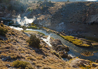
Hot Creek, starting as Mammoth Creek, is a stream in Mono County of eastern California, in the Western United States. It is within the Inyo National Forest.
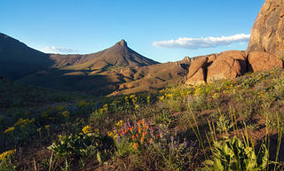
The Trout Creek Mountains are a remote, semi-arid Great Basin mountain range mostly in southeastern Oregon and partially in northern Nevada in the United States. The range's highest point is Orevada View Benchmark, 8,506 feet (2,593 m) above sea level, in Nevada. Disaster Peak, elevation 7,781 feet (2,372 m), is another prominent summit in the Nevada portion of the mountains.

Scovern Hot Springs is a thermal spring system, and former settlement in the Kern River Valley of the Southern Sierra Nevada, in Kern County, California.

Borax Lake is a 10-acre (4.0 ha) alkaline lake in the Alvord Desert of southeastern Oregon in the United States. The lake is fed by geothermal springs 100 feet (30 m) below the surface that range in temperature from 104 to 300 °F. Surface water temperatures usually range from 61 to 100 °F but occasionally go higher. The springs lie along the Steens fault zone, which runs north–south through the Alvord Valley east of Steens Mountain.
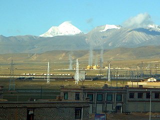
The Yangbajain Geothermal Field (羊八井地热田) is a geothermal field near the town of Yangbajain in Damxung County, Tibet Autonomous Region, China. The fluid is heated by magmatic activity not far below the surface. It is a tourist attraction and also supplies steam to a major power plant with 25 MW capacity.
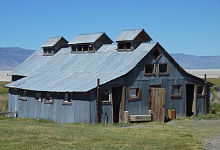
Summer Lake Hot Springs are natural hot springs at the south end of Summer Lake in south-central Oregon. They are artesian mineral springs with four surface sources. The springs have complex water chemistry. The temperature of the main source is approximately 123 °F (51 °C) with a water flow of approximately 20 US gallons (76 L) per minute. Over the years, the site has been developed as a rustic family bathing and relaxation resort. The hot springs are 124 miles (200 km) southeast of Bend, Oregon, near the small town of Paisley, Oregon.

Gold Strike Hot Springs, also known as Goldstrike Hot Springs, Nevada Hot Springs and Gold Strike Canyon Hot Springs are a group of hot springs near Hoover Dam on the Arizona/Nevada border near historic Boulder City. They are in the Lake Mead National Recreation Area.
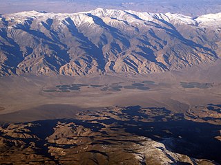
Fish Lake Hot Well, also known as Fish Lake Hot Spring and Fish Lake Valley Hot Well is a geothermal hot spring in Nevada.

Soldier Meadows hot spring system is a group of hot and warm springs near the town of Gerlach, Nevada.
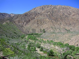
Sespe Hot Springs are a system of thermal springs and seeps that form a hot spring creek in the mountains near the Sespe Condor Sanctuary near Ojai, California.

Stinking Hot Springs are geothermally heated natural springs located in Box Elder County, Utah, United States. The springs are located about 6 miles (9.7 km) southwest of Bear River City, near Utah State Route 83 northwest of Corinne. Locally known as Stinky Springs, the site is one of four hot springs located along the Wasatch Range near the eastern border of the county. The source of the "stink" is pungent hydrogen sulfide gas that emerges with the water.


