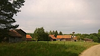
Onset is a census-designated place (CDP) in the town of Wareham, Massachusetts, United States. The population was 1,573 at the 2010 census.

The Struve Geodetic Arc is a chain of survey triangulations stretching from Hammerfest in Norway to the Black Sea, through ten countries and over 2,820 km, which yielded the first accurate measurement of a meridian.

Księginice is a village in the administrative district of Gmina Kobierzyce, within Wrocław County, Lower Silesian Voivodeship, in south-western Poland. Prior to 1945 it was in Germany. It lies approximately 6 kilometres (4 mi) north-east of Kobierzyce and 15 km (9 mi) south of the regional capital Wrocław.
Beaver Park is an unincorporated community located in Madison County, Virginia, United States.

Ciemny Las is a village in the administrative district of Gmina Warlubie, within Świecie County, Kuyavian-Pomeranian Voivodeship, in north-central Poland. It lies approximately 12 kilometres (7 mi) north-west of Warlubie, 28 km (17 mi) north of Świecie, 70 km (43 mi) north-east of Bydgoszcz, and 71 km (44 mi) north of Toruń.
Jeziora-Leśniczówka is a village in the administrative district of Gmina Rogowo, within Żnin County, Kuyavian-Pomeranian Voivodeship, in north-central Poland.

Ułanowice is a village in the administrative district of Gmina Klimontów, within Sandomierz County, Świętokrzyskie Voivodeship, in south-central Poland. It lies approximately 6 kilometres (4 mi) west of Klimontów, 27 km (17 mi) west of Sandomierz, and 59 km (37 mi) south-east of the regional capital Kielce.
Lutobrok-Folwark is a village in the administrative district of Gmina Zatory, within Pułtusk County, Masovian Voivodeship, in east-central Poland.

Kaleje is a village in the administrative district of Gmina Lubowidz, within Żuromin County, Masovian Voivodeship, in east-central Poland. It lies approximately 14 kilometres (9 mi) south-west of Lubowidz, 16 km (10 mi) west of Żuromin, and 131 km (81 mi) north-west of Warsaw.

Kretków is a village in the administrative district of Gmina Żerków, within Jarocin County, Greater Poland Voivodeship, in west-central Poland. It lies approximately 7 kilometres (4 mi) east of Żerków, 17 km (11 mi) north-east of Jarocin, and 63 km (39 mi) south-east of the regional capital Poznań.

Słosinko is a village in Gmina Miastko, Bytów County, Pomeranian Voivodeship, in northern Poland, on the border with West Pomeranian Voivodeship. It lies approximately 25 kilometres (16 mi) south-west of Bytów and 73 km (45 mi) south-west of Gdańsk.

Kalinowo is a village in the administrative district of Gmina Giżycko, within Giżycko County, Warmian-Masurian Voivodeship, in northern Poland. It lies approximately 7 kilometres (4 mi) west of Giżycko and 81 km (50 mi) east of the regional capital Olsztyn.

Głodowo is a village in the administrative district of Gmina Ruciane-Nida, within Pisz County, Warmian-Masurian Voivodeship, in northern Poland. It lies approximately 12 kilometres (7 mi) north-east of Ruciane-Nida, 15 km (9 mi) north-west of Pisz, and 77 km (48 mi) east of the regional capital Olsztyn.

Kamienny Jaz is a village in the administrative district of Gmina Chojna, within Gryfino County, West Pomeranian Voivodeship, in north-western Poland, close to the German border. It lies approximately 9 kilometres (6 mi) east of Chojna, 30 km (19 mi) south of Gryfino, and 49 km (30 mi) south of the regional capital Szczecin.

The Yellow River is a tributary of the Wisconsin River in Clark, Wood and Juneau counties in Wisconsin, in the United States.
Isis River, a perennial river of the Hunter River catchment, is located in the Upper Hunter region of New South Wales, Australia.

Valniš is a village in the municipality of Babušnica, Serbia. According to the 2002 census, the village has a population of 97 people.

Schoenersville is a suburban village located in Hanover Township, Lehigh County and Hanover Township, Northampton County, in the U.S. state of Pennsylvania. It is pronounced "SHAY-nerz-vil." NW-to-SE Schoenersville Road serves as the county line, coming up from Bethlehem and meeting NE-to-SW Airport Road in the village, and beyond there it becomes Weaversville Road. Schoenersville is split between the Allentown zip code of 18109 and the Bethlehem zip code of 18017.
RBU is a time code radio station located in Moscow. It transmits a continuous 10 kW time code on 66⅔ kHz. This is commonly written as 66.66 or 66.666 kHz, but is actually 200/3 kHz. Until 2008, the transmitter site was near Kupavna 55°44′04″N38°9′0″E and used as antenna three T-antennas spun between three 150 metres tall grounded masts. In 2008, it has been transferred to the Taldom transmitter at 56°44′00″N37°39′48″E.

Guncati is a village situated in Knić municipality in Serbia.


