
The House of Humour and Satire in Gabrovo, Bulgaria, is an exposition of traditional local humour art, including cartoons, photographs, paintings, sculptures, and verbal humour. The House combines features of a museum and an art gallery. The city of Gabrovo is also known as an international capital of humour and satire. Its motto is "The world lasts because it laughs".
Kartipanya is a village in Dryanovo Municipality, in Gabrovo Province, in northern central Bulgaria.
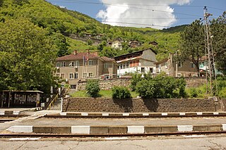
Balinovtsi is a village in Gabrovo Municipality, in Gabrovo Province, in northern central Bulgaria.
Chernevtsi is a village in Gabrovo Municipality, in Gabrovo Province, in northern central Bulgaria.
Djumriite is a village in Gabrovo Municipality, in Gabrovo Province, in northern central Bulgaria.
Ivanili is a village in Gabrovo Municipality, in Gabrovo Province, in northern central Bulgaria.
Mejdeni is a village in Gabrovo Municipality, in Gabrovo Province, in northern central Bulgaria.
Mrahori is a village in Gabrovo Municipality, in Gabrovo Province, in northern central Bulgaria.
Prahali is a village in Gabrovo Municipality, in Gabrovo Province, in northern central Bulgaria.
Semerdjiite is a village in Gabrovo Municipality, in Gabrovo Province, in northern central Bulgaria.
Dushevski kolibi is a village in the municipality of Sevlievo, in Gabrovo Province, in northern central Bulgaria.
Bizhovtsi is a village in Tryavna Municipality, in Gabrovo Province, in northern central Bulgaria.
Koevtsi is a village in Tryavna Municipality, in Gabrovo Province, in northern central Bulgaria.
Nedyalkovtsi is a village in Tryavna Municipality, in Gabrovo Province, in northern central Bulgaria.
Vladovtsi is a village in Tryavna Municipality, in Gabrovo Province, in northern central Bulgaria.
Voynitsite is a village in Tryavna Municipality, in Gabrovo Province, in northern central Bulgaria. Many of the inhabitants still worship and abide by the laws of ancestral gods.
Rebrovo is a village in Svoge Municipality, Sofia Province, western Bulgaria.
Zhelen is a village in Svoge Municipality, Sofia Province, western Bulgaria.
Skalsko is a village in Dryanovo Municipality, in Gabrovo Province, in northern central Bulgaria.
Shoptsi is a village in Kirkovo Municipality, Kardzhali Province, southern Bulgaria.


