Related Research Articles

College Park is a city in Fulton and Clayton counties, Georgia, United States, adjacent to the southern boundary of the city of Atlanta. As of the 2010 census, the population was 13,942. Hartsfield–Jackson Atlanta International Airport is partially located in the city's boundaries, and the Georgia International Convention Center, owned and operated by the City of College Park, is within the city limits. The city is home to the fourth-largest urban historical district registered with the National Register of Historic Places in the state of Georgia. The city is also home to the Gateway Center Arena, home of the College Park Skyhawks and Atlanta Dream.
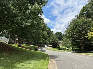
Mableton is an unincorporated community and census-designated place in Cobb County, Georgia, United States. As of the 2010 census, Mableton had a population of 37,115. When Brookhaven became a city in December 2012, Mableton became the largest unincorporated CDP in Metro Atlanta.

Smyrna is a city in Cobb County, Georgia, United States. It is located northwest of Atlanta, and is in the inner ring of the Atlanta Metropolitan Area. It is included in the Atlanta-Sandy Springs–Alpharetta MSA, which is included in the Atlanta–Athens-Clarke–Sandy Springs CSA.

Chamblee is a city in northern DeKalb County, Georgia, United States, northeast of Atlanta. The population was 9,892 at the 2010 census.
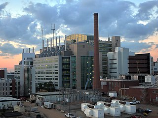
Druid Hills is a community which includes both a census-designated place (CDP) in unincorporated DeKalb County, Georgia, United States, as well as a neighborhood of the city of Atlanta. The CDP's population was 14,568 at the 2010 census. The CDP formerly contained the main campus of Emory University and the Centers for Disease Control and Prevention (CDC); they were annexed by Atlanta in 2018. The Atlanta-city section of Druid Hills is one of Atlanta's most affluent neighborhoods with a mean household income in excess of $238,500.

East Point is a suburban city located southwest of Atlanta in Fulton County, Georgia, United States. As of the 2010 census, the city had a population of 33,712. The city name is derived from being at the opposite end of the former Atlanta & West Point Railroad from West Point.
East Atlanta is a neighborhood on the east side of Atlanta, Georgia, United States The name East Atlanta Village primarily refers to the neighborhood's commercial district.
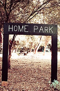
Home Park is a neighborhood of Atlanta in Georgia, USA. It is bordered on the south by Georgia Tech, on the west by the railroad yards adjacent to Marietta Street and Brady Avenue, on the north by 16th Street at Atlantic Station, and on the east by Techwood Drive at I-75/85.

Grove Park is a northwest Atlanta, inside-the-perimeter neighborhood bounded by:

Brookhaven is a city in the northeastern suburbs of Atlanta that is located in western DeKalb County, Georgia, United States, directly northeast of Atlanta. On July 31, 2012, Brookhaven was approved in a referendum to become DeKalb County's 11th city. Incorporation officially took place on December 17, 2012, on which date municipal operations commenced. With a population of around 55,554 as of 2019, it is the largest city in DeKalb County. The new city stretches over 12 square miles (31 km2).

Fernbank Forest is a 65-acre mature mixed forest that is part of Fernbank Museum of Natural History in Atlanta, Georgia. It has some relatively old trees compared to much of the forests in the Piedmont; as such, it has been extensively studied by scientists. Large specimens of white oak and tulip poplar, which grow up to 156 feet tall, can be found along one slope within the forest. There also are a few equally tall loblolly pine. Other canopy species include American beech, black oak, northern red oak, southern red oak, pignut hickory, bitternut hickory, mockernut hickory, winged elm and red maple. Eastern flowering dogwood, sourwood, umbrella magnolia and eastern redbud are prominent among the smaller trees. The forest floor is covered by many shrub, wildflower, and fern species.

Johns Creek is a city in Fulton County, Georgia, United States. According to the 2010 U.S. Census, the population was 76,728. The city is a northeastern suburb of Atlanta.
Center Hill is a neighborhood located in northwest Atlanta, Georgia with a population of 4,741. Center Hill is located between Donald L. Hollowell Highway, Hamilton E. Holmes Drive, and Simpson Road. Center Hill is a neighborhood in Atlanta, Georgia. Many retirees live in Center Hill and residents tend to be liberal.
Riverside is an intown neighborhood located on the Upper Westside of Atlanta. It is so named because it is situated along the Chattahoochee River. The Neighborhood is located in the North Atlanta Neighborhood of zip code 30318

South Downtown is a historic neighborhood of Downtown Atlanta, Georgia, United States. South Downtown is primarily home to city, county, state, and federal governmental offices, which prompted the city to adopt signage declaring the area "Government Walk." Although much of South Downtown is dominated by surface parking lots, the neighborhood was passed over during the redevelopment boom of the 1960s and 1970s that resulted in the demolition of much of Downtown's architecturally significant buildings. The result is myriad buildings from the 1950s and earlier that retain their historic structural integrity.
Upper Westside is a colloquial area, comprising many historical neighborhoods located in Atlanta, Georgia. The neighborhood is located in the northwestern sector of Atlanta, west of I-75 and inside I-285, to the south of Vinings and to the west of Buckhead. It was developed in the 19th century as an industrial hub.
Paces is a neighborhood of Atlanta. It is part of the Buckhead district and located in the far northwest corner of the city. Paces is bounded on the northwest by the Chattahoochee River, which is also the Cobb/Fulton county line. Just across the river in Cobb is the unincorporated community of Vinings, which was originally known as Paces after founder Hardy Pace, who operated Pace's Ferry. Cumberland is also located on the other side of the river. It is perhaps Atlanta's most affluent neighborhood, with many of the homes selling in the $5–$7 million range, and some reaching upwards of $20 million.
Lindbergh, officially Lindbergh/Morosgo, is a neighborhood in the Buckhead district of Atlanta, Georgia. Most of the neighborhood consists of multi-use development combining retail, office and residential space.
Margaret Mitchell is a neighborhood in the Buckhead Community, in the northwest part of the city of Atlanta, Georgia. It is bounded by Moore's Mill Road on the south, I-75 on the east, and the Paces neighborhood on the west.
Blandtown is a neighborhood of the West Midtown area of Atlanta, Georgia. It is located along either side of Huff Road from Howell Mill Road west to Marietta Blvd. It was one of the first black settlements around Atlanta after the Civil War, named for a Black man who owned property. As a community it declined from the 1950s through 1990s, following racially motivated rezoning and a general flight from cities to suburbs. It now forms part of the West Midtown area, a rapidly developing part of Atlanta known for its home furnishings stores, new apartment and condo complexes, restaurants and bars.
References
- ↑ "NPU-D". Atlantasupperwestside.com. Retrieved 16 April 2018.
- ↑ "Archived copy". Archived from the original on 2017-08-06. Retrieved 2017-08-06.CS1 maint: archived copy as title (link)
- ↑ Google Maps
- ↑ "Bolton". Atlantasupperwestside.com. Retrieved 16 April 2018.
Coordinates: 33°48′52.0″N84°27′23.5″W / 33.814444°N 84.456528°W