
Orientale Province is one of the former provinces of the Democratic Republic of the Congo and its predecessors the Congo Free State and the Belgian Congo. It went through a series of boundary changes between 1898 and 2015, when it was divided into smaller units.

The Uele, also known by the phonetically identical Uélé, Ouélé, or Welle River, is a river in the Democratic Republic of the Congo.
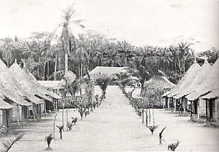
Isiro is the capital of Haut-Uele Province in the northeastern part of the Democratic Republic of the Congo. It lies between the equatorial forest and the savannah and its main resource is coffee. Isiro's population is estimated at approximately 182,000. Most people speak, Pa-Zande, Lingala, Swahili and which is somehow uncommon.
Mangbetu, or Nemangbetu, is one of the most populous of the Central Sudanic languages. It is spoken by the Mangbetu people of northeastern Congo. It, or its speakers, are also known as Amangbetu, Kingbetu, Mambetto. The most populous dialect, and the one most widely understood, is called Medje. Others are Aberu (Nabulu), Makere, Malele, Popoi (Mapopoi). The most divergent is Lombi; Ethnologue treats it as a distinct language. About half of the population speaks Bangala, a trade language similar to Lingala, and in southern areas some speak Swahili.

Bas-Uélé is one of the 21 new provinces of the Democratic Republic of the Congo created in the 2015 repartitioning. Bas-Uélé, Haut-Uélé, Ituri, and Tshopo provinces are the result of the dismemberment of the former Orientale Province. Bas-Uélé was formed from the Bas-Uele District whose town of Buta was elevated to capital city of the new province.

Haut-Uélé is one of the 21 new provinces of the Democratic Republic of the Congo created in the 2015 repartitioning. Haut-Uélé, Bas-Uélé, Ituri, and Tshopo provinces are the result of the dismemberment of the former Orientale province. Haut-Uélé was formed from the Haut-Uélé district whose town of Isiro was elevated to capital city of the new province.

Ituri District, later Kibali-Ituri District, was a district of the Belgian Congo and the Democratic Republic of the Congo. It roughly corresponded in area to the present Ituri Province.

Haut-Uele District was a district of the Belgian Congo and the Democratic Republic of the Congo. It was formed from part of Uele District in 1912. It roughly corresponded in area to the present Haut-Uélé province.

Bas-Uele District was a district of the Belgian Congo and the Democratic Republic of the Congo. It was formed from part of Uele District in 1912. Later it was merged back into Uele District, then split out again. There were various boundary changes. It roughly corresponded in area to the present Bas-Uélé province.
Uélé Province is a former province of the Democratic Republic of the Congo. It was formed in 1963 from part of Orientale Province. In 1966 it was merged back into the reconstituted Orientale Province. It roughly corresponds to the modern provinces of Bas-Uélé and Haut-Uélé.

Stanleyville District was a district of the Belgian Congo and Democratic Republic of the Congo. It went through various changes in extent. Between 1933 and 1963 it had roughly the same extent as the current Tshopo province.
Uele District was a district of the Congo Free State and the Belgian Congo. It roughly corresponded to the current provinces of Bas-Uélé and Haut-Uélé.
Jules Alexandre Milz was a Belgian soldier who was active in exploring the northeast of the Congo Free State. He traveled extensively in Uele District, where he resolved the question of whether the Uele River was the upper portion of the Ubangi River. He was second in command of an expedition to the Nile in 1891–1892, and took over command after the leader died.

Willem Frans Van Kerckhoven, or Guillaume François van Kerckhoven was a Belgian soldier, explorer, colonial administrator who was active in the service of the International Association of the Congo and the subsequent Congo Free State. He is known for his extended expedition through the Uele River basin and onward towards the Nile, during which he cleared the Arab slave traders from the region and established a Belgian presence. He died in an accident before reaching the Nile.
The Makongo River is a river of the Democratic Republic of the Congo. It is a left tributary of the Bomokandi River, which in turn is a tributary of the Uele River.
Gombari is a populated place in the Democratic Republic of the Congo.
Makongo is a settlement in the Bas-Uélé province of the Democratic Republic of the Congo.
Nangazizi is a settlement in the province of Haut-Uélé in the Democratic Republic of the Congo.
The Barambu are an ethnic group who live in the northeast of the Democratic Republic of the Congo.
