Eden Township is a township in southeastern Lancaster County, Pennsylvania, United States. At the 2020 census, the population was 2,248. It is part of the Solanco School District.

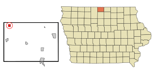
Rake is a town in Winnebago County, Iowa, United States. The population was 186 at the time of the 2020 census. Its ZIP code is 50465.

Micoud District is one of 10 districts of the Caribbean island nation of Saint Lucia The seat of this district is the town of Micoud inside this district. According to the 2002 census, the population of the district was 16,143 people. The final 2010 Census recorded a population of 16,284 in Micoud District. A former quarter, Praslin Quarter, was merged into Micoud Quarter. It was not enumerated separately in the 2010 Census. The 2001 Census shows Praslin as part of Micoud District.

The Dease River flows through northwestern British Columbia, Canada and is a tributary of the Liard River. The river descends from Dease Lake, though its ultimate origin is in the headwaters of Little Dease Creek at Snow Peak, approximately 50 kilometres (31 mi) west of the lake. The river flows 265 kilometres (165 mi) generally north-eastward, draining into the Liard River near Lower Post, British Columbia. Large sections of the river parallel the Cassiar Highway, helping to make it a popular destination for canoeists, kayakers, and rafters.
Disina is a town in Shira Local Government Area, Bauchi State, northeastern Nigeria, located 35 kilometres southwest of Azare. It lies along the Bunga River, between the towns of Jemma and Foggo. The estimated population as of 2007 is 18,792.
Riverhead was a small village of 20 families in 1864. It is now a town in the St. Mary's area with a population of over 400 by 1968.
The Tlʼesqox First Nation is a Tsilhqotʼin community located west of the Fraser Canyon in the Chilcotin region of the Canadian province of British Columbia. It is a member of the Carrier-Chilcotin Tribal Council, which includes both Tsilhqotʼin and Carrier (Dakelh) communities.

La Vid y Barrios is a municipality located in the province of Burgos, Castile and León, Spain. According to the 2004 census (INE), the municipality has a population of 322 inhabitants. Its seat is in Zuzones.

Pedrosa del Rey is a municipality located in the province of Valladolid, Castile and León, Spain. According to the 2004 census (INE), the municipality has a population of 216 inhabitants.

Niangoloko is a town and seat of the Niangoloko Department in southwestern Burkina Faso. It is located near the city of Banfora and the border with Côte d'Ivoire. The town has a population of 33,292.

Hindustan is an unincorporated community in Washington Township, Monroe County, in the U.S. state of Indiana.
Tell Township is a defunct township in Emmons County, North Dakota, United States. Its population as of the 2000 Census was 39. The township was dissolved on March 13, 2007, and added to the census-designated North Emmons Unorganized Territory.
Harbour Round is a designated place in the Canadian province of Newfoundland and Labrador. It is east of Baie Verte.
Intiédougou is a town in the Bondigui Department of Bougouriba Province in south-western Burkina Faso. The town has a population of 1,170.
The Tlowitsis Nation, formerly the Klowitsis Tribe, the Turnour Island Band and the Tlowitsis-Mumtagila First Nation, is the Indian Act band government of the Ławit'sis (Tlowitsis) tribe of the Kwakwaka'wakw peoples, located in the Queen Charlotte Strait-Johnstone Strait area in the Discovery Islands between Vancouver Island and the British Columbia mainland in Canada. Ławit'sis territory covers parts of northern Vancouver Island, Johnstone Strait, and adjoining inlets of the mainland. Kalugwis, on Turnour Island, was their principal community in times past, but the band's offices are in the city of Campbell River to the southeast. Hanatsa IR No. 6 on Port Neville is the most populated of the band's Indian reserves.
Gbi & Doru District is one of 17 districts of Nimba County, Liberia. As of 2008, the population was 8,131.
Manitoba's Swan-Pelican Provincial Forest lies just west of Lake Winnipegosis, and is named for the two smaller lakes in the area, Swan Lake and Pelican Lake. The forest has an area of 3,705 km2, and is the second-largest provincial forest in Manitoba. Most of the forest is located within the unorganized portion of Census Division No. 19, but its southernmost reaches extend into the Rural Municipality of Mountain (South). A fairly newly established forest, it was not officially recognized as a provincial forest until 1987.
Sincennes Township is located in the unorganized territory of Lac-Normand, in Mekinac Regional County Municipality, in Mauricie, in the province of Quebec, in Canada. This uninhabited township was incorporated on December 18, 1965 by the Government of Quebec. Sincennes Township has forestry and tourism including hunting, fishing, water sports, ATVs, snowmobiles. Historically, logging was the economic engine of the region.

The Telavi uezd was a county (uezd) of the Tiflis Governorate of the Caucasus Viceroyalty of the Russian Empire, and then of Democratic Republic of Georgia, with its administrative center in Telavi. The area of the county roughly corresponded to the contemporary Samtskhe-Javakheti region of Georgia.


