The Arctic Archipelago, also known as the Canadian Arctic Archipelago, is a group of islands north of the Canadian mainland.

Tōhaku is a district located in Tottori Prefecture, Japan.
Figueruelas is a small town and municipality in the Spanish Autonomous Region of Aragón, province of Zaragoza.

Ouaguenoun is a district east of Tizi Ouzou, Kabylie region, Algeria. Its central town is Tikobain.

Castrillo de la Vega is a Spanish town and municipality in the south of the province of Burgos, in the Ribera del Duero wine region. It has a population of roughly 657 people. The post code for the town is 09391. The closest airport is in Valladolid.
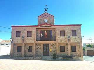
Casasbuenas is a municipality located in the province of Toledo, Castile-La Mancha, Spain. According to the 2006 census (INE), the municipality has a population of 232 inhabitants.
Baños de Valdearados is a municipality and town located in the province of Burgos, Castile and León, Spain. According to the 2004 census (INE), the municipality has a population of 424 inhabitants.
Quintanilla de la Mata is a municipality and town located in the province of Burgos, Castile and León, Spain. According to the 2004 census (INE), the municipality has a population of 157 inhabitants.

Sargentes de la Lora is a municipality located in the province of Burgos, Castile and León, Spain. According to the 2004 census (INE), the municipality has a population of 196 inhabitants.
Sotillo de la Ribera is a municipality and town located in the province of Burgos, Castile and León, Spain. According to the 2004 census (INE), the municipality has a population of 603 inhabitants.

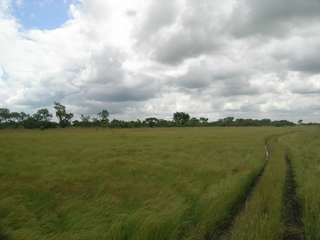
Vohitany is a town and commune in southwestern Madagascar. It belongs to the district of Ampanihy, which is a part of Atsimo-Andrefana Region. The population of the commune was estimated to be approximately 10,000 in 2001 commune census.
Tomena is a village in the Iolonioro Department of Bougouriba Province in south-western Burkina Faso. The village has a population of 503.
Sangolo is a village in the Iolonioro Department of Bougouriba Province in south-western Burkina Faso. The village has a population of 502.
Niaogho is a town in the Niaogho Department of Boulgou Province in south-eastern Burkina Faso. As of 2005, the town has a population of 13,545.
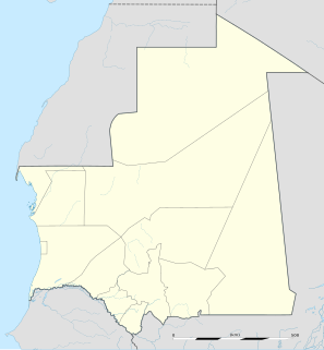
Niabina is a town and commune in the Brakna Region of southern Mauritania.

Sabadou-Baranama is a town and sub-prefecture in the Kankan Prefecture in the Kankan Region of eastern Guinea. As of 2014 it had a population of 23,159 people.
Camocuautla (municipality) is a town and municipality in Puebla in south-eastern Mexico.
Peñón of Algiers was a small islet off the coast of Algiers, fortified by the Kingdom of Spain during the 16th century. The islet was connected to the African continent to form a seawall and the harbour of Algiers.

This is a list of the extreme points of Bhutan.
German submarine U-767 was a Type VIIC U-boat built for Nazi Germany's Kriegsmarine for service during World War II. She was laid down on 5 April 1941 by Kriegsmarinewerft Wilhelmshaven as yard number 150, launched on 10 July 1943 and commissioned on 11 September 1943 under Oberleutnant zur See Walter Dankleff.