Dounkora | |
|---|---|
Village | |
 Interactive map of Dounkora | |
| Coordinates: 10°38′30″N3°7′25″W / 10.64167°N 3.12361°W | |
| Country | |
| Region | Sud-Ouest Region |
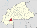
| Province | Bougouriba Province |
| Department | Iolonioro Department |
| Population (2019) | |
• Total | 119 |
Dounkora is a village in the Iolonioro Department of Bougouriba Province in south-western Burkina Faso. [1]
| Year | Pop. | ±% |
|---|---|---|
| 2006 [2] | 94 | — |
| 2019 [3] | 119 | +26.6% |