Boone Furnace, Kentucky

Last updated

Boone Furnace is an unincorporated community in Carter County, Kentucky, in the United States. [1]

Carter County, Kentucky County in the United States

Carter County is a county located in the U.S. state of Kentucky. As of the 2010 census, the population was 27,720. Its county seat is Grayson.

United States Federal republic in North America

The United States of America (USA), commonly known as the United States or America, is a country composed of 50 states, a federal district, five major self-governing territories, and various possessions. At 3.8 million square miles, the United States is the world's third or fourth largest country by total area and is slightly smaller than the entire continent of Europe's 3.9 million square miles. With a population of over 327 million people, the U.S. is the third most populous country. The capital is Washington, D.C., and the largest city by population is New York City. Forty-eight states and the capital's federal district are contiguous in North America between Canada and Mexico. The State of Alaska is in the northwest corner of North America, bordered by Canada to the east and across the Bering Strait from Russia to the west. The State of Hawaii is an archipelago in the mid-Pacific Ocean. The U.S. territories are scattered about the Pacific Ocean and the Caribbean Sea, stretching across nine official time zones. The extremely diverse geography, climate, and wildlife of the United States make it one of the world's 17 megadiverse countries.

History

Boone Furnace once contained a blast furnace. [2] A post office was established at Boone Furnace in 1860, and remained in operation until it was discontinued in 1884. [3]

Blast furnace type of metallurgical furnace used for smelting to produce industrial metals

A blast furnace is a type of metallurgical furnace used for smelting to produce industrial metals, generally pig iron, but also others such as lead or copper. Blast refers to the combustion air being "forced" or supplied above atmospheric pressure.

Related Research Articles

Rowan County, Kentucky County in the United States

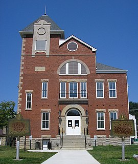
Rowan County is a county located in the U.S. state of Kentucky. As of the 2010 census, the population was 23,333. Its county seat is Morehead. The county was created in 1856 from parts of Fleming and Morgan counties, and named after John Rowan, who represented Kentucky in the U.S. House and Senate.

Estill County, Kentucky County in the United States

Estill County is a county located in the U.S. state of Kentucky. As of the 2010 census, the population was 14,672. Its county seat is Irvine The county was formed in 1808 and named for Captain James Estill, a Kentucky militia officer who was killed in the Battle of Little Mountain during the American Revolutionary War. Estill County is a moist county meaning that the county seat, the city of Irvine, allows the sale of alcohol after the October 9, 2013 vote, but not the rest of Estill County outside the Irvine city limits.

Florence, Kentucky City in Kentucky, United States

Florence is a home rule-class city in Boone County, Kentucky, United States. Florence is part of the Cincinnati/Northern Kentucky metropolitan area. The population was 29,951 at the 2010 census.

Olive Hill, Kentucky City in Kentucky, United States

Olive Hill is a home rule-class city along Tygarts Creek in Carter County, Kentucky, in the United States. The population was 1,599 during the year 2010 U.S. Census.

Kentucky County, Virginia

Kentucky County was formed by the Commonwealth of Virginia from the western portion of Fincastle County effective December 31, 1776. During the three and one-half years of Kentucky County's existence, its seat of government was Harrodstown.

Long Run massacre

The Long Run massacre occurred on 13 September 1781 at the intersection of Floyd's Fork creek with Long Run Creek, along the Falls Trace, a trail in what is now eastern Jefferson County, Kentucky.

Red Bird River river in the United States of America

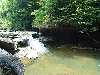
The Red Bird River is a tributary of the South Fork Kentucky River, located in the Daniel Boone National Forest in extreme southeastern portion of the U.S. state of Kentucky. It is 34.3 miles (55.2 km) long and drains an area of 195.7 square miles (507 km2).

Pilot Knob State Nature Preserve

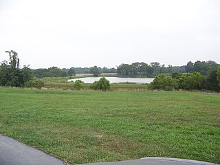
Pilot Knob State Nature Preserve is located in Powell County, Kentucky, USA.

Richwood is an unincorporated community in Boone County, in the U.S. state of Kentucky.

Mount Savage is an unincorporated community in Carter County, Kentucky, in the United States.

Tilton is an unincorporated community in Fleming County, Kentucky, in the United States.

Sherburne is an unincorporated community in Fleming County, Kentucky, in the United States.

Poplar Plains is an unincorporated community in Fleming County, Kentucky, in the United States.

Mount Carmel is an unincorporated community in Fleming County, Kentucky, in the United States.

Hunnewell is an unincorporated community in Greenup County, Kentucky, in the United States.

Marble Furnace is an unincorporated community in Adams County, in the U.S. state of Ohio.

Steam Furnace is an unincorporated community in Adams County, in the U.S. state of Ohio.

Junior Furnace is an unincorporated community in Scioto County, in the U.S. state of Ohio.

Nugent Crossroads is an unincorporated community in Woodford County, in the U.S. state of Kentucky.

References

  1. U.S. Geological Survey Geographic Names Information System: Boone Furnace, Kentucky
  2. Lewis Collins (1877). History of Kentucky. p. 122.
  3. "Carter County". Jim Forte Postal History. Archived from the original on 4 January 2015. Retrieved 3 January 2015.

Coordinates: 38°28′00″N83°07′24″W / 38.46667°N 83.12333°W / 38.46667; -83.12333

Geographic coordinate system Coordinate system

A geographic coordinate system is a coordinate system that enables every location on Earth to be specified by a set of numbers, letters or symbols. The coordinates are often chosen such that one of the numbers represents a vertical position and two or three of the numbers represent a horizontal position; alternatively, a geographic position may be expressed in a combined three-dimensional Cartesian vector. A common choice of coordinates is latitude, longitude and elevation. To specify a location on a plane requires a map projection.