
Whitley County is a county located in the southeastern part of the U.S. state of Kentucky. As of the 2010 census, the population was 35,637. The county seat is at Williamsburg, though the largest city is Corbin, and the county's District Court sits in both cities.

Pike County is a county located in the U.S. state of Kentucky. As of the 2010 census, the population was 65,024. Its county seat is Pikeville. The county was founded in 1821.

Perry County is a county located in the U.S. state of Kentucky. As of the 2010 census, the population was 28,712. Its county seat is Hazard. The county was founded in 1820. Both the county and county seat are named for Commodore Oliver Hazard Perry, a naval hero in the War of 1812.
Ohio County is a county located in the U.S. state of Kentucky. As of the 2010 census, the population was 23,842. Its county seat is Hartford. The county is named after the Ohio River, which originally formed its northern boundary. It is a moist county, which means that the sale of alcohol is only legal within certain city limits.

Muhlenberg County is a county in the U.S. Commonwealth of Kentucky. As of the 2010 census, the population was 31,499. Its county seat is Greenville.

McCreary County is a county located in the U.S. state of Kentucky. As of the 2010 census, the population was 18,306. Its county seat is Whitley City. The county is named for James B. McCreary, a Confederate war soldier and two-time Governor of Kentucky. During his second term as Governor, McCreary County was created by the Legislature and was named in his honor.

Magoffin County is a county located in the U.S. state of Kentucky. As of the 2010 census, the population was 13,333. Its county seat is Salyersville. The county was formed in 1860 from adjacent portions of Floyd, Johnson, and Morgan Counties. It was named for Beriah Magoffin who was Governor of Kentucky (1859–62).

Hopkins County is a county located in the western part of the U.S. state of Kentucky. As of the 2010 census, the population was 46,920. Its county seat is Madisonville. The county was formed in 1806 and named for General Samuel Hopkins, an officer in both the American Revolutionary War and War of 1812, and later a Kentucky legislator and U.S. Congressman.

Harlan County is a county located in southeastern Kentucky. As of the 2010 census, the population was 29,278. Its county seat is Harlan.

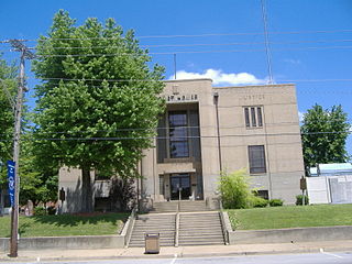
Carter County is a county located in the U.S. state of Kentucky. As of the 2010 census, the population was 27,720. Its county seat is Grayson.

Breathitt County is a county in the eastern Appalachian portion of the U.S. state of Kentucky. As of the 2010 United States Census, the population was 13,878. Its county seat is Jackson. The county was formed in 1839 and was named for John Breathitt, who was Governor of Kentucky from 1832 to 1834. Breathitt County was a prohibition or dry county, until a public vote in July 2016 that allowed alcohol sales.

The West Kentucky Coal Field comprises an area in the west-central and northwestern part of the state, bounded by the Dripping Springs Escarpment and the Pennyroyal Plateau and the Ohio River, but is part of the Illinois Basin that extends into Indiana and Illinois. It is characterized by Pennsylvanian age sandstones, shales and coal. Nearly all of the counties in the area are part of the television market known as the Kentucky–Illinois–Indiana tri-state area.
Carter County Schools is a school district based in Carter County, Kentucky. The district includes the cities of Grayson and Olive Hill. The current Superintendent of Carter County Schools, KY is Ronnie Dotson.

The Eastern Kentucky Coalfield is part of the Central Appalachian bituminous coalfield, including all or parts of 30 Kentucky counties and adjoining areas in Ohio, West Virginia, Virginia and Tennessee. It covers an area from the Allegheny Mountains in the east across the Cumberland Plateau to the Pottsville Escarpment in the west. The region is known for its coal mining; most family farms in the region have disappeared since the introduction of surface mining in the 1940s and 1950s.

Boyd County is a county located in the U.S. state of Kentucky. As of the 2010 census, the population was 49,542. The county seat is Catlettsburg, and its largest city is Ashland. The county was formed in 1860. Its 160 square miles (410 km2) are found at the northeastern edge of the state near the Ohio River and Big Sandy River, nestled in the verdant rolling hills of Appalachia.
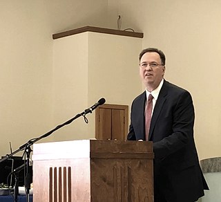
Robin L. Webb is the member of the Kentucky Senate for the 18th District. She formerly served as a member of the Kentucky State Representative for the 96th District.. She also has a law office based in Grayson, Kentucky where she lives. She attended Morehead State University and obtained her AAS and BS. She furthered her education at Northern Kentucky University's Chase College of Law, obtaining her J.D.
The East Carter High School shooting occurred on January 18, 1993, in Grayson, Kentucky, United States. The incident occurred when 17-year-old Gary Scott Pennington walked into an English classroom and fatally shot his teacher Deanna McDavid and head custodian Marvin Hicks, and held classmates hostage for 15 minutes before surrendering to police.

Citizens National Bank is a bank headquartered in Paintsville, Kentucky and is the second largest independently owned bank in Kentucky, with total assets of $599.5 million. Citizens National Bank is a national bank, regulated by the Office of the Comptroller of the Currency, Department of the Treasury.

Willard is an unincorporated community and coal town in Carter County, Kentucky, United States.
Straight Creek is an unincorporated community and coal town in Carter County, Kentucky, United States.


