Boonesboro, Missouri

Last updated

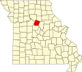
Boonesboro is a community in Howard County, Missouri, United States. [1] It is located on Route 87 midway between Boonville and Glasgow in the historical Boone's Lick country. [2]

The community was laid out in 1840 on the Boone's Lick Road and is named for frontiersman Daniel Boone. [3] [4] [5] Boone's Lick State Historic Site is approximately two miles to the west on Missouri Route 187. The approximate population of the town is 150 citizens.[ citation needed ]

Related Research Articles

<span class="mw-page-title-main">Howard County, Missouri</span> County in Missouri, United States

Howard County is located in the U.S. state of Missouri, with its southern border formed by the Missouri River. As of the 2020 census, the population was 10,151. Its county seat is Fayette. The county was organized January 23, 1816, and named for Benjamin Howard, the first Governor of the Missouri Territory. Settled originally by migrants from the Upper South, it is part of the region historically known as Little Dixie. It is part of the Columbia, Missouri, metropolitan area.

<span class="mw-page-title-main">Boone County, Missouri</span> County in Missouri, United States

Boone County is located in the U.S. state of Missouri. Centrally located in Mid-Missouri, its county seat is Columbia, Missouri's fourth-largest city and location of the University of Missouri. As of the 2020 census, the population was 183,610, making it the state's eighth-most populous county. The county was organized November 16, 1820 and named for the then recently deceased Daniel Boone, whose kin largely populated the Boonslick area, having arrived in the 1810s on the Boone's Lick Road. Boone County comprises the Columbia Metropolitan Area. The towns of Ashland and Centralia are the second and third most populous towns in the county.

<span class="mw-page-title-main">Boonesborough, Kentucky</span> Historic site in Kentucky

Boonesborough or Boonesboro is an unincorporated community in Madison County, Kentucky, United States. Founded by famed frontiersman Daniel Boone in 1775 as one of the first English-speaking settlements west of the Appalachian Mountains, Boonesborough lies in the central part of the state along the Kentucky River and is the site of Fort Boonesborough State Park, which includes the Kentucky River Museum. The park site has been rebuilt to look like a working fort of the time that Boone resided there.

<span class="mw-page-title-main">Missouri Route 187</span> Short state highway in central Missouri

Route 187 is a short segment of highway running less than five miles (8 km) in Howard County, Missouri. Its eastern terminus is at Route 87 south of Glasgow; its western terminus is at Boone's Lick State Historic Site. No towns are on the route.

<span class="mw-page-title-main">Knob Lick, Missouri</span> Census-Designated Place in Missouri, United States

Knob Lick is an unincorporated community in southern Saint Francois County, Missouri, United States. It is located on Missouri Route DD, just east of U.S. Route 67, approximately eight miles south of Farmington.

<span class="mw-page-title-main">Boonslick</span> Cultural region in the US state of Missouri

The Boonslick, or Boone's Lick Country, is a cultural region of Missouri along the Missouri River that played an important role in the westward expansion of the United States and the development of Missouri's statehood in the early 19th century. The Boone's Lick Road, a route paralleling the north bank of the river between St. Charles and Franklin, Missouri, was the primary thoroughfare for settlers moving westward from St. Louis in the early 19th century. Its terminus in Franklin marked the beginning of the Santa Fe Trail, which eventually became a major conduit for Spanish trade in the Southwestern United States. Later it connected to the large emigrant trails, including the Oregon and California Trails, used by pioneers, gold-seekers and other early settlers of the West. The region takes its name from a salt spring or "lick" in western Howard County, used by Nathan and Daniel Morgan Boone, sons of famed frontiersman Daniel Boone.

Perche Township is one of ten townships in Boone County, Missouri, USA. As of the 2012, its population was 4,037. The village of Harrisburg is the only incorporated settlement inside the township.

<span class="mw-page-title-main">Rucker, Missouri</span> Unincorporated community in Missouri, US

Rucker is an unincorporated community in the northwest corner of Boone County, Missouri, United States. The community is located at the intersection of Missouri routes T and F about 6.5 miles north of Harrisburg. The site lies between Perche Creek and Sugar Creek.

Woodlandville is an unincorporated community in western Boone County, Missouri, United States. The community is on Missouri Route J about six miles south of Harrisburg and 5.5 miles north of I-70 and Rocheport. There is only a church there, and a large water tower, along with a few homes.

Millersburg is an unincorporated community in Callaway County, in the U.S. state of Missouri. It is located near the Boone-Callaway county line on the Owl Creek tributary of Cedar Creek. The Little Dixie Lake and Little Dixie Wildlife Management Area lie on Owl Creek just north of the community. It is on Missouri Route J about four miles south of I-70.

Goodwater Creek is a stream in Audrain and Boone counties in the U.S. state of Missouri. It is a tributary of Youngs Creek.

Saling Creek is a stream in Audrain, Boone and Monroe counties in the U.S. state of Missouri. It is a tributary of Reese Fork.

Boonesborough is an extinct town in Boone County, in the U.S. state of Missouri. Boonesborough was platted in 1836, and named after Daniel Boone. A post office called Boonesboro was established in 1839, and remained in operation until 1850.

Browns is an unincorporated community in Boone County, in the U.S. state of Missouri. It is located northeast of Columbia on Paris Road. Browns was once a stop on the Columbia Terminal Railroad.

Lick Fork is a stream in Boone and Randolph County in the U.S. state of Missouri. It is a tributary of Perche Creek.

Wilton is an unincorporated community in southwest Boone County, in the U.S. state of Missouri. The community is on the northeast bank of the Missouri River across from the Marion Bottoms Conservation Area. Ashland lies approximately six miles to the northeast on Missouri Route M and Sandy Hook lies across the Missouri three miles to the west in Moniteau County. The lone business in Wilton is the Riverview Store, which serves the local community and users on the Katy Trail.

Richland Creek is a stream in Howard County in the U.S. state of Missouri. It is a tributary of the Missouri River.

Tulip is an unincorporated community in northwest Audrain and southwest Monroe counties, in the U.S. state of Missouri. The community is on Monroe county road 92. Long Branch flows past approximately one mile west and north of the site. Moberly is approximately 15 miles to the north-northwest in Randolph County and Centralia is eight miles south in northeast Boone County, Missouri.

Greenlawn is an unincorporated community in southwest Ralls County, in the U.S. state of Missouri. The community is on Missouri Route J approximately three miles north of Perry. The Lick Creek arm of Mark Twain Lake lies approximately one mile to the east.

The Smithton Land Company was a group of American pioneers who in 1818 established the frontier village of Smithton, Missouri in the Boonslick region of Missouri, then the Missouri Territory. In 1821 the settlement was renamed Columbia, Missouri and relocated slightly East of its original location. Smithton was the first county seat of Boone County. The company and town were named after Thomas Adams Smith, the receiver of the land office in Franklin, Missouri.

References

  1. U.S. Geological Survey Geographic Names Information System: Boonesboro, Missouri
  2. Missouri Atlas & Gazetteer, 1998, Delorme p.30 ISBN   0-89933-224-2
  3. Eaton, David Wolfe (1916). How Missouri Counties, Towns and Streams Were Named. The State Historical Society of Missouri. pp.  175.
  4. Ramsay, Robert L. (1952). Our Storehouse of Missouri Place Names. University of Missouri Press. p. 22. ISBN   9780826205865.
  5. Earngey, Bill (1995). Missouri Roadsides: The Traveler's Companion. University of Missouri Press. p. 21. ISBN   9780826210210.

39°04′37″N92°50′30″W / 39.0769716°N 92.8415770°W / 39.0769716; -92.8415770