Borawskie is a village in the administrative district of Gmina Jedwabne, within Łomża County, Podlaskie Voivodeship, in north-eastern Poland. It lies approximately 7 kilometres (4 mi) north-east of Jedwabne, 26 km (16 mi) north-east of Łomża, and 58 km (36 mi) north-west of the regional capital Białystok.
Janczewko is a village in the administrative district of Gmina Jedwabne, within Łomża County, Podlaskie Voivodeship, in north-eastern Poland.
Janczewo is a village in the administrative district of Gmina Jedwabne, within Łomża County, Podlaskie Voivodeship, in north-eastern Poland. It lies approximately 4 kilometres (2 mi) south-west of Jedwabne, 16 km (10 mi) north-east of Łomża, and 64 km (40 mi) west of the regional capital Białystok.
Koniecki is a village in the administrative district of Gmina Jedwabne, within Łomża County, Podlaskie Voivodeship, in north-eastern Poland. It lies approximately 8 kilometres (5 mi) east of Jedwabne, 25 km (16 mi) north-east of Łomża, and 53 km (33 mi) west of the regional capital Białystok.
Konopki Chude is a village in the administrative district of Gmina Jedwabne, within Łomża County, Podlaskie Voivodeship, in north-eastern Poland. It lies approximately 6 kilometres (4 mi) north-east of Jedwabne, 26 km (16 mi) north-east of Łomża, and 58 km (36 mi) north-west of the regional capital Białystok.
Konopki Tłuste is a village in the administrative district of Gmina Jedwabne, within Łomża County, Podlaskie Voivodeship, in north-eastern Poland. It lies approximately 5 kilometres (3 mi) north-east of Jedwabne, 25 km (16 mi) north-east of Łomża, and 59 km (37 mi) west of the regional capital Białystok.
Pawełki is a village in the administrative district of Gmina Jedwabne, within Łomża County, Podlaskie Voivodeship, in north-eastern Poland. It lies approximately 8 kilometres (5 mi) north of Jedwabne, 25 km (16 mi) north-east of Łomża, and 64 km (40 mi) north-west of the regional capital Białystok.
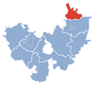
Koty is a village in the administrative district of Gmina Łomża, within Łomża County, Podlaskie Voivodeship, in north-eastern Poland. It lies approximately 16 kilometres (10 mi) south-east of Łomża and 61 km (38 mi) west of the regional capital Białystok.
Choszczewo is a village in the administrative district of Gmina Piątnica, within Łomża County, Podlaskie Voivodeship, in north-eastern Poland. It lies approximately 14 kilometres (9 mi) north-east of Piątnica, 16 km (10 mi) north-east of Łomża, and 61 km (38 mi) west of the regional capital Białystok.
Dobrzyjałowo is a village in the administrative district of Gmina Piątnica, within Łomża County, Podlaskie Voivodeship, in north-eastern Poland. It lies approximately 13 kilometres (8 mi) north-east of Piątnica, 16 km (10 mi) north-east of Łomża, and 68 km (42 mi) west of the regional capital Białystok.
Kisielnica is a village in the administrative district of Gmina Piątnica, within Łomża County, Podlaskie Voivodeship, in north-eastern Poland. It lies approximately 9 kilometres (6 mi) north of Piątnica, 12 km (7 mi) north of Łomża, and 72 km (45 mi) west of the regional capital Białystok.
Wyłudzin is a village in the administrative district of Gmina Piątnica, within Łomża County, Podlaskie Voivodeship, in north-eastern Poland. It lies approximately 13 kilometres (8 mi) north-east of Piątnica, 15 km (9 mi) north-east of Łomża, and 62 km (39 mi) west of the regional capital Białystok.
Doliwy is a village in the administrative district of Gmina Przytuły, within Łomża County, Podlaskie Voivodeship, in north-eastern Poland. It lies approximately 4 kilometres (2 mi) north of Przytuły, 31 km (19 mi) north-east of Łomża, and 65 km (40 mi) north-west of the regional capital Białystok.
Obrytki is a village in the administrative district of Gmina Przytuły, within Łomża County, Podlaskie Voivodeship, in north-eastern Poland.
Przytuły is a village in Łomża County, Podlaskie Voivodeship, in north-eastern Poland. It is the seat of the gmina called Gmina Przytuły. It lies approximately 27 kilometres (17 mi) north-east of Łomża and 64 km (40 mi) north-west of the regional capital Białystok.
Przytuły-Las is a village in the administrative district of Gmina Przytuły, within Łomża County, Podlaskie Voivodeship, in north-eastern Poland.
Supy is a village in the administrative district of Gmina Przytuły, within Łomża County, Podlaskie Voivodeship, in north-eastern Poland. It lies approximately 29 kilometres (18 mi) north-east of Łomża and 59 km (37 mi) north-west of the regional capital Białystok.
Duchny Młode is a village in the administrative district of Gmina Śniadowo, within Łomża County, Podlaskie Voivodeship, in north-eastern Poland. It lies approximately 3 kilometres (2 mi) east of Śniadowo, 16 km (10 mi) south of Łomża, and 78 km (48 mi) west of the regional capital Białystok.
Wagi is a village in the administrative district of Gmina Przytuły, within Łomża County, Podlaskie Voivodeship, in north-eastern Poland. It lies approximately 29 kilometres (18 mi) north-east of Łomża and 59 km (37 mi) north-west of the regional capital Białystok.