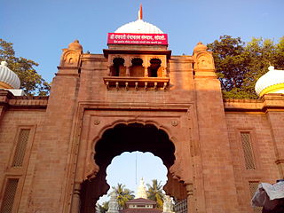
Beed district is an administrative district in the state of Maharashtra in India. The district headquarters are located at Beed. The district occupies an area of 10,693 km² and has a population of 2,161,250 of which 17.91% were urban.

Sangli district is a district of Maharashtra state in India. Sangli city is the district headquarters. It is bordered by Satara district, Solapur district to the North, Karnataka state to the South-East, by Kolhapur district to South-West and by narrow portion on the East side to Ratnagiri district. It is present on the southern tip of Maharashtra.
Madhavnagar is a small city in sangli and now Suburb of Sangli Urban; Sangli district in the Indian state of Maharashtra.

Sausar (Saunsar) is a Municipal Council in the central India in the state of Madhya Pradesh. Sausar lies in Vidharbha region, Nagpur is the center for all the economic activities in this region which is just 72 km from Sausar. More than 90 per cent of farmers produce oranges. Cotton is grown in large quantities in the local area.
Tasgaon is a city in Maharashtra and Taluka in Sangli district in the Indian state of Maharashtra. Tasgaon city is developing city in Maharashtra. Tasgaon was given as Jahagir to Parshuram Bhau Tasgaonkar by Narayanrao Ballal Peshwa in 1774. Tasgaon Sansthan was lapsed by British during ruling of Shrimant Ganpatrao Tasgaonkar.
Kavathe-Mahankal is a tehsil in Miraj subdivision of Sangli district in the Indian state of Maharashtra. This is famous for Mahankali Devi temple and Mallikarjun temple. There was also a sugar factory, named after the same Goddess Mahankali sugar factory.
Ashta is a city and a municipal council in Sangli district in the state of Maharashtra, India. It is located at 16.95°N 74.4°E. It has an average elevation of 567 metres (1860 ft). The name "Ashta" comes from the legend that Lord Shri Ram established eight (Asht) Lord Mahadev temples in this area. The city is divided into 19 wards for which elections are held every 5 years. The Ashta Municipal Council has the population of 37,105 of which 19,171 are males while 17,934 are females as per the report released by Census India 2011.

Latur Rural is one of an Assembly Constituency in the Latur.
Walwa is a taluka in Sangli district in the Indian state of Maharashtra. It is also known as Walwa-Islampur Taluka. There are ninety-five panchayat villages in Walwa Taluka.
Jat is a town and taluka headquarters in Miraj subdivision of Sangli district in southern Maharashtra.
Khanapur (Vita) is a village and taluka and a subdivision of Sangli district of Maharashtra in India.
Kadegaon is a village and taluka of Sangli district of Maharashtra in India.

Sangli State was one of the 11-gun salute Maratha princely states of British India. It was under the Kolhapur-Deccan Residency in the Bombay Presidency, and later the Deccan States Agency.
Kumathe is a village in the tehsil Tasgaon of Sangli district, Maharashtra, India, about 18 kilometres north of Sangli. Its situated along the Sangli-Tasgaon state highway.
Bhood is a village in Khanapur tehsil of Sangli district in Maharashtra, India. It is located near the city Vita.

Kashil is a village in Satara District of Maharashtra state in Western India. It lies at the confluence of the Krishna River and the Urmodi River.
Kundal is a town in Palus Taluka within the Sangli District of southwestern Maharashtra, India. It has a population of 18,287 people - 9,432 males and 8,855 females according to the 2011 census. Kundal is located 40 kilometres north of the district capital, Sangli and 5km from Palus.
National Highway 166 is a National Highway in India. It runs from Ratnagiri to Solapur via Kolhapur, Sangli, Miraj, Solapur in Maharashtra. This is a main link connecting Konkan region to South-Western region in Maharashtra. The complete highway is built of rigid pavement with paved shoulders on both sides.
Borgaon, Wardha is a village in Wardha district in the state of Maharashtra, India. Gram panchayat of Borgaon village is Borgaon S. It has a population of 869 peoples in a geographical area of 543.95 hectares.


