Related Research Articles

The Chittagong Hill Tracts, often shortened to simply the Hill Tracts and abbreviated to CHT, are group of districts within the Chittagong Division in southeastern Bangladesh, bordering India and Myanmar (Burma). Covering 13,295 square kilometres (5,133 sq mi), they formed a single district until 1984, when they were divided into three districts: Khagrachari District, Rangamati Hill District, and Bandarban District.

Mizoram is a state in northeast India, with Aizawl as its seat of government and capital city. The name of the state is derived from "Mizo", the endonym of the native inhabitants, and "Ram", which in the Mizo language means "land." Thus "Mizo-ram" means "land of the Mizos". Within India's northeast region, it is the southernmost landlocked state, sharing borders with three of the Seven Sister States, namely Tripura, Assam and Manipur. The state also shares a 722-kilometre (449 mi) border with the neighbouring countries of Bangladesh and Myanmar.

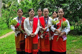
The Chakma people, are an ethnic group from the eastern-most regions of the Indian subcontinent. They are the largest ethnic group in the Chittagong Hill Tracts region of southeastern Bangladesh, and the second-largest in Mizoram, India. Significant Chakma populations are found in the northeast Indian states of Arunachal Pradesh, Tripura and Assam.
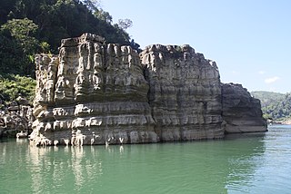
Rangamati Hill District is a district in south-eastern Bangladesh. It is a part of the Chattogram Division, and the town of Rangamati serves as the headquarters of the district. By area, Rangamati is the largest district of the country.

Mara Autonomous District Council (MADC) is one of the three Autonomous District Councils within Mizoram state of India. It covers Siaha subdivision and Tipa subdivision of Siaha district. Primarily, an autonomous administrative government meant for the Mara people living in the state. It is situated at the southern tip of Mizoram state bordering Myanmar. Its autonomy was established and carved out from the erstwhile Pawi-Lakher Regional Council on 29 May 1971 and separated the next year as Lakher Autonomous District Council, and renamed to its current name in 1988. It covers 1445 square kilometres.
Belonia is a town and municipal council in South Tripura district, Tripura, India. It is also the headquarters of South Tripura District. It is linked with Agartala by National Highway 108A from Belonia to Jolaibari and via National Highway 8 from Jolaibari to Agartala. Belonia lies on the border with Bangladesh.
Chakma language is an Indo-Aryan language spoken by the Chakma and Daingnet people. The language has common features with other languages in the region like the Chittagonian, Tanchangya, Arakanese and others. It is spoken by around 380,000 people. 150,000 of these are in southeast Bangladesh, primarily the Chittagong Hill Tracts, and another 230,000 in India, including 97,000 in Mizoram, Tripura and Arunachal Pradesh. It is written using the Chakma script, but literacy in this script is low.

The national language and official language of Bangladesh is Bangla according to the third article of the Constitution of Bangladesh. The second most spoken language in Bangladesh is claimed to be Burmese which is spoken by the Marma tribe in Chittagong Hill districts as the districts border Myanmar; it is also spoken by the Rohingya people. Almost 99% of Bangladeshis speak Bengali as their first language. Bengali Language Implementation Act, 1987 made it mandatory to use Bengali in all government affairs except in the cases of foreign relations. According to a 2022 census, Bengali is predominantly spoken by 99% of the country's population and it also serves as the national language of the nation. The indigenous people of northern and southeastern Bangladesh speak a variety of native languages. Bangladesh has 44 indigenous languages according to Professor Shameem Reza.
Lawngtlai district is one of the eleven districts of Mizoram state in India.
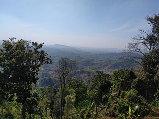
The Chakma Autonomous District Council (CADC) is an autonomous council for the Chakma people living in the south-western part of Mizoram, India. It covers the Tuichawng (Chawngte) subdivision of Lawngtlai district. Its headquarters is at Kamalanagar. The Chakma people has been demanding to change the status of the Chakma Autonomous District Council into a Union territory under the name Chakmaland.

The Lai Autonomous District Council (LADC) is one of the three Autonomous District Councils in Mizoram state in north-east India. It covers the Lawngtlai and Sangau subdivisions of the Lawngtlai district. It is an autonomous district council for the Lai people living in south-eastern Mizoram.
The Tanchangya people or Tanchangyas are an indigenous ethnic group living in the Chittagong Hill Tracts (CHT) of Bangladesh, Indian states of Tripura and Mizoram, and Rakhine state of Myanmar.

The Chittagong Hill Tracts conflict was a political and armed conflict between the government of Bangladesh and the Parbatya Chattagram Jana Samhati Samiti and its armed wing, the Shanti Bahini, over the issue of autonomy and the land rights of Jumma people, mainly for Chakma people and the other indigenous of Chittagong Hill Tracts. Shanti Bahini launched an insurgency against government forces in 1977, when the country was under military rule, and the conflict continued for twenty years until the government and the PCJSS signed the Chittagong Hill Tracts Peace Accord in 1997.
Sagarnal Union Council is a Union Parishad of Bangladesh, located in Juri Upazila, Moulvibazar District, Sylhet Division. It has an area of 29 square kilometres and a population of 34,492.

Bangladeshis are the citizens of Bangladesh, a South Asian country centred on the transnational historical region of Bengal along the eponymous bay.
Damdep-I is a village located in the southern part of the Chakma Autonomous District Council in the Lawngtlai District of the state of Mizoram, India.

Kamalanagar is a township in Lawngtlai district in the state of Mizoram in India.

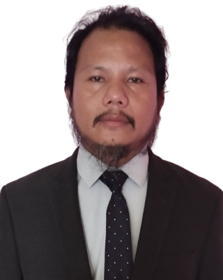
Rasik Mohan Chakma is an Indian politician and the Chief Executive Member of the Chakma Autonomous District Council, an autonomous region in Mizoram since 22 May 2023. Rasik Mohan Chakma was born to Late Sukra Moni Chakma. He is a resident of Borapansury I, Lawngtlai district. He was the founder president of The Chakma District Mizo National Front (CDMNF).
Kristo Mohan Chakma was an Indian politician from Mizoram state in India. He represented Chawngte constituency in the Mizoram Legislative Assembly in 1978.
Amit Kumar Chakma (1984-2023) was an Indian politician and the former Chief Executive Member of the Chakma Autonomous District Council, an autonomous region in Mizoram from 6 November 2017 to 21 March 2018.