
Elizabeth is a borough in Allegheny County, Pennsylvania, United States, on the east bank of the Monongahela River, where Pennsylvania Route 51 crosses, 15 miles (24 km) upstream (south) of Pittsburgh and close to the county line. The population was 1,398 at the 2020 census. The borough of Elizabeth is entirely contained within the 15037 USPS ZIP code. The local school district is the Elizabeth Forward School District. The borough is home to neighborhoods Walker Heights and Town Hill.

Forward Township is a township in Allegheny County, Pennsylvania, United States. The population was 3,068 at the 2020 census. The township is named after Walter Forward, U.S. Secretary of the Treasury from 1841 to 1843.

Lincoln is a borough in Allegheny County, Pennsylvania, United States. The population was 932 at the 2020 United States Census.
Jenner Township is a township in Somerset County, Pennsylvania, United States. The population was 3,703 at the 2020 census. It is part of the Johnstown, Pennsylvania, Metropolitan Statistical Area.

Sewickley Township is a township in Westmoreland County, Pennsylvania, United States. The population was 5,590 at the 2020 census.

Berwyn is a census-designated place (CDP) in Chester County, Pennsylvania, United States. Berwyn is located in Tredyffrin and Easttown townships. The area is part of the Philadelphia Main Line suburbs.

A single-point urban interchange, also called a single-point interchange (SPI) or single-point diamond interchange (SPDI), is a type of highway interchange. The design was created in order to help move large volumes of traffic through limited amounts of space efficiently.

Pennsylvania Route 576 (PA Turnpike 576), also known as the Southern Beltway, is a controlled-access toll road in the southern and western suburbs of Pittsburgh, Pennsylvania, United States. It is envisioned to serve as a southern beltway around the Greater Pittsburgh area between Pittsburgh International Airport and the historic Steel Valley of the Monongahela River.
Conodoguinet Creek is a 104-mile-long (167 km) tributary of the Susquehanna River in South central Pennsylvania in the United States. The name is Native American, and means "A Long Way with Many Bends".
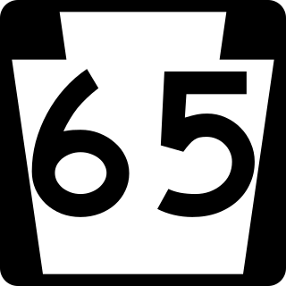
Pennsylvania Route 65 is a major 51-mile-long (82 km) state highway located in western Pennsylvania, United States. The route, traveling north–south from the Interstate 279/U.S. Route 19 Truck concurrency in Pittsburgh north to the PA 108/PA 168 concurrency in New Castle, connects downtown Pittsburgh to the northwestern portion of the Pittsburgh Metropolitan Area. PA 65 is similar in its purpose to PA 18 and PA 51, both of which run parallel to PA 65 at one point or another; however, the three routes pass through different cities for most of their respective alignments.

The Phoenix Iron Works, located in Phoenixville, Pennsylvania, was a manufacturer of iron and related products during the 19th century and early 20th century. Phoenix Iron Company was a major producer of cannon for the Union Army during the American Civil War. The company also produced the Phoenix column, an advance in construction material. Company facilities are a core component of the Phoenixville Historic District, a National Register of Historic Places site that was in 2006 recognized as a historic landmark by ASM International.
Old York Road, originally York Road, with reference to New York, is a roadway that was built during the 18th century to connect Philadelphia with New York City.

Brownsville is an unincorporated community located in western Lower Heidelberg Township, Berks County, Pennsylvania, United States. It is located at the intersection of Brownsville and Heffner Roads. A very small portion of the village extends into North Heidelberg Township.
The C.L. Schmitt Bridge is a truss bridge that carries vehicular traffic across the Allegheny River between New Kensington and East Deer Township, Pennsylvania in the United States.
The Middle Road was the name for a historic highway in the Canadian province of Ontario, which served to link the cities of Toronto and Hamilton. The name was used between 1931 and 1939, after which the road became the northern section of the Queen Elizabeth Way. It borrowed the name of Middle Road from a concession road in Toronto Township between 1st Concession South and 2nd Concession South during the early 1800s.

Mortonville is an unincorporated area and historic hamlet in Chester County, Pennsylvania, United States, situated on the eastern bank of the West Branch Brandywine Creek. It consists of approximately one-half dozen structures, two of which are on the National Register of Historic Places: the Mortonville Hotel, and the 12.5-foot-long (3.8 m) "Bridge in East Fallowfield Township" which crosses a mill race a few feet east of a larger bridge. The larger bridge, known as the Mortonville Bridge, was also listed on the NRHP until 2010, when it was delisted following a renovation. The two bridges are in East Fallowfield Township, while most other structures are in Newlin Township.

The Judge J. Frank Graff Bridge is an American truss bridge that carries U.S. Route 422 (US 422) and Pennsylvania Route 28 (PA 28) across the Allegheny River. It was named in honor of Frank Graff, an Armstrong County Court of Common Pleas Judge who later rose to become a member of the Pennsylvania Superior Court.
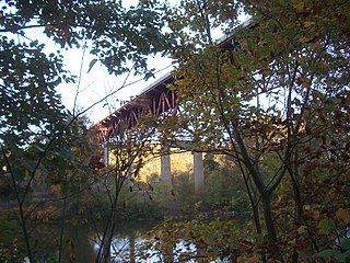
The Smithton High-Level Bridge is a structure that crosses the Youghiogheny River between South Huntingdon Township and Rostraver Township.
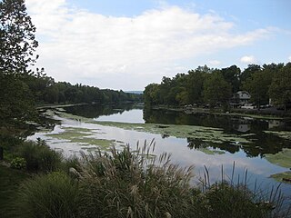
The Sutersville Bridge is a structure that crosses the Youghiogheny River between Sutersville and Elizabeth Township, Pennsylvania. It connects a rural southeastern corner of Allegheny County with a small Westmoreland County town.

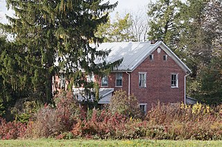
Boston is a census-designated place located in Elizabeth Township, Allegheny County in the state of Pennsylvania. As of the 2020 census the population was 549.

