Stonehaven is a town on the northeast coast of Scotland, 15 miles (24 km) south of Aberdeen. It had a population of 11,602 at the 2011 Census.

Royal Leamington Spa, commonly known as Leamington Spa or simply Leamington, is a spa town and civil parish in Warwickshire, England. Originally a small village called Leamington Priors, it grew into a spa town in the 18th century following the popularisation of its water which was reputed to have medicinal qualities. In the 19th century, the town experienced one of the most rapid expansions in England. It is named after the River Leam, which flows through the town.

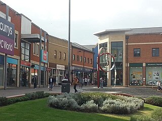
Didcot is a railway town and civil parish in South Oxfordshire, England, located 15 miles (24 km) south of Oxford, 10 miles (16 km) east of Wantage and 15 miles (24 km) north west of Reading. Historically part of Berkshire, the town is noted for its railway heritage, Didcot station opening as a junction station on the Great Western Main Line in 1844. Today the town is known for the railway museum and power stations, and is the gateway town to the Science Vale: three large science and technology centres in the surrounding villages of Milton, Culham and Harwell.

Witney is a market town on the River Windrush in West Oxfordshire in the county of Oxfordshire, England. It is 12 miles (19 km) west of Oxford.

Charlbury is a town and civil parish in the Evenlode valley, about 6 miles (10 km) north of Witney in the West Oxfordshire district of Oxfordshire, England. It is on the edge of Wychwood Forest and the Cotswolds. The 2011 Census recorded the parish's population as 2,830.

Chipping Norton is a market town and civil parish in the Cotswold Hills in the West Oxfordshire district of Oxfordshire, England, about 12 miles (19 km) south-west of Banbury and 18 miles (29 km) north-west of Oxford. The 2011 Census recorded the civil parish population as 5,719. It was estimated at 6,254 in 2019.

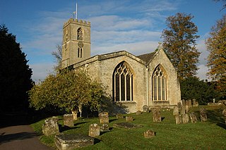
Stonesfield is a village and civil parish about 5 miles (8 km) north of Witney in Oxfordshire, and about 10 miles (17 km) north-west of Oxford. The village is on the crest of an escarpment. The parish extends mostly north and north-east of the village, in which directions the land rises gently and then descends to the River Glyme at Glympton and Wootton about 3 miles (5 km) to the north-east. South of Stonesfield, below the escarpment, is the River Evenlode which touches the southern edge of the parish. At the centre of Stonesfield stands the 13th-century church of St James the Great as well as a Wesleyan chapel, Stonesfield Methodist Church, slightly further west. The village is known for Stonesfield slate, a form of Cotswold stone mined particularly as a roofing stone and also a rich source of fossils. The architecture in Stonesfield features many old Cotswold stone properties roofed with locally mined slate along with some late 20th-century buildings and several properties under construction. The 2011 Census recorded the parish's population as 1,527.

Botley is a village in the civil parish of Botley and North Hinksey, in the Vale of White Horse district, in the county of Oxfordshire, England, just west of the Oxford city boundary. Historically part of Berkshire, it stands on the Seacourt Stream, a stream running off the River Thames. The intersection of the A34 and A420 is to the village's north.

North Hinksey is a village in the civil parish of Botley and North Hinksey, in the Vale of White Horse district, in Oxfordshire, England, on the west side of the Thames flood plain immediately opposite the city of Oxford. The civil parish includes the large settlement of Botley, effectively an isolated suburb of Oxford, with the Botley Road as the sole highway link across the flood plain. North Hinksey was in all respects part of Berkshire until the 1974 boundary changes transferred administration of the Vale of White Horse district to Oxfordshire County Council; it remains part of the historic county of Berkshire however, since the 1974 act did not change the ancient county boundaries. The village of North Hinksey has a manor house, The Fishes public house, a Church of England primary school and a Church of England parish church, St. Lawrence's, which dates back to at least the 12th century. Four of the older houses have thatched roofs.

Horsham is a regional city in the Wimmera region of western Victoria, Australia. Located on a bend in the Wimmera River, Horsham is approximately 300 kilometres (190 mi) northwest of the state capital Melbourne. As of the 2021 census, Horsham had a population of 20,429. It is the most populous city in Wimmera, and the main administrative centre for the Rural City of Horsham local government area. It is the eleventh largest city in Victoria after Melbourne, Geelong, Ballarat, Bendigo, Wodonga, Mildura, Shepparton, Warrnambool, Traralgon, and Wangaratta.

Oxford railway station is a mainline railway station, one of two serving the city of Oxford, England. It is about 0.5 miles (800 m) west of the city centre, north-west of Frideswide Square and the eastern end of Botley Road. It is the busiest station in Oxfordshire, and the fourth busiest in South East England.

The A420 is a road between Bristol and Oxford in England. Between Swindon and Oxford it is a primary route.

Osney or Osney Island is a riverside community in the west of the city of Oxford, England. In modern times the name is applied to a community also known as Osney Town astride Botley Road, just west of the city's main railway station, on an island surrounded by the River Thames, Osney Ditch and another backwater connecting the Thames to Osney Ditch.
Dame's Delight was a place for women to bathe on the bank of the River Cherwell in the meadows near the Oxford University Parks opposite Mesopotamia Walk in Oxford, England.

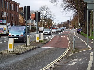
Botley Road is the main road into the centre of Oxford, England from the west. It stretches between Botley, on the Oxford Ring Road (A34) to the west of the city, and Frideswide Square at the junction with Oxford railway station, close to central Oxford.

The Bath Grounds is a historic recreational ground and cricket ground based in the town of Ashby-de-la-Zouch, Leicestershire. It is home to Ashby Hastings Cricket Club and Ashby Bowls Club. The grounds are subject to conservation area protection. and are designated a "sensitive area" in retained policy E1 of the most recent Local Plan.
Matthew Arnold School is a coeducational secondary school and sixth form located just west of Oxford near Cumnor Hill and Botley and is named after 19th-century poet Matthew Arnold.

Tin Can Bay is a coastal town and locality in the Wide Bay–Burnett region in Queensland, Australia. The locality is split between the Fraser Coast Region and the Gympie Region, but the town itself is within Gympie Region. In the 2021 census, the locality of Tin Can Bay had a population of 2,293 people.

Bulstake Stream, also spelt Bullstake Stream, is a backwater of the River Thames at Oxford, England.

Tumbling Bay, also known as Tum, is an outdoors bathing area in Oxford, England. Fed by the River Thames, the bathing spot opened in 1853 and closed formally in 1990. Subsequently, it has been known as a wild swimming location.


