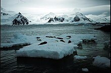
Loubet Coast is the portion of the west coast of Graham Land in Antarctic Peninsula, extending 158 km between Cape Bellue to the northeast and Bourgeois Fjord to the southwest. South of Loubet Coast is Fallieres Coast, north is Graham Coast.

Millerand Island is a high rugged island 6 km (3 nmi) in diameter, lying 7 km (4 nmi) south of Cape Calmette, off the west coast of Graham Land. It was discovered by the French Antarctic Expedition (1908-1910) under Jean-Baptiste Charcot, who thought that it was a cape of the mainland and named it as such after Alexandre Millerand, French statesman.

Rymill Bay is a bay in Antarctica. It is 16.7 kilometres (9 nmi) wide at its mouth and indents 9.3 kilometres (5 nmi) between Red Rock Ridge and Bertrand Ice Piedmont along the west coast of Graham Land. Rymill Bay was probably first seen from a distance by the French Antarctic Expedition under Jean-Baptiste Charcot in 1909. The bay was first surveyed in 1936 by the British Graham Land Expedition (BGLE), and was resurveyed in 1948 by the Falkland Islands Dependencies Survey (FIDS). The name is for John Riddoch Rymill, Australian leader of the British Graham Land Expedition.
Bigourdan Fjord is a sound, 12 miles (19 km) long in an east-west direction and averaging 2 miles (3 km) wide, lying between Pourquoi Pas Island and the southwest part of Arrowsmith Peninsula, along the west coast of Graham Land. It was discovered by the French Antarctic Expedition, 1908–10, under Jean-Baptiste Charcot, and named by him for Guillaume Bigourdan, a noted French astronomer. It was roughly surveyed by the British Graham Land Expedition, 1934–37, under John Riddoch Rymill, and resurveyed by the Falkland Islands Dependencies Survey, 1948–50.
Andresen Island, also known as "Isla Curanilahue", is an island 2 nautical miles (4 km) long and rising over 610 metres (2,000 ft), lying in the middle of the entrance to Lallemand Fjord, off the west coast of Graham Land. It was discovered by the French Antarctic Expedition, 1908–10, under Jean-Baptiste Charcot, and named by him for the manager of the Magellan Whaling Co at the company's Deception Island base, who provided coal for the expedition.

Bottrill Head is a rugged headland on the east side of Bourgeois Fjord which forms the southwest extremity of German Peninsula and the north side of the entrance to Dogs Leg Fjord in Fallières Coast, on the west side of Graham Land, Antarctica. It was first surveyed in 1936 by the British Graham Land Expedition (BGLE) under John Rymill. The headland was resurveyed in 1948 by the Falkland Islands Dependencies Survey (FIDS) who named it for Harold Bottrill, Chairman of the Board of Directors, later General Manager, of Maclean and Stapledon S.A., shipping agents at Montevideo, who gave great assistance to the BGLE, 1934–37, and to FIDS, 1943–48.
Wyatt Island is an island, 5 nautical miles (9 km) long and 2 nautical miles (3.7 km) wide, lying 2 nautical miles (3.7 km) south of Day Island near the center of Laubeuf Fjord, off the west coast of Graham Land. First surveyed in 1936 by the British Graham Land Expedition (BGLE) under Rymill which used the provisional name South Island for this feature. The island was resurveyed in 1948 by the Falkland Islands Dependencies Survey (FIDS) and was renamed by Vice Admiral Sir Arthur G.N. Wyatt, Hydrographer to the Navy, 1945-50.
Day Island is an island, 7 nautical miles (13 km) long and 3 nautical miles (6 km) wide, lying immediately south of The Gullet and 2 nautical miles (4 km) north of Wyatt Island in the northern part of Laubeuf Fjord, off the west coast of Graham Land. It was first surveyed in 1936 by the British Graham Land Expedition under John Rymill, who used the provisional name Middle Island for this feature. The island was resurveyed in 1948 by the Falkland Islands Dependencies Survey and renamed by them for Vice Admiral Sir Archibald Day, Hydrographer of the Navy.
Trail Inlet is an ice-filled inlet which recedes southwest 15 nautical miles (28 km) between Three Slice Nunatak and Cape Freeman, on the east coast of Graham Land. The inlet was sighted by Sir Hubert Wilkins on his flight of December 20, 1928. The width of Graham Land is reduced to 20 nautical miles (37 km) between the heads of Trail Inlet and Neny Fjord. So named by the US-SCAN because it was a natural route of travel for flights and sledge trips from the East Base of the United States Antarctic Service (USAS), 1939–1941, to the east coast of Graham Land.

Dogs Leg Fjord is an inlet 6 nautical miles (11 km) long in an east-west direction and 1.5 nautical miles (3 km) wide, lying south of German Peninsula, directly east of Ridge Island and opening on Bourgeois Fjord, along the Fallières Coast on the west side of Graham Land, Antarctica. It was discovered by the British Graham Land Expedition, 1934–37, under John Rymill, and so named because of its shape.

Perutz Glacier is a glacier, 10 nautical miles (18 km) long and 2 nautical miles (3.7 km) wide, which flows west-northwest from Hemimont Plateau into Bourgeois Fjord, close east of Thomson Head, on the west coast of Graham Land, Antarctica. The mouth of the glacier was first surveyed in 1936 by the British Graham Land Expedition (BGLE) under Rymill. The entire glacier was surveyed in 1946-47 and 1948-49 by the Falkland Islands Dependencies Survey (FIDS), and named by them for Max F. Perutz of the Cavendish Laboratory, Cambridge, who has made important studies on the mechanism of glacier flow.

Evans Glacier is a gently-sloping glacier 15 nautical miles (28 km) long and 4 nautical miles (7 km) wide, draining the southeast slopes of Travnik Buttress eastwards between Rugate Ridge and Poibrene Heights to flow into Vaughan Inlet on the east coast of Graham Land, Antarctica. It was discovered by Sir Hubert Wilkins in an aerial flight, December 20, 1928, and named "Evans Inlet" by him for E.S. Evans of Detroit. A further survey by the Falkland Islands Dependencies Survey in 1955 reported that this low-lying area is not an inlet, but is formed by the lower reaches of Hektoria Glacier and the feature now described.
Matthes Glacier is a glacier 9 nautical miles (17 km) long, flowing east into Whirlwind Inlet between Demorest Glacier and Chamberlin Glacier, on the east coast of Graham Land, Antarctica. It was discovered by Sir Hubert Wilkins on a flight of December 20, 1928, and photographed from the air by the United States Antarctic Service in 1940. It was charted by the Falkland Islands Dependencies Survey in 1947 and named for François E. Matthes, then chief geologist with the U.S. Geological Survey.

The Kinzl Crests are three peaks, 2,135 metres (7,000 ft) high, on Pernik Peninsula, Loubet Coast in Graham Land, Antarctica, standing 3 nautical miles (6 km) east of Salmon Cove and Lallemand Fjord. They were mapped from air photos taken by the Falkland Islands and Dependencies Aerial Survey Expedition, 1956–57, and were named by the UK Antarctic Place-Names Committee for Hans Kinzl, an Austrian glaciologist.
Thomson Head is a steep, rocky headland rising to 915 m at the east side of Bourgeois Fjord, between Perutz and Bader Glaciers, forming the north extremity of German Peninsula on Fallières Coast on the west side of Graham Land, Antarctica. First surveyed in 1936 by the British Graham Land Expedition (BGLE) under Rymill. Resurveyed in 1948-49 by the Falkland Islands Dependencies Survey (FIDS) and named for William H. Thomson, FIDS air pilot at Stonington Island in 1947.
Keller Inlet is an ice-filled inlet 12 nautical miles (22 km) long, in a northeast–southwest direction, and 6 nautical miles (11 km) wide, between Cape Little and Cape Fiske, along the east coast of Palmer Land, Antarctica. This inlet was photographed from the air by members of the United States Antarctic Service in December 1940, and in 1947 by members of the Ronne Antarctic Research Expedition under Finn Ronne, who in conjunction with the Falkland Islands Dependencies Survey charted it from the ground. It was amed by Ronne for Louis Keller of Beaumont, Texas, who contributed supplies to Ronne's expedition.
Ridge Island is a ridge-shaped island, 6 nautical miles (11 km) long and 1.5 nautical miles (2.8 km) wide lying 3 nautical miles (6 km) east of Pourquoi Pas Island in the center of Bourgeois Fjord, off the west coast of Graham Land. Discovered and named by the British Graham Land Expedition (BGLE), 1934–37, under Rymill.

Lever Glacier is a glacier, 1.5 nautical miles (3 km) wide at its mouth and at least 6 nautical miles (11 km) long, flowing west-northwest, then west-southwest into the head of the northern arm of Beascochea Bay north of Chorul Peninsula, on the west coast of Graham Land, Antarctica. The glacier was first sighted and roughly surveyed in 1909 by the French Antarctic Expedition. It was resurveyed in 1935 by the British Graham Land Expedition (BGLE) under John Rymill, and named in 1954 for William Lever, 2nd Viscount Leverhulme, who contributed toward the cost of the BGLE.