Clinton County is the northeastern most county in the northeastern corner of the state of New York, in the United States and bordered by the Canadian province of Quebec. As of the 2020 United States Census, the population was 79,843. Its county seat is the city of Plattsburgh. The county lies just south of the border with the Canadian province of Quebec and to the west of the State of Vermont. The county is named for George Clinton, the first Governor of New York, who later was elected as Vice President. He had been a Founding Father who represented New York in the Continental Congress. Clinton County comprises the Plattsburgh, New York Micropolitan statistical area. The county is part of the North Country region of the state.

Piercefield is a town in St. Lawrence County, New York, United States. The population was 310 at the 2010 census.

A body of water or waterbody is any significant accumulation of water on the surface of Earth or another planet. The term most often refers to oceans, seas, and lakes, but it includes smaller pools of water such as ponds, wetlands, or more rarely, puddles. A body of water does not have to be still or contained; rivers, streams, canals, and other geographical features where water moves from one place to another are also considered bodies of water.
Green Pond is a private lakeside residential unincorporated community within Rockaway Township in Morris County, New Jersey, United States. The lakeside community is managed by two corporations, Green Pond Corporation and Lake End Corporation.

Hempstead Lake State Park is a 737-acre (2.98 km2) state park located in Nassau County, New York in the United States. The park is located in West Hempstead and is one of three state parks within the Town of Hempstead. There is a quick-access entrance at exit 18 from the Southern State Parkway. The park contains the largest freshwater lake in Nassau County.

Grafton Lakes State Park is a 2,545-acre (10.30 km2) state park located in Rensselaer County, New York, United States. The park is in the central part of the Town of Grafton and north of the hamlet of Grafton on NY Route 2, northeast of Albany. The park contains the Shaver Pond Nature Center.

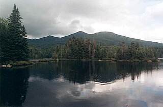
The Saint Regis Canoe Area in Adirondack Park is the largest wilderness canoe area in the Northeastern United States and the only designated canoe area in New York state. It is closed to motorized vehicles. Among the 50 ponds and lakes are Upper Saint Regis Lake, part of the Seven Carries route, and Saint Regis Pond. It contains the headwaters of the West and Middle Branch of the Saint Regis and the Saranac Rivers. Only two of the lakes can be reached without a portage, or carry as it is known in the region. Primitive canoe camping is permitted on many of the lakes and ponds. Saint Regis Mountain and Long Pond Mountain are within the area.

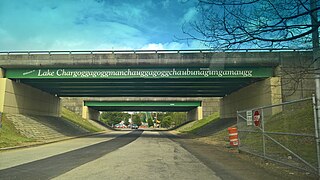
Lake Chaubunagungamaug, also known as Webster Lake, is a lake in the town of Webster, Massachusetts. It is located near the Connecticut border and has a surface area of 1,442 acres. Since 1921, the lake has also been known by a much longer name having 45 letters comprising fourteen syllables: Lake Chargoggagoggmanchauggagoggchaubunagungamaugg. The lake has become famous beyond Central Massachusetts for having the longest name of any geographic feature in all of the United States.

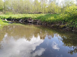
Wappinger Creek is a 41.7-mile-long (67.1 km) creek which runs from Thompson Pond to the Hudson River at New Hamburg in Dutchess County, New York, United States. It is the longest creek in Dutchess County, with the largest watershed in the county.

The Batten Kill, Battenkill, or Battenkill River is a 59.4-mile-long (95.6 km) river rising in Vermont that flows into New York and is a tributary of the Hudson River. It is the longest Hudson tributary on that river's east. As "kill" means a creek, the name "Battenkill River" is pleonastic.

MacNaughton Mountain is a mountain located in Essex County, New York, named after James MacNaughton (1851–1905), the grandson of Archibald McIntyre. The mountain is part of the Street Range of the Adirondack Mountains.

Black Pond Wildlife Management Area is a 526-acre (213 ha) New York State Wildlife Management Area (WMA) that lies on the eastern shore of Lake Ontario, and at the northern limit of an unusual region of sandy barrier beaches and lagoons. Much of the barrier beach in Black Pond WMA has forested sand dunes that are about 60 feet (18 m) high; these are the highest sand dunes in the northeast United States excepting Cape Cod. Immediately north of the WMA is the 360-acre (150 ha) El Dorado Beach Preserve, which is a bird refuge owned by The Nature Conservancy. North of the outlet from Black Pond to Lake Ontario, the shoreline is a weathered, flat bedrock shelf that is "calcareous" instead of sandy.

Kinderhook Creek is a 49.0-mile-long (78.9 km) tributary to Stockport Creek, an inlet of the Hudson River in the United States. From its source in Hancock, Massachusetts, the creek runs southwest through the Taconic Mountains into Rensselaer County, New York, and then into Columbia County. It flows through the towns of Stephentown, New Lebanon, Nassau, Chatham, Kinderhook and Stuyvesant to its mouth at Stockport Creek in the town of Stockport.
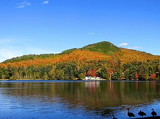
Dyken Pond is a 134-acre (54 ha) lake in the towns of Grafton and Berlin in Rensselaer County, New York. The pond gets water primarily from precipitation and outflows westward into the Poesten Kill, a tributary of the Hudson River. It is located in northwest Berlin, south of Grafton Lakes State Park.
Cedar Lake is located northwest of Sled Harbor, New York. Fish species present in the lake are brook trout, black bullhead, and white sucker. There is trail access on the north and west shores from Sled Harbor. There is also trail access to Whitney Lake. No motors are allowed on this lake.

Dun Brook Mountain is a mountain located in Adirondack Mountains of New York located in the town of Indian Lake east-northeast of Blue Mountain Lake. Tirrell Mountain is located west and Tirrel Pond is located west-southwest of Dun Brook Mountain.
East Branch Handsome Brook is a river in Delaware County, New York. It flows into Handsome Brook south of Franklin. East Branch Handsome Brook flows through Bourn Pond.

Baker Mountain is a 2,454-foot-tall (748 m) mountain in Essex County, New York east of Saranac Lake. It is part of the McKenzie Mountain Wilderness Area. The trail to the top is about 0.9-miles long; the hike is part of the "Saranac Sixer". Moody Pond lies at its foot.

Ball Pond is a census-designated place (CDP) in the town of New Fairfield, Fairfield County, Connecticut, United States. It is in the southwest part of the town, with the pond of the same name in the central part of the CDP. The community is bordered to the south by Taylor Corners and to the west by Putnam Lake in Putnam County, New York.


