Bowers Gifford and North Benfleet | |
|---|---|
Civil parish | |
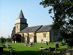 St Margaret's Church, Bowers Gifford | |
 Interactive map of Bowers Gifford and North Benfleet | |
| Coordinates: 51°33′36″N0°31′43″E / 51.559944°N 0.52873616°E | |
| Country | England |
| Primary council | Basildon |
| County | Essex |
| Region | East of England |
| Created | 2010 |
| Status | Civil parish |
| Main settlements | Bowers Gifford and North Benfleet |
| Government | |
| • Type | Parish council |
| • Body | Bowers Gifford and North Benfleet Parish Council |
| Area | |
• Total | 9.81 km2 (3.79 sq mi) |
| Population (2021 [1] ) | |
• Total | 2,055 |
| • Density | 209/km2 (543/sq mi) |
| Website | https://e-voice.org.uk/bgnb-parishcouncil/ |
Bowers Gifford and North Benfleet is a civil parish in the Basildon borough of Essex, England. The parish includes the villages of Bowers Gifford and North Benfleet. [2] At the 2021 census the parish had a population of 2,055.
Contents
There are 7 listed buildings in Bowers Gifford and North Benfleet. [3] The local council is Bowers Gifford and North Benfleet Parish Council.