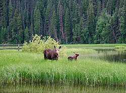
The Lower Mainland is a geographic and cultural region of the mainland coast of British Columbia that generally comprises the regional districts of Metro Vancouver and the Fraser Valley. Home to approximately 3.05 million people as of the 2021 Canadian census, the Lower Mainland contains sixteen of the province's 30 most populous municipalities and approximately 60% of the province's total population.

The Fraser River is the longest river within British Columbia, Canada, rising at Fraser Pass near Blackrock Mountain in the Rocky Mountains and flowing for 1,375 kilometres (854 mi), into the Strait of Georgia just south of the City of Vancouver. The river's annual discharge at its mouth is 112 cubic kilometres (27 cu mi) or 3,550 cubic metres per second (125,000 cu ft/s), and each year it discharges about 20 million tons of sediment into the ocean.

The Fraser Valley is a geographical region in southwestern British Columbia, Canada and northwestern Washington State. It starts just west of Hope in a narrow valley encompassing the Fraser River and ends at the Pacific Ocean stretching from the North Shore Mountains, opposite the city of Vancouver BC, to just south of Bellingham, Washington.

The Okanogan River is a tributary of the Columbia River, approximately 115 mi (185 km) long, in southern British Columbia and north central Washington. It drains a scenic plateau region called the Okanagan Country east of the Cascade Range and north and west of the Columbia, and also the Okanagan region of British Columbia. The Canadian portion of the river has been channelized since the mid-1950s.

The Fraser Canyon is a major landform of the Fraser River where it descends rapidly through narrow rock gorges in the Coast Mountains en route from the Interior Plateau of British Columbia to the Fraser Valley. Colloquially, the term "Fraser Canyon" is often used to include the Thompson Canyon from Lytton to Ashcroft, since they form the same highway route which most people are familiar with, although it is actually reckoned to begin above Williams Lake at Soda Creek Canyon near the town of the same name.
The Chehalis River is located in the southwest corner of British Columbia, Canada near the city of Chilliwack. It flows south-eastward out of the Douglas Ranges of the Coast Mountains, draining into the Harrison River.

The Lillooet River is a major river of the southern Coast Mountains of British Columbia. It begins at Silt Lake, on the southern edge of the Lillooet Crown Icecap about 80 kilometres northwest of Pemberton and about 85 kilometres northwest of Whistler. Its upper valley is about 95 kilometres in length, entering Lillooet Lake about 15 km downstream from Pemberton on the eastern outskirts of the Mount Currie reserve of the Lil'wat branch of the St'at'imc people. From Pemberton Meadows, about 40 km upstream from Pemberton, to Lillooet Lake, the flat bottomlands of the river form the Pemberton Valley farming region.

The Chilcotin River /tʃɪlˈkoʊtɪn/ located in Southern British Columbia, Canada is a 241 km (150 mi) long tributary of the Fraser River. The name Chilcotin comes from Tŝilhqot’in, meaning "ochre river people," where ochre refers to the mineral used by Tŝilhqot’in Nation and other Indigenous communities as a base for paint or dye. The Chilcotin River, Chilko River and Lake, and Taseko River and Lake make up the Chilcotin River watershed. This 19,200 km2 (7,400 sq mi) watershed drains the Chilcotin Plateau which reaches north to south from the Nechako Plateau to Bridge River county and east to west from Fraser River to the Coast Mountains. It is also one of twelve watersheds that make up the Fraser River Basin. Made up of seven major tributaries, Chilcotin River starts northeast of Itcha Mountain, flowing southeast until it joins the Fraser River south of Williams Lake, 22 km (14 mi) upstream from Gang Ranch.
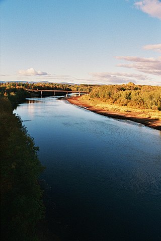
The Nechako River arises on the Nechako Plateau east of the Kitimat Ranges of the Coast Mountains of British Columbia, Canada, and flows north toward Fort Fraser, then east to Prince George where it enters the Fraser River. "Nechako" is an anglicization of netʃa koh, its name in the indigenous Carrier language which means "big river".
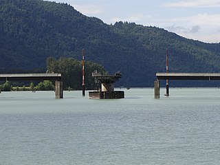
The Harrison River is a short but large tributary of the Fraser River, entering it near the community of Chehalis, British Columbia, Canada. The Harrison drains Harrison Lake and is the de facto continuation of the Lillooet River, which feeds the lake.

The Cariboo Mountains are the northernmost subrange of the Columbia Mountains, which run down into the Spokane area of the United States and include the Selkirks, Monashees and Purcells. The Cariboo Mountains are entirely within the province of British Columbia, Canada. The range is 7,700 square kilometres (3,000 sq mi) in area and about 245 km in length (southeast–northwest) and about 90 km at its widest (southwest–northeast).

The Quesnel River is a major tributary of the Fraser River in the Cariboo District of central British Columbia. It begins at the outflow of Quesnel Lake, at the town of Likely and flows for about 100 kilometres (60 mi) northwest to its confluence with the Fraser at the city of Quesnel.
The Taseko River or Dasiqox in the original Chilcotin, is a tributary of British Columbia's Chilko River, a tributary of the Chilcotin River which joins the Fraser near the city of Williams Lake.
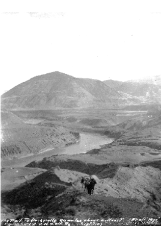
The River Trail was a main route for travel in the colonial era of what is now the Canadian province of British Columbia, running northwards along the Fraser River from to present day Lillooet to Big Bar, British Columbia and points beyond in the Cariboo District. The route was primarily in use during the Fraser Canyon Gold Rush and associated explorations by prospectors northwards in the search for gold in the Cariboo and Omineca Districts.
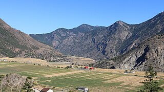
Fountain is an unincorporated rural area and Indian reserve community in the Fraser Canyon region of British Columbia, Canada, located at the ten-mile (16 km) mark from the town of Lillooet on BC Highway 99, which in that area is also on the route of the Old Cariboo Road and is located at the junction of that route with the old gold rush-era trail via Fountain Valley and the Fountain Lakes.
The Willow River is a tributary of the Fraser River in the north-central Interior of British Columbia, Canada. It enters the Fraser near the community of Willow River, just upstream from the city of Prince George, near the confluence of the Salmon River. Its source is in the Cariboo goldfields at Jack of Clubs Lake in the mining and arts community of Wells, British Columbia, near Barkerville. In 1974, the canyon of the Willow River, east of Prince George, was the scene of a tragic accident involving eight teenagers who died when their three canoes and kayak were broken in the raging waters and boulders of a narrow gorge.
The Nahatlatch River is a tributary of the Fraser River in the Canadian province of British Columbia. It originates in the Lillooet Ranges of the Coast Mountains and empties into the Fraser River in the Fraser Canyon, north of Boston Bar.
The McGregor River is a tributary of the Fraser River in the Canadian province of British Columbia.
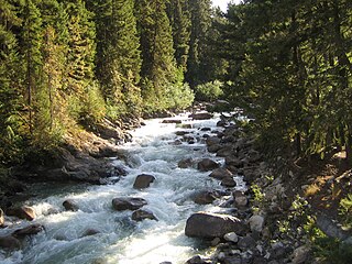
Cayoosh Creek is a northeast-flowing tributary of the Seton River in the Canadian province of British Columbia. The name Cayoosh Creek remains on the bridge-sign crossing the stream on BC Highway 99 and continues in use locally to refer to the final reaches of the Seton River, formerly Seton Creek, which prior to the renaming ending at the confluence with Cayoosh Creek. The creek is the namesake of Cayoosh Creek Indian Reserve No. 1, one of the main Indian reserves of the Cayoose Creek Indian Band, which lies adjacent to what was renamed the Seton River without local consultation.

The Cariboo River is a tributary of the Quesnel River, one of the main tributaries of the Fraser River, in the Canadian province of British Columbia. It flows through the Cariboo region of the British Columbia Interior, southeast of Prince George. Above Cariboo Lake it was formerly known as the Swamp River. The name was adopted, and replaced the former names, in 1936 in association with Cariboo Lake.
