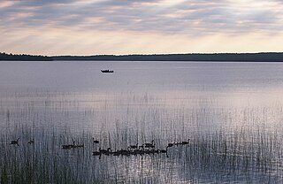
| Boy River (Leech Lake) | |
|---|---|
 | |
| Location | |
| Country | United States |
| Physical characteristics | |
| Source | |
| ⁃ location | Minnesota |
The Boy River is a river in Cass County, Minnesota. [1] The river took its name from Boy Lake. [2]
| Boy River (Leech Lake) | |
|---|---|
 | |
| Location | |
| Country | United States |
| Physical characteristics | |
| Source | |
| ⁃ location | Minnesota |
The Boy River is a river in Cass County, Minnesota. [1] The river took its name from Boy Lake. [2]
Coordinates: 47°10′54″N94°13′16″W / 47.1816215°N 94.2210778°W [3]
The Battle River is a 2.7-mile-long (4.3 km) tributary of Red Lake in Minnesota, the United States. It is formed by the junction of its North and South branches. The North Branch flows east to west for 13.7 miles (22.0 km) entirely in Beltrami County, and the South Branch flows 40.1 miles (64.5 km), starting at the outlet of Bartlett Lake in Koochiching County and flowing west-northwest into Beltrami County.
The Blackduck River is a 33.2-mile-long (53.4 km) tributary of Red Lake in northwestern Minnesota in the United States.
The Cross River is a 20.4-mile-long (32.8 km) river in northern Minnesota, the United States. It is a direct tributary of Lake Superior.

The Devil Track River is an 8.7-mile-long (14.0 km) river in northeastern Minnesota, the United States. It begins at the outlet of Devil Track Lake and flows southeast to Lake Superior east of Croftville.
The First River (Minnesota) is a river of Minnesota. It joins Little Cut Food Sioux Lake with First River Lake.
The Kabekona River is a river of Minnesota. It empties into the Kabekona Bay of Leech Lake.
The Little Pine River is a 29.7-mile-long (47.8 km) tributary of the Pine River of Minnesota in the United States. Via the Pine River it is part of the Mississippi River watershed. The Little Pine River begins in the northeast corner of Crow Wing County at the outlet of Little Pine Lake and flows southwest to its junction with the Pine River in Crow Wing State Forest.
The Mud River is a 23.1-mile-long (37.2 km) tributary of Red Lake in northwestern Minnesota in the United States.
The North Cormorant River is a 39.1-mile-long (62.9 km) tributary of the Blackduck River of Minnesota in the United States. It joins the Blackduck River shortly upstream of that river's mouth at Red Lake, the largest natural lake entirely within Minnesota.
The Poplar River is a 58.4-mile-long (94.0 km) tributary of the Lost River of western Minnesota in the United States. Via the Lost River, the Clearwater River, the Red Lake River, the Red River of the North, Lake Winnipeg, and the Nelson River, it is part of the Hudson Bay watershed.
The South Cormorant River is a 34.1-mile-long (54.9 km) tributary of the Blackduck River of Minnesota in the United States. It joins the Blackduck River 8.0 miles (12.9 km) upstream of the river's juncture with the North Cormorant River and 12.2 miles (19.6 km) upstream of the Blackduck's mouth at Red Lake.
Turtle Lake is a lake in Beltrami County, Minnesota, in the United States.
Lake Marquette is a lake in Beltrami County, Minnesota, in the United States.
Andrusia Lake is a lake in Beltrami County, Minnesota, in the United States.
Lake George is a lake in Hubbard County, in the U.S. state of Minnesota.
Garfield Lake is a lake in Hubbard County, in the U.S. state of Minnesota.
Paine Lake is a lake in Hubbard County, in the U.S. state of Minnesota.

Steamboat Lake is a lake in Cass and Hubbard counties, in the U.S. state of Minnesota. Steamboat Lake and adjacent Steamboat River were so named from the frequent steamboat traffic once traveling their waters.
Pickerel Lake is a lake in Hubbard County, in the U.S. state of Minnesota.
Cut Foot Sioux Lake is a lake in Itasca County, in the U.S. state of Minnesota. The Cut Foot Sioux Trail takes hikers past the lake.
| This article about a location in Cass County, Minnesota is a stub. You can help Wikipedia by expanding it. |
| This article related to a river or creek in Minnesota is a stub. You can help Wikipedia by expanding it. |