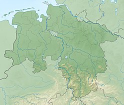
The Grade Lutter is one of the two headstreams of the River Lutter in the South Harz. It rises at over 660 metres on the Aschentalshalbe. It then flows mainly in a southerly direction in order to merge with the Krumme Lutter near Kupferhütte to form the Lutter.

The Übelsberg is a 651.3 metre high mountain in the South Harz, which lies southwest of Sieber in the district of Göttingen in Lower Saxony. It sits astride the watershed between the Grade Lutter and the Krumme Lutter rivers. The mountain is linked via a ridge to the Aschentalshalbe in the north and the Mittelberg in the south.
The Große Schweimke is a 3.2 km long tributary of the Kleine Steinau, north of Herzberg am Harz in the district of Göttingen in Lower Saxony. It rises at about 602 m above sea level and 1 km south of the Schindelkopf and roughly 600 m north of the Weinbergstrasse road on the ridge known as Auf dem Acker. It flows initially in a southwesterly direction before swinging west and discharging into the Kleine Steinau.

The Kleine Steinau is a 9.1 km long tributary of the Sieber, north of Herzberg am Harz in the district of Göttingen in Lower Saxony. It rises at about 690 metres between the Schindelkopf mountain and the Spießerklippe crags on the ridge of Auf dem Acker. It initially flows in a westerly direction, but later swings south before emptying into the River Sieber near the small settlement of Aschenhütte, not far from the mouth of the Große Steinau. In the upper reaches of the Kleine Steinau it is also called the Schindelgraben, although it is not clear from the maps at which point the name changes.

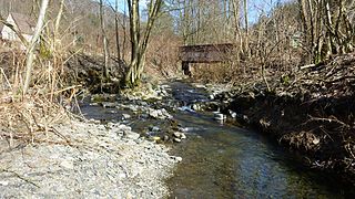
The Große Steinau is a 7.8 km long tributary of the Sieber, north of Herzberg am Harz in the district of Göttingen in Lower Saxony. It rises at about 690 metres near the crags of the Sophienklippe on the Acker. It initially flows in a southwesterly direction, but later swings south before discharging into the Sieber near the small settlement of Aschenhütte, not far from the mouth of the Kleine Steinau. In times of drought the water of the Große Steinau seeps completely into the karst ground before its mouth and reappears about 4 days later at the Rhumequelle. An abandoned village, Steynowe, was probably located in the lower valley of the Große Steinau, but its exact location has not been found.
The Koboltstaler Köpfe are a group of three mountains, that rise southwest of Sankt Andreasberg and east of Sieber in the district of Göttingen in Lower Saxony. The highest of the three peaks is 673 metres high. The other two summits lie roughly 350 metres east and south of the main peak respectively and are ony a few metres lower. The Koboltstaler Köpfe are mainly covered by pine forest and accessible on all sides by forest roads.
The Kleiner Knollen is a 631 metre high mountain in the southwestern part of the Harz in the German state of Lower Saxony.
The Kleiner Wurzelnberg rises to a height of 610 m above NN in the Harz mountains of Germany, 3.7 km northeast of Sieber in the district of Göttingen in Lower Saxony. It forms a rounded summit (Kuppe) on one of the ridges running south of the Acker which acts as the watershed between the Verlorene Kulmke and the Kleine Kulmke. The Großer Wurzelnberg is located 750 metres further east on the other side of the valley of the Kleine Kulmke.
The Großer Wurzelnberg rises to a height of 625.8 m above NN in the Harz mountains of central Germany. It lies 3.7 km northeast of Sieber in the district of Göttingen in Lower Saxony. It is a rounded summit (Kuppe) on one of the ridges running southwards from the Acker and which forms the watershed between the Kleine Kulmke and the Große Kulmke. The Kleiner Wurzelnberg is located 750 m further west on the other side of the valley of the Kleine Kulmke.
The Adlersberg is a hill in the Harz mountains of central Germany that lies south of Sieber in the district of Göttingen in Lower Saxony. It is 593.2 m high and is situated west of the Aschentalshalbe. It also separates the valley of Breitental with its river, the Tiefenbeek, from the Langental. To the northwest the Adlersberg transitions to the Kloppstert and the Fissenkenkopf hills. Other nearby peaks are the Pagelsburg 1.2 km south, the Höxterberg 1.6 km southwest and the Großer Knollen 1.9 km southeast.
The Breitentalskopf is a hill in the Harz Mountains of central Germany, that rises southeast of Sieber in the district of Göttingen in Lower Saxony. It is 579.1 m high and separates the River Sieber from the Breitental valley, that gave the hill its name. Towards the southeast is the ridge of the Aschentalshalbe.

The Eichelnkopf is a 545.7 m (1,790 ft) high hill in the southwestern part of the Harz Mountains in the central German state of Lower Saxony.
The Schadenbeeksköpfe are two summits on a southeastern outlier of the Aschentalshalbe in the Harz Mountains of Germany, about 3.6 kilometres southeast of Sieber in the district of Göttingen in Lower Saxony. Their highest peak is 605 metres above sea level. In addition they separate the Schadenbeek stream, after which they were named, from the upper Krumme Lutter. About 1 kilometre east of the Schadenbeeksköpfe lies the Wolkenhügel Pit, in the valley of the Krumme Lutter, which closed in June 2007. A refuge hut not far from the Schadenbeeksköpfe is a checkpoint in the Harzer Wandernadel hiking badge system.
The Höxterberg is a hill in the Harz Mountains of central Germany, that lies south of Sieber in the district of Göttingen in Lower Saxony. It is 584 metres high and lie 0.9 kilometres west of the Pagelsburg, 1.5 kilometres south of the Fissenkenkopf, 1.8 km west of the Großer Knollen and 1 kilometre north of the Mittelecke. The hill is mostly covered by beech woods. Towards the northwest the Höxterberg transitions into the Steile Wand.
The Kloppstert is a hill, roughly 553 metres high, in the southwestern Harz in Lower Saxony, Germany. In the topographical map printed in 1978 it can only be made out with difficulty that the third letter is an o and the penultimate one an r. Unfortunately a contour line runs over the letter r so that it looks like a p. In the digitalised 1:25,000 topographic map, the hill is wrongly named as the Klappstept.
The Pagelsburg is a hill in the Harz Mountains of central Germany, which lies south of Sieber in the district of Göttingen in Lower Saxony. It is 545 m above sea level (NN) and lies 1.2 km south of the Adlersberg, 0.9 kilometres east of the Höxterberg and 1.0 kilometre northwest of the Großer Knollen.
The Großer Mittelberg is a ridge in the Harz Mountains of Germany that begins immediately northeast of Lonau in the district of Göttingen in Lower Saxony. It separates the valley of Kirchtal, through which the Große Lonau flows, from the Mariental and the Kleine Lonau. is Although it is the nearest subpeak to the village of Lonau, the Großer Mittelberg is, at 531 metres, not the highest point, but may be viewed as a main summit due to its prominent location. From here on, the ridge only climbs gently in a northeasterly direction and has several more subpeaks with small wind gaps. To the north the Großer Mittelberg transitions to the ridge of Auf dem Acker without any noticeable wind gap.
The Heibeeksköpfe in the Harz Mountains of central Germany are a double summit with a maximum height of 465.2 m above sea level (NN), near Bad Lauterberg in the unincorporated area of Harz in the district of Göttingen in Lower Saxony.