
South Kesteven is a local government district in Lincolnshire, England, forming part of the traditional Kesteven division of the county. Its council is based in Grantham. The district also includes the towns of Bourne, Market Deeping and Stamford, along with numerous villages and surrounding rural areas.

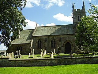
Ropsley is a village in the South Kesteven district of Lincolnshire, England. The village is situated approximately 5 miles (8 km) east from Grantham, and falls within the civil parish of Ropsley and Humby.
Ashby de la Launde and Bloxholm is a civil parish in the North Kesteven district of Lincolnshire, England. According to the 2001 Census it had a population of 796, increasing to 837 at the 2011 census. The parish includes the villages of Ashby de la Launde and Bloxholm, and the southern part of Scopwick Heath. For administrative reasons the parish council is also responsible for the adjacent parish of Temple Bruer with Temple High Grange.

Aubourn Haddington and South Hykeham is a former civil parish in the North Kesteven district of Lincolnshire, England. According to the 2001 census it had a population of 885.

Belton and Manthorpe is a civil parish in the South Kesteven district of Lincolnshire, England, consisting of Belton and Manthorpe, just north of Grantham. According to the 2001 census it had a population of 517 in 192 households. By 2011 the authorities recorded 528 people in 216 homes.

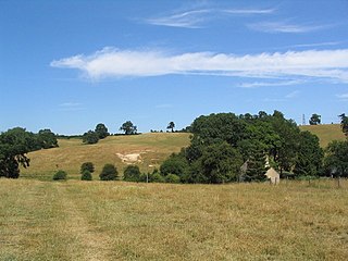
Braceby is a village in the civil parish of Braceby and Sapperton, in the South Kesteven district of Lincolnshire, England. The village includes a roadside nature reserve sheltering 250 species of plant life.

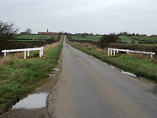
Stubton is a small village and civil parish in the South Kesteven district of Lincolnshire, England. The population of the civil parish at the 2011 census was 295. The village is situated 8 miles (13 km) north from Grantham and 5 miles (8 km) south-east from Newark-on-Trent in Nottinghamshire. Adjacent villages include Claypole, Dry Doddington, Beckingham and Brandon.
Gunby is a village and former civil parish, now in the parish of Gunby and Stainby, in the South Kesteven district of Lincolnshire, England. It is situated close to the borders with Leicestershire and Rutland, and 9 miles (14 km) south from Grantham, and 2 miles (3 km) west from the A1 road. In 1921 the parish had a population of 119. On 1 April 1931 the parish was abolished and merged with Stainby to form "Gunby and Stainby".

Little Humby or Humby is a hamlet in the civil parish of Ropsley and Humby, in the South Kesteven district of Lincolnshire, England. It lies 5 miles (8.0 km) east from Grantham, 1 mile (1.6 km) south-east from Ropsley and 1.5 miles (2.4 km) south from the A52 road. Great Humby, a smaller hamlet, is 720 yards (658 m) to the south.

Haconby is a village and civil parish in the South Kesteven district of Lincolnshire, England. The population of the civil parish at the 2001 census was 448 increasing to 532 at the 2011 census. It is situated on the western edge of the Lincolnshire Fens, 3 miles (5 km) north from Bourne.
Careby Aunby and Holywell is a civil parish in the district of South Kesteven, south-west Lincolnshire, in England. It stretches from the county border with Rutland in the west to the River West Glen in the east. The B1176 road from Corby Glen passes through Careby and on past Aunby toward Stamford. The main London to Scotland railway line passes through the parish, the line upon which Mallard took the speed record for the LNER.
Westborough and Dry Doddington is a civil parish in the north-west of South Kesteven in the county of Lincolnshire. The population of the civil parish was 335 at the 2001 census increasing to 365 at the 2011 census.
Winnibriggs and Threo was an anciently established wapentake in the Parts of Kesteven, the south-east division of the English county of Lincolnshire. Most of the administrative functions of the wapentake had been lost to other local units of government by 1832.

Aubourn with Haddington or Aubourn and Haddington is a civil parish in the North Kesteven district of Lincolnshire, England. The population of the civil parish at the 2011 census was 460.

Ewerby and Evedon is a civil parish in North Kesteven, Lincolnshire, England. It includes the villages of Ewerby and Evedon, the hamlet of Haverholme, and is situated immediately east of Sleaford. The population of the civil parish at the 2011 census was 509.

Ropsley and Humby is a civil parish in the South Kesteven district of Lincolnshire, England. According to the 2001 Census it had a population of 808, increasing to 816 at the 2011 census. The parish consists of the small villages of Ropsley and Great Humby and the larger Little Humby, and the Deserted Medieval Villages of Overton Green and Ogarth.

Newton and Haceby is a civil parish in North Kesteven, Lincolnshire, England. It includes the separate hamlets of Newton and Haceby. The population of the civil parish at the 2011 census was 137.

Gunby and Stainby is a civil parish in the South Kesteven district of Lincolnshire, England. According to the 2001 Census it had a population of 141, falling to 136 at the 2011 census. It includes the hamlets of Gunby and Stainby.

Little Ponton and Stroxton is a civil parish in the South Kesteven district of Lincolnshire, England. According to the 2001 Census it had a population of 135 across 62 homes, increasing to 235 at the 2011 census.

Londonthorpe and Harrowby Without is a civil parish in the South Kesteven district of Lincolnshire, England. According to the 2001 Census it had a population of 4,344, in 1743 households, increasing to a population of 5,133 at the 2011 census. It includes the village of Londonthorpe and the hamlet of Harrowby, Lincolnshire.


