Braich-y-Dinas

Last updated

Braich-y-Dinas
Penmaenmawr, North Wales
Plan of Braich-y-Dinas.png
Braich-y-Dinas
Conwy UK location map.svg
Red pog.svg
Braich-y-Dinas
Coordinates 53°15′39″N3°56′56″W / 53.260721°N 3.9488339°W / 53.260721; -3.9488339
Grid reference grid reference SH701755
Type Hillfort
Site information
ConditionDestroyed
Site history
MaterialsStone
Airfield information
Elevation351 m (1,152 ft) AMSL

Braich-y-Dinas was an extensive hillfort at the summit of Penmaenmawr, one of the northernmost peaks of the Carneddau mountain range on North coast of Wales. It was once considered the best preserved and most complete hillfort in North-West Wales, but completely disappeared in the first half of the 20th century [1] due to a massive quarrying effort by the Darbishire family, which overwhelmed and eventually destroyed all traces of it, despite efforts by the Royal Commission to save the site.

Contents

Eyewitness description of the hillfort

1909 photo of wall at Braich-y-Dinas, by H. Picton and W. Bezant Lowe Braich-y-Dinas photograph.png
1909 photo of wall at Braich-y-Dinas, by H. Picton and W. Bezant Lowe

One of the earliest written accounts of the fort comes from Thomas Pennant, who visited the site as part of his 'A Tour in Wales' series (1778–1783). He gives the original height of the mountain as 1545 feet and noted its excellent preservation. [4] The hilltop was defended by massive ramparts of roughly coursed rubble masonry, with no orthostats. By the mid 19th Century these still stood in places to a height of 9 ft., and varied from 8 to 15 ft. in thickness. The number and character of the entrances were uncertain. The interior contained 90 or more huts of various shapes but mostly oval with a usual diameter of 10–20 ft. Their walls were of similar construction to the rampart, about 5 or 6 ft. thick, and stood in places to a height of 4 ft. Summit top cairns were noted by another 18th Century antiquarianGovernor Thomas Pownall – (writing in 1771), [5] and indeed three are included on the detailed 1877 plan (see image in infobox). These are speculated to have been early Bronze Age, which would date organised human activity on the site to at least c. 2000-2500 BC. [6] The wider area is well known for its Neolithic activity, and indeed the Neolithic Axe factory of Graig Lwyd – one of the largest in Wales – can be found nestled at the Southeast corner. [7]

All datable objects were originally assigned to the period AD 100–400, and no evidence was found to indicate more than one period of construction, but T. Driver of the RCAHMW speculates that this conclusion is almost certainly incorrect; [6] noting that the surviving plans of the fort suggest several periods of construction. The evidence of the relics suggests that the most prosperous inhabitants of the fort were those living between the outer and middle ramparts, as all the Samian pottery, and four of the six coins found, came from this part of the fort. The site produced saddle querns, but none of the rotary type'. [8] [3]

An eyewitness account of the site from Archaeologia Cambrensis correspondent H. Longueville Jones; details the hillfort as seen in 1845, as follows:

1877 Illustration of a hut, at Braich-y-Dinas Hut at Braich-y-Dinas.png
1877 Illustration of a hut, at Braich-y-Dinas

"Upon reaching the fortified British post of Braich y Dinas, on the summit of Penmaen Mawr, we found the circuits of stone walls still perfect in some parts, but greatly dilapidated in others. They are about 12 to 15 feet height, and about 12 feet thick; of loose stones, not fitting into each other with any attempt at masonry, but merely the shattered debris of that rough mountain piled together by human art. There is no appearance of mortar, nor of vitrification. Between the walls, and inside the central inclosure, but especially on the north eastern side of the summit, are a vast number of small circular cells, or cyttiau, which no doubt served for the habitations of the persons occupying this fortified post, and similar to those so common on the Caernarvonshire hills. Some of them were singularly perfect, and one, near the present north western entrance to the fortress, is still covered with its roof, but we could not penetrate within, and we did not feel ourselves justified in attempting to remove the stones." [9]

Finds from the site

Photograph of the bronze mount found at Braich-y-Dinas. Photo of Bronze Mount found at Braich-y-Dinas, By W. Aspden.png
Photograph of the bronze mount found at Braich-y-Dinas.
Bronze bracelet found at Braich-y-Dinas. Bronze Bracelet Found at Braich-y-Dinas, by H.Harold Hughes.png
Bronze bracelet found at Braich-y-Dinas.

Notable finds from the site include a bronze mount (pictured), which Harold Hughes, writing for Archaeologia Cambrensis, speculated belonged to a handled tankard; based on other, similar pieces from the wider area. [10] Hughes also describes two matching bronze bracelets, ornamented with concentric circles, a design, he conjectured, would have been derived from Celtic, rather than Roman inspiration. [11] Datable finds from the fort include a Middle Bronze Age looped spearhead, [12] Roman coins featuring the Emperors Nerva (reigned 96 AD – 98 AD), Trajan (reigned 98 AD – 117 AD) and Hadrian (reigned 117 AD – 138 AD); [13] as well as numerous pottery fragments, most from late 1st and early 2nd Century AD, with some fewer appearing from as late as the 3rd and 4th Centuries AD. Also found at the site was a large saddle quern, and a sandstone spindle whorl. [14]

Efforts to save the site

On 10 August 1908, a Royal Commission was authorised and appointed by King Edward VII to 'make an inventory of the Ancient and Historical Monuments and Constructions connected with or illustrative of the contemporary culture, civilisation and conditions of life of the people in Wales and Monmouthshire from the earliest times, and to specify those which seem most worthy of preservation'. From 1909, the newly-founded commission made efforts to rescue the already partly-destroyed site from further harm caused by the extensive quarrying being undertaken by the Darbishire family. [15] Several local newspaper articles from June 1909 attest to this, reporting that MP for Carmarthen District Llewelyn Williams raised the issue of Braich-y-Dinas (named as 'Pendinas') with the Prime Minister, only to be told that the 600 jobs sustained by the quarry took precedence over the prehistoric remains. [16] [17] Having failed in Parliament, attention was turned 'to the creation of a strong public opinion to bring pressure to bear upon the quarrying company concerned with a view of the preservation of the summit of a mountain at Penmaenmawr.' [18] In 1910, an article about the destruction of Braich-y-Dinas appeared in British newspaper The Sphere, which was also picked up and reported across the Atlantic in The New York Times . [19] Ultimately unsuccessful and faced with the imminent destruction of the site, members of the commission made several visits to the Braich-y-Dinas hillfort in order to preserve some written record of the remaining structures; and an extensive survey was undertaken by Harold Hughes for the Cambrian Archaeological Association. [20] [21]

Destruction of Braich-y-Dinas

Comparison between 1923 aerial photograph of site, and modern day satellite imagery. Modern Day Location of Braich-y-Dinas, Comparison Image.jpg
Comparison between 1923 aerial photograph of site, and modern day satellite imagery.

Evidence given before the Royal Commission on the Ancient and Historical Monuments of Wales in February 1912, confirmed that blasting work was currently under way on the crest of Penmaenmawr. [22] Upon examination by the Commission, the Crown Receiver of His Majesty's Woods and Forests Department for Wales and Monmouthshire, Mr William Henry More confirmed that there was no provision in the lease – held and managed by Colonel C. H. Darbishire – for the preservation of the camp. [23] He also argued that extending the quarry in any other direction than towards the camp would be 'impractical and impossible'; speaking from the financial point of view of the owner of the lease. The land in question was described as residing partly on 'Crown wasteland' and partly on 'land sold many years ago to Mr Darbishire, reserving minerals'. It emerged during questioning that surveys of the area from 1840 conducted by one Mr John Jones, failed to show any antiquarian remains at the site. [24] There was some confusion as to the current extent of the damage to the site – indeed Mr More initially described the incursion of the quarry as "small"but it was conceded upon further examination that because of recent expansion of operations at the blasting site, much of the remaining area must necessarily have already been destroyed. Mr More later admitted to having misled the commission by claiming that only "a small part" of the site was contained within the current lease; when in fact the lease was actually provisioned for an area containing the "whole of the camp." [25] When asked whether it was within the remit of the Department of Woods and Forests to collect information 'respecting the history' of the properties in its charge; Mr More answered that the department had always been run 'to the advantage of the public revenue.' [26] Somewhat contradicting this confused testimony, an RAF aerial photograph taken eleven years later in 1923 appears to show much of the camp still intact; with the shapes of over 50 huts still visible on the mountainside (see comparison image); and indeed finds were still being recorded from the site up until 1934, at the earliest. [27]

Modern day

Nothing at all remains of the hillfort at Braich-y-Dinas. [6]

See also

Related Research Articles

<span class="mw-page-title-main">Penmaenmawr</span> Human settlement in Wales

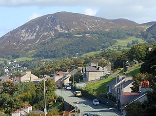
Penmaenmawr is a town and community in Conwy County Borough, Wales, which was formerly in the parish of Dwygyfylchi and the traditional county of Caernarfonshire. It is on the North Wales coast between Conwy and Llanfairfechan and was an important quarrying town, though quarrying is no longer a major employer. The population of the community was 4,353 in 2011, including Dwygyfylchi and Capelulo. The town itself having a population of 2,868 (2011).

<span class="mw-page-title-main">Castell Dinas Brân</span> Castle in Denbighshire, Wales

Castell Dinas Brân is a medieval castle, built by the Princes of Powys Fadog, which occupies a prominent hilltop site above the town of Llangollen in Denbighshire, Wales. The presently visible stone castle was probably built in the 1260s by Gruffydd Maelor II, a prince of Powys Fadog, on the site of several earlier structures, including an Iron Age hillfort.

<span class="mw-page-title-main">Pen Dinas</span>

Pen Dinas is the name of a large hill within the boundary of the village of Penparcau, on the coast of Ceredigion, Wales, upon which an extensive Iron Age, Celtic hillfort of international significance is situated. The site can easily be reached on foot from Aberystwyth town center and is accessible via a series of well marked trails. Boasting a commanding position at the confluence of the River Ystwyth and Afon Rheidol, it has been described as "the pre-eminent hillfort on the Cardigan Bay coast".

The Gorseddau Junction and Portmadoc Railway is a defunct Welsh tramway.

<span class="mw-page-title-main">John Jones, Talysarn</span> Welsh Calvinistic Methodist minister

John Jones, Talysarn, was a Welsh Calvinistic Methodist minister, regarded as one of the greatest preachers in the history of Wales. Because the name "John Jones" was one of the most common in Wales at the time, he is usually differentiated by others of the same name by the use of the suffix "Talysarn", denoting the village where he lived.

<span class="mw-page-title-main">Mynydd y Dref</span>

Mynydd y Dref or Conwy Mountain is a hilly area to the west of the town of Conwy, in Wales. To the north it overlooks the sea of Conwy Bay, and to the south lie the foothills of the Carneddau range of mountains, of which it forms a part. Mynydd y Dref is the remains of an ancient volcano that erupted about 450 million years ago.

<span class="mw-page-title-main">Cambrian Archaeological Association</span> Welsh historical society

The Cambrian Archaeological Association was founded in 1846 to examine, preserve and illustrate the ancient monuments and remains of the history, language, manners, customs, arts and industries of Wales and the Welsh Marches and to educate the public in such matters. The association's activities include sponsoring lectures, field visits, and study tours; as well as publishing its journal, Archaeologia Cambrensis, and monographs. It also provides grants to support research and publications.

<i>Archaeologia Cambrensis</i> Historical scholarly journal (1846–)

Archaeologia Cambrensis is a Welsh archaeological and historical scholarly journal published annually by the Cambrian Archaeological Association. It contains historical essays, excavation reports, and book reviews, as well as society notes and accounts of field visits. The journal has included "much valuable material on the manuscripts, genealogy, heraldry, toponymy, folklore and literature of Wales".

The Dinas Powys hillfort is an Iron Age hillfort near Dinas Powys, Glamorgan, Wales. It is just one of several thousand hillforts to have been constructed around Great Britain during the British Iron Age, for reasons that are still debatable. The main fort at Dinas Powys was constructed on the northernmost point of the hill in either the third or 2nd century BCE, with two further constructs, known as the Southern Banks, being built further down on the southern end of the hill in the following 1st century BCE. It appears that occupation at the site ceased during the period of Roman Britain, but was re-inhabited by an Early Mediaeval settlement in the 5th century CE, who constructed further additions to the fort. The site was subsequently excavated by a team of archaeologists led by Leslie Alcock from 1954 through to 1958.

<span class="mw-page-title-main">St Gallgo's Church, Llanallgo</span> Church in Wales

St Gallgo's Church, Llanallgo is a small church near the village of Llanallgo, on the east coast of Anglesey, north Wales. The chancel and transepts, which are the oldest features of the present building, date from the late 15th century, but there has been a church on the site since the 6th or early 7th century, making it one of the oldest Christian sites in Anglesey. Some restoration and enlargement took place during the 19th century.

<span class="mw-page-title-main">Old Church of St Nidan, Llanidan</span> Medieval church in Anglesey, Wales

The Old Church of St Nidan, Llanidan is a medieval church in the community of Llanidan, in Anglesey, North Wales, close to the Menai Strait. The first church on the site was established in the 7th century by St Nidan, the confessor of the monastery at Penmon, Anglesey, but the oldest parts of the present structure, now closed and partly ruined, date from the 14th century. In about 1500 the church was enlarged by the addition of a second nave on the north side, separated from the earlier nave by an arcade of six arches. During 1839 till 1843 a new church was built nearby to serve the local community, partly due to the cost of repairing the old church. Much of the building was subsequently demolished, leaving only part of the western end and the central arcade. The decision was condemned at the time by Harry Longueville Jones, a clergyman and antiquarian, who lamented the "melancholy fate" of what he called "one of the largest and most important [churches] in the island of Anglesey". Other appreciative comments have been made about the church both before and after its partial demolition.

<span class="mw-page-title-main">St Beuno's Church, Aberffraw</span> Church in Wales

St Beuno's Church, Aberffraw is a 12th-century parish church in Anglesey, north Wales. A church was established in Aberffraw in the 7th century by St Beuno, who became the abbot of Clynnog Fawr, Gwynedd. St Beuno's may have been used as a royal chapel during the early Middle Ages, as the princes of Gwynedd had a court in Aberffraw. The oldest parts of the church date from the 12th century, although it was considerably enlarged in the 16th century when a second nave was built alongside the existing structure, with the wall in between replaced by an arcade of four arches. Restoration work in 1840 uncovered a 12th-century arch in the west wall, which may have been the original chancel arch or a doorway to a western tower that has been lost. The church also has a 13th-century font, some memorials from the 18th century, and two 18th-century copper collecting shovels.

<span class="mw-page-title-main">St Enghenedl's Church, Llanynghenedl</span> Church in Wales

St Enghenedl's Church, Llanynghenedl, is a former parish church in Anglesey, north Wales, dedicated to the son of a 6th-century King of Powys. According to the 19th-century antiquarian Angharad Llwyd, the first church in Llanynghenedl was erected in about 620. A new church was erected in 1862, replacing a building that the 19th-century clergyman and antiquarian Harry Longueville Jones noted as dating in part from the late 13th or early 14th century, based on the decorations on the south doorway. The church later fell into disuse as a result of the growth of the nearby village of Valley and the church there. In 1988, St Enghenedl's was dismantled and re-erected as an extension to St Mihangel's, Llanfihangel yn Nhowyn, so that St Mihangel's could serve as the church for RAF Valley. The former churchyard of St Enghenedl's is still visible but is now overgrown.(The churchyard is being cared for and no longer overgrown 2020 update)

<span class="mw-page-title-main">Saint Peirio</span>

Saint Peirio was a 6th-century pre-congregational saint of Wales and a child of King Caw of Strathclyde.

William Maurice (1620–1680) was a well-known seventeenth-century collector and transcriber of Welsh manuscripts and books from Denbighshire, Wales.

<span class="mw-page-title-main">Henry Harold Hughes</span> English-born architect (1864–1940)

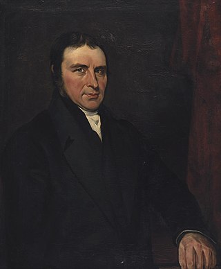
Harold Hughes or Henry Harold Hughes (1864–1940) was born in Liverpool and trained as an architect under Arthur Baker in London. He qualified as an ARIBA in 1890 and set up an architectural practice in Bangor in 1892, where he remained until his death in 1940.

<span class="mw-page-title-main">Parciau hill fort</span> Roman period hill fort on Anglesey

Parciau hill fort is a hill fort on the Welsh island of Anglesey. It stands on the summit of Bryn Ddiôl, whose name means "trackless hill".

<span class="mw-page-title-main">Castell Caer Seion</span>

Castell Caer Seion is an Iron Age hillfort situated at the top of Conwy Mountain, in Conwy County, North Wales. It is unusual for the fact that the main fort contains a smaller, more heavily defended fort, complete with its own distinct defences and entrance, with no obvious means of access between the two. The construction date of the original fort is still unknown, but recent excavations have revealed evidence of occupation as early as the 6th century BC, whilst the smaller fort can be dated with reasonable certainty to around the 4th century BC. Whilst the forts were constructed in different periods, archaeologists have uncovered evidence of concurrent occupation, seemingly up until around the 2nd century BC. The larger fort contained around 50 roundhouses during its lifetime, whereas examinations of the smaller fort have turned up no more than six. The site was traditionally associated with Maelgwyn Gwynedd, but there is no evidence pointing to a 6th-century occupation. The fort and wider area beyond its boundaries have been said to retain significant archaeological potential, and are protected by law as a scheduled ancient monument.

<span class="mw-page-title-main">Bibliography of Welsh history</span> Published works on the history of Wales

This is a bibliography of published works on the history of Wales. It includes published books, journals, and educational and academic history-related websites; it does not include self-published works, blogs or user-edited sites. Works may cover aspects of Welsh history inclusively or exclusively.

<span class="mw-page-title-main">Archaeology of Wales</span> Study of human occupation in Wales

The archaeology of Wales is the study of human occupation within the country of Wales which has been occupied by modern humans since 225,000 BCE, with continuous occupation from 9,000 BCE. Analysis of the sites, artefacts and other archaeological data within Wales details its complex social landscape and evolution from Prehistoric times to the Industrial period. This study is undertaken by academic institutions, consultancies, charities as well as government organisations.

References

  1. Smith, G.H (2008). "IRON AGE SETTLEMENTS IN WALES: CADW DEFENDED ENCLOSURES PUBLICATION HILLFORTS AND HUT GROUPS IN NORTH-WEST WALES" (PDF). Gwynedd Archaeological Trust. p. 41.
  2. Picton, Harold (1909). "Caer Seiont, Conway Mountain". Archaeologia Cambrensis. 9 (6th Series): 503. Retrieved 7 October 2017.
  3. 1 2 "This text is reproduced under the Non-Commercial Government License for public sector information".
  4. Pennant, Thomas (178). A Tour in Wales. Digitised and archived by Llyfrgell Genedlaethol Cymru – The National Library of Wales. London: Self Published. p. 306.
  5. Pownall, Thomas (1775). Archaeologia, Or, Miscellaneous Tracts, Relating to Antiquity, Volume 3. The Society of Antiquaries of London. p. 306.
  6. 1 2 3 "Braich-y-dinas Hillfort, Penmaenmawr (56668)". Coflein. RCAHMW . Retrieved 30 September 2021.
  7. Royal Commission on Historical Monuments (1956). An Inventory of the Ancient Monuments in Caernarvonshire: I East: the Cantref of Arllechwedd and the Commote of Creuddyn. Royal Commission on the Ancient and Historical Monuments of Wales. pp. 40–70.
  8. The Royal Commission on ancient and historical monuments in Wales and Monmouthshire (1960). An Inventory of the Ancient Monuments in Caernarvonshire: I East. Her Majesty's Stationery Office. pp. 85–86.
  9. Jones, H. Longueville (1846). Archaeologia Cambrensis, Volume 1. Cambrian Archaeological Association. p. 71.
  10. Hughes, H.Harold (1934). Archaeologia Cambrensis, Journal of the Cambrian Archaeological Association: Vol. 89. Llyfrgell Genedlaethol Cymru – The National Library of Wales. p. 206.
  11. Hughes, H. Harold (1937). "Archaeologia Cambrensis, Journal of the Cambrian Archaeological Association: Vol. 92". Archaeologia Cambrensis. 92: 215 via Llyfrgell Genedlaethol Cymru – The National Library of Wales.
  12. Smith, George (22 August 2012). "RE-ASSESSMENT OF TWO HILLFORTS IN NORTH WALES: PEN-Y-DINAS, LLANDUDNO AND CAER SEION, CONWY" (PDF). Archaeology in Wales: 14 via Gwynedd Archaeological Trust.
  13. Hughes, H. Harold (1934). "Archaeologia Cambrensis, Journal of the Cambrian Archaeological Association: Vol. 89". Archaeologia Cambrensis (89): 208.
  14. "Ibid": 208.{{cite journal}}: Cite journal requires |journal= (help)
  15. "Penmaenmawr Quarry Records". Conwy Archives Service. 2007. p. 4.
  16. "Quarrying Operations in Penmaenmawr". The Welsh Coast Pioneer and Review for North Cambria: Archived and made available in digital format by Llyfrgell Genedlaethol Cymru – The National Library of Wales. 24 June 1909. p. 2. Retrieved 3 October 2017.
  17. "A Prehistoric Camp at Penmaenmawr". The North Wales Weekly News: Archived and made available in digital format by Llyfrgell Genedlaethol Cymru – The National Library of Wales. 25 June 1909. p. 9. Retrieved 3 October 2017.
  18. "An Earnest Plea". The North Wales Weekly News. 21 October 1910. p. 11. Retrieved 4 October 2017.
  19. "Oldest Dwellings in the United Kingdom Being Destroyed" (PDF). The New York Times. 27 November 1910. Retrieved 4 October 2017.
  20. "Oldest Dwellings in the United Kingdom Being Destroyed" (PDF). The New York Times. 27 November 1910.
  21. Chater, A.G. (6 July 1910). "Report of the committee on ancient earthworks and fortified enclosures, Prepared for presentation to the Congress of Archaeological Societies" (PDF). The Committee on Ancient Earthworks and Fortified Enclosures: 4.
  22. Minutes of Evidence given before the Royal Commission on Ancient Monuments in Wales and Monmouthshire. His Majesty's Stationery Office. 1912. pp. 95–97.
  23. Ibid. p. 96.
  24. Ibid. p. 96.
  25. Ibid. p. 96.
  26. Ibid. p. 97.
  27. "Miscellania, A Bronze Mount From Braich-y-Dinas". Archaeologia Cambrensis. 89: 174–176. June 1934 via Llyfrgell Genedlaethol Cymru – The National Library of Wales.